
LUBBOCK, Texas (KCBD) – Much of the South Plains will wake up Saturday to low clouds, patchy fog, and leftover moisture from last night’s storms.
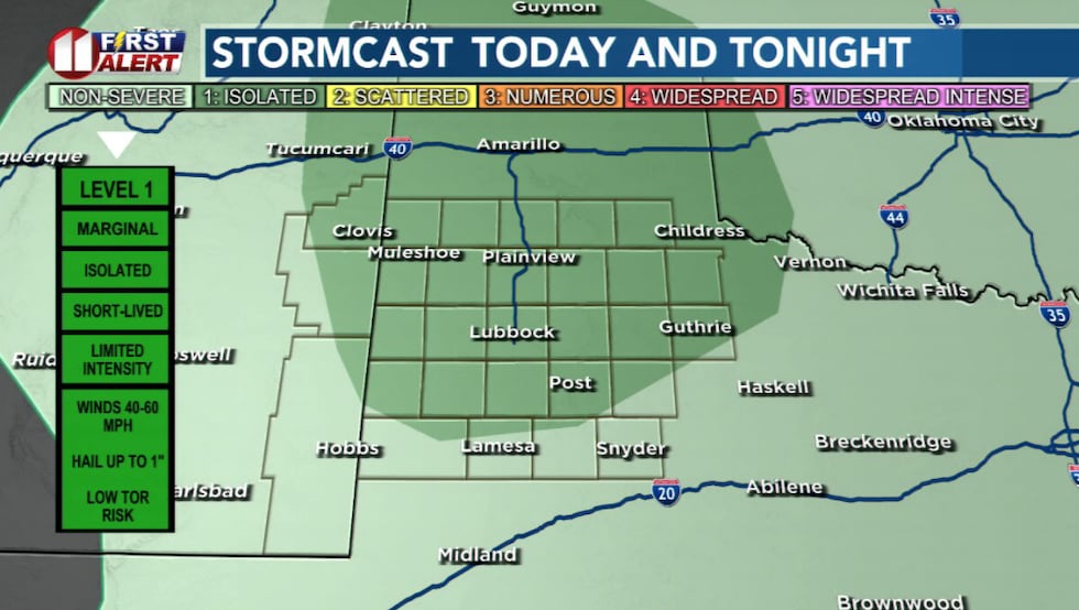 Isolated storms possible(KCBD)
By Saturday afternoon, temperatures climb back into the 80s and isolated thunderstorms could bubble again, especially near the New Mexico state line and across the Caprock.
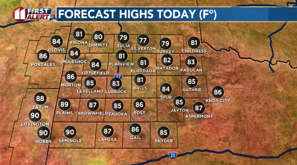 Highs today will warm into the 80s(KCBD)
Not everyone will see rain, but a few storms could turn briefly strong with gusty winds and hail before fading after sunset.
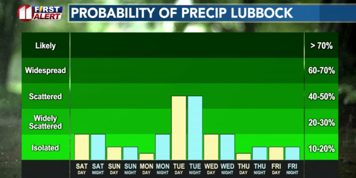
Memorial Day Monday looks warm, humid, and unsettled.
Expect a mix of clouds and sunshine with highs in the 80s. A few scattered storms are possible, though coverage appears very spotty.
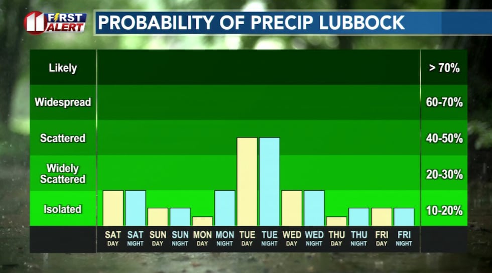 Daily rain chances this week(KCBD)
The bigger story may arrive Tuesday into midweek as another storm system approaches from the West.
That set up could bring more widespread showers and thunderstorms across the region. There is at least some risk for severe weather depending on how the timing evolves.
After that, temperatures likely trend warmer later next week, with isolated storm chances.
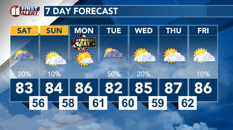 7 Day Forecast(KCBD)
Copyright 2026 KCBD. All rights reserved.