
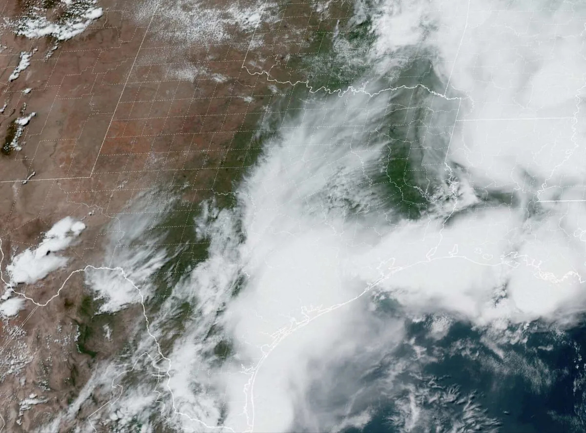
It was quite the soggy Saturday across Southeast Texas. Widespread thunderstorms moved into the Houston metro area during the afternoon and evening, resulting in about 1-3 inches of rain throughout much of the area.
Heading into Sunday, another round of rain is expected to develop for parts of the region, especially in areas along and near the Gulf Coast. After that, drier weather is becoming more likely heading into Monday and Tuesday. The break in activity will be short-lived, however, as yet another round of heavy rain will be possible by the middle of the week.
Sunday’s forecast
Houston’s best chance of rain Sunday is expected during the morning hours, especially between 5 and 10 a.m. Not everyone will see rainfall, though, as the heaviest activity is expected to form along and near the Gulf Coast.
Rain chances in areas like Galveston, League City, Pearland and the south side of Houston will be at around 50% to 70%. Rain chances will be lower in areas farther north, with just a 30% to 50% chance of storms from the north side of Houston to areas like Spring and The Woodlands.
Additional rainfall totals between 1-2 inches are possible in areas near the coast, which could result in isolated flash flooding. From Houston and into areas farther north, less than an inch of additional rainfall is expected, but isolated higher totals are still possible.
Rain chances across Southeast Texas will decrease significantly by the afternoon. An isolated shower or storms will stay possible through the evening, but most will stay dry. Temperatures will also stay slightly below average, with highs expected to top out in the low 80s.
Memorial Day forecast
Rain chances will continue to decrease Monday across Southeast Texas. Early in the morning, there is a slight chance of showers or isolated weak storms, but overall rain chances will only be about 30%.
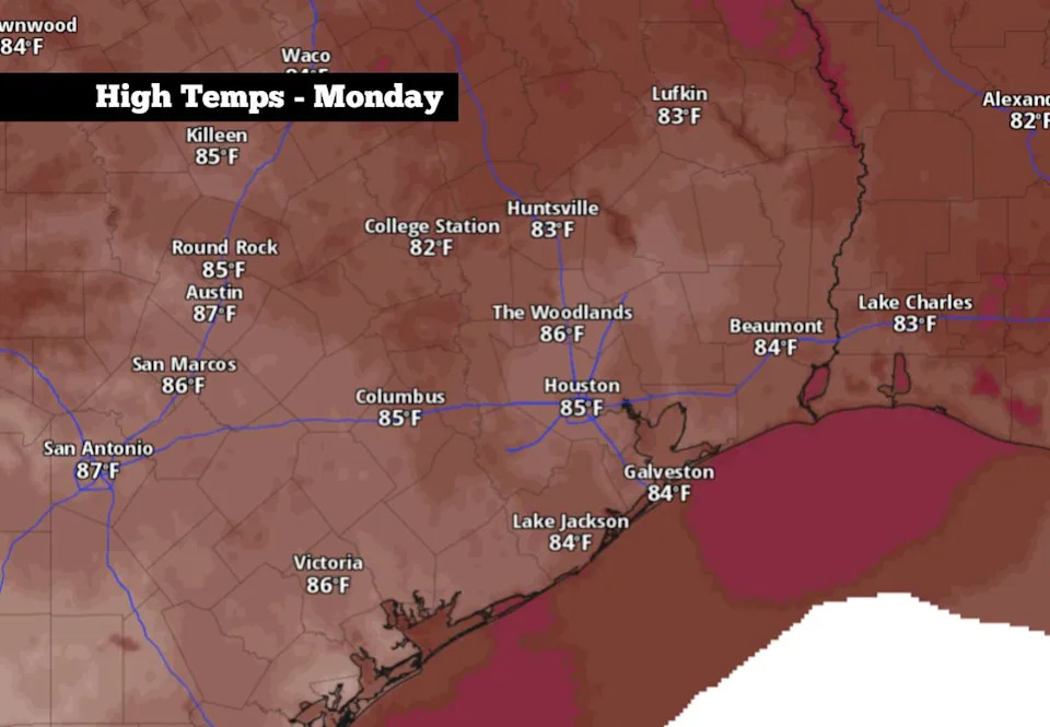
Shown are the expected high temperatures across Southeast Texas on Memorial Day. (Pivotal Weather)
Besides the slight chance of rain, comfortable conditions are expected with morning temperatures expected to hover in the 70s. Houston will likely reach 80 degrees by noon, before topping out in the mid-80s by the late afternoon.
A few scattered showers and storms will stay possible throughout the afternoon and evening, but this activity is not expected to be widespread. If you have outdoor plans for the holiday, there’s no need to cancel them, but have an umbrella ready just in case.
More heavy rain coming
Dry conditions are expected across much of Southeast Texas on Tuesday. However, a low-pressure system is expected to redevelop across the western U.S., and it will bring additional chances of heavy rain by the middle of the week.
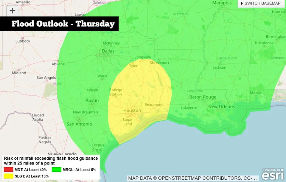
The National weather Service has placed Houston under a Level 2 of 4 risk of flash flooding on Thursday, May 28. (National Weather Service)
Houston rain chances will rise again by Wednesday morning, with chances of widely scattered storms lasting into Wednesday evening and early Thursday. Overall rain chances will be about 60% to 80% in the Houston metro area.
Weather models show that another 1 to 2.5 inches of rain is likely across Harris County through Thursday with isolated higher totals of up to 4 inches possible. The National Weather Service has placed Houston in a level 2 of 4 risk of flash flooding during this time. Rain chances are expected to decrease by Friday, but a few lingering showers and storms are still possible.
Subscribe
There’s more to Houston with the Chronicle. Subscribe today for just 25¢.
This article originally published at More rounds of rain are coming to Southeast Texas? Here’s the updated forecast..