
LUBBOCK, Texas (KCBD) – The next couple of days will bring a stretch of drier and warmer weather, though a few isolated storms may pop up late each afternoon. Then a couple days of more active weather is currently expected around Friday and Saturday.
Severe Threat
Scattered rain showers with a few thunderstorms, mainly along and east of I27-H87, will continue to drift northward until after sunset. While the severe threat has nearly ended, some storms may produce wind gusts up to around 60 mph.
End of Showers
Tonight into early Wednesday morning any lingering showers and storms will move out of the KCBD/FOX34 viewing area. The night will be mostly cloudy with an overcast sky likely near and just after sunrise.
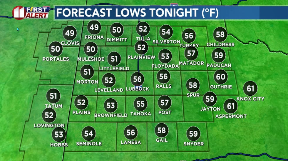 Lows about five degrees below average for late May.(KCBD First Alert)
Overnight temperatures will drop to about five degrees below late May averages. Our northwestern zones with be coolest.
Drier, Warmer
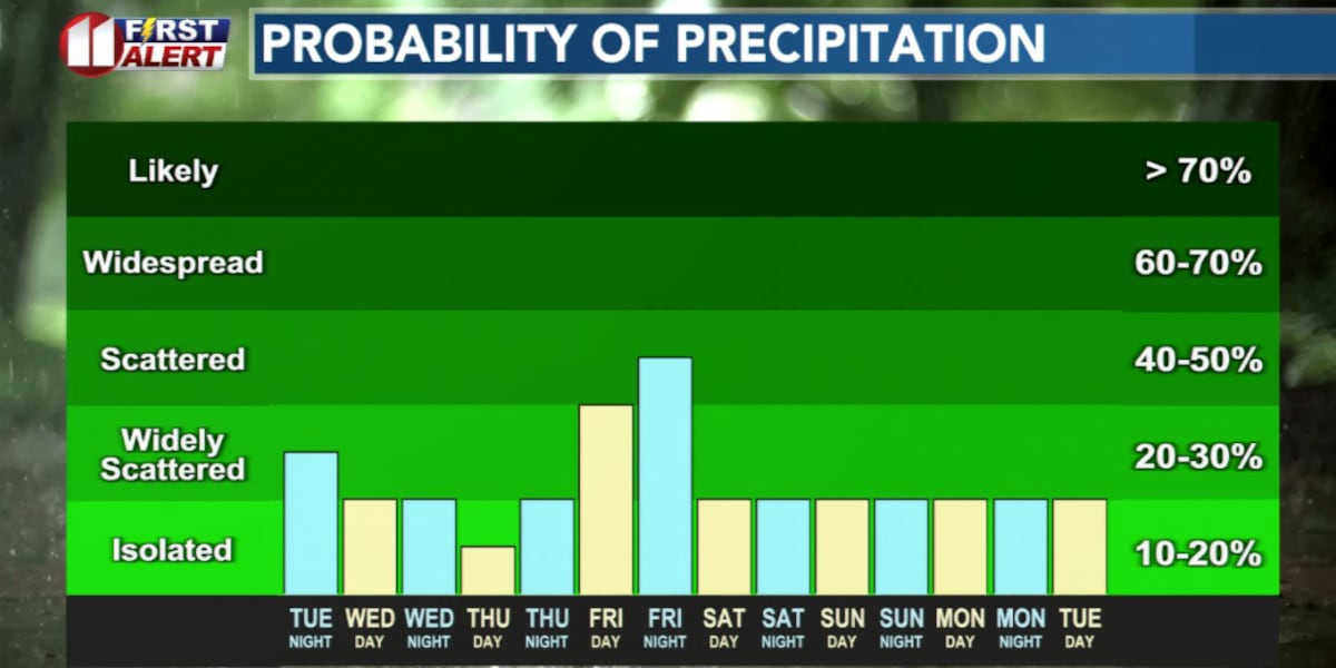
Wednesday and Thursday will be mostly quiet, offering an opportunity to catch up on outdoor activity. Rain chances will be minimal, only abut 20 percent for much of the area and near 30 percent for our northern counties.
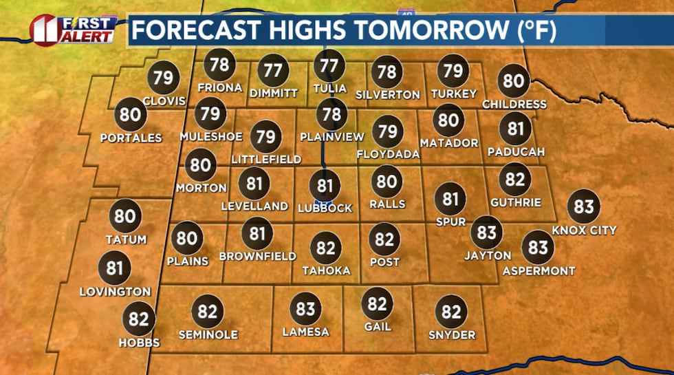 Much warmer Wednesday afternoon, though temperatures will peak 6 to 7 degrees below average for the date.(KCBD First Alert)
It’ll be warmer than what we’ve experienced recently, with afternoon highs climbing into the 80s across the South Plains.
Storms Return
The pattern shifts late in the week as a slow-moving weather system moves eastward out of the southern Rockies.
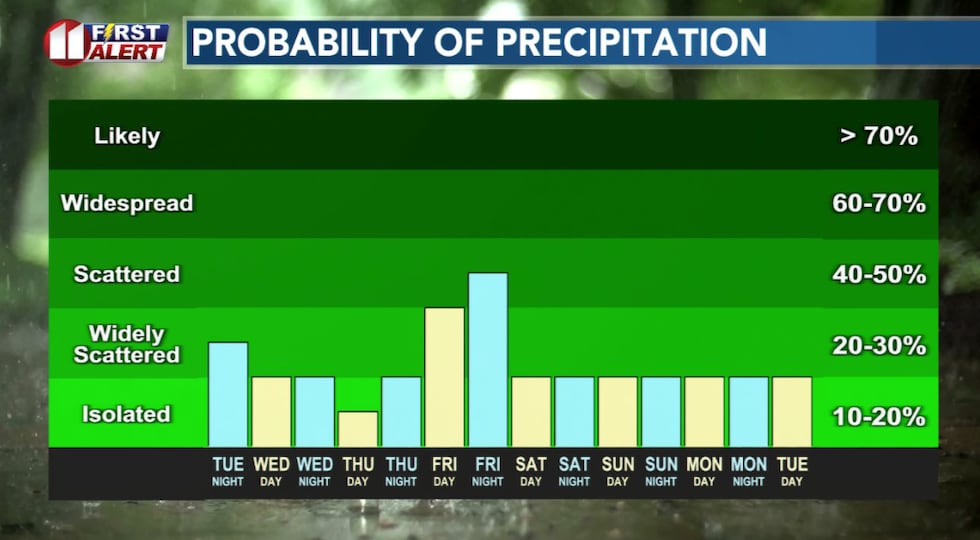 Less rain, though a chance of a few isolated storms in the area late Wednesday and Thursday.(KCBD First Alert)
A dryline (the boundary between warm and moist air to the east and warm-to-hot and very dry air to the west) should make a return to eastern New Mexico. As it moves eastward late Friday is will bring better chances for storms back on the Caprock.
Temperatures will continue warm, with afternoon highs mostly in the 80s and some spots peaking in the low 90s.
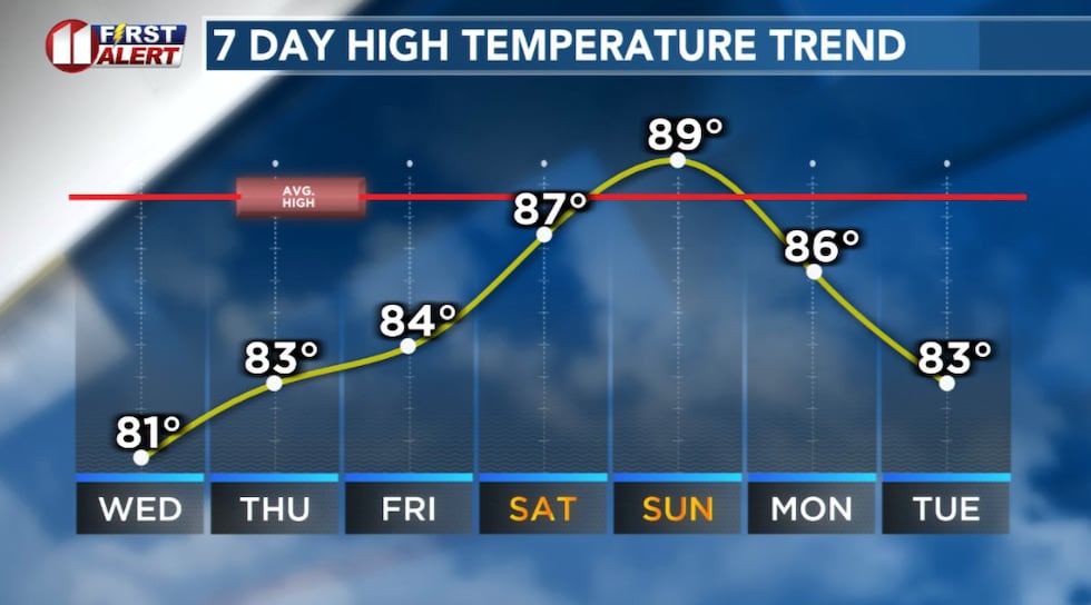 Temperatures will gradually warm to near average by this weekend.(KCBD First Alert)
Stay weather aware. Severe prospects are in play given the pattern and the atmospheric support we’re seeing.
Looking ahead
A semi-active is anticipated into early next week, which keeps the daily chances of storms in our forecast. It’s a reminder that while we’re getting a couple of quieter days this week, our severe weather season is not over.
 First Alert Weather App(KCBD)
Keep an eye on the forecast as we move through the weekend and into next week.
On This Date
On this date in 1541, a diary from a priest accompanying Coronado’s exploration chronicled a fierce hailstorm, believed by many archeologists to have occurred at a campsite in Blanco Canyon south of Floydada where numerous artifacts were discovered. “A tempest came up one afternoon with a very high wind and hail. The hail broke many tents and tattered many helmets.”
(Source: National Weather Service, Lubbock)
Copyright 2026 KCBD. All rights reserved.