
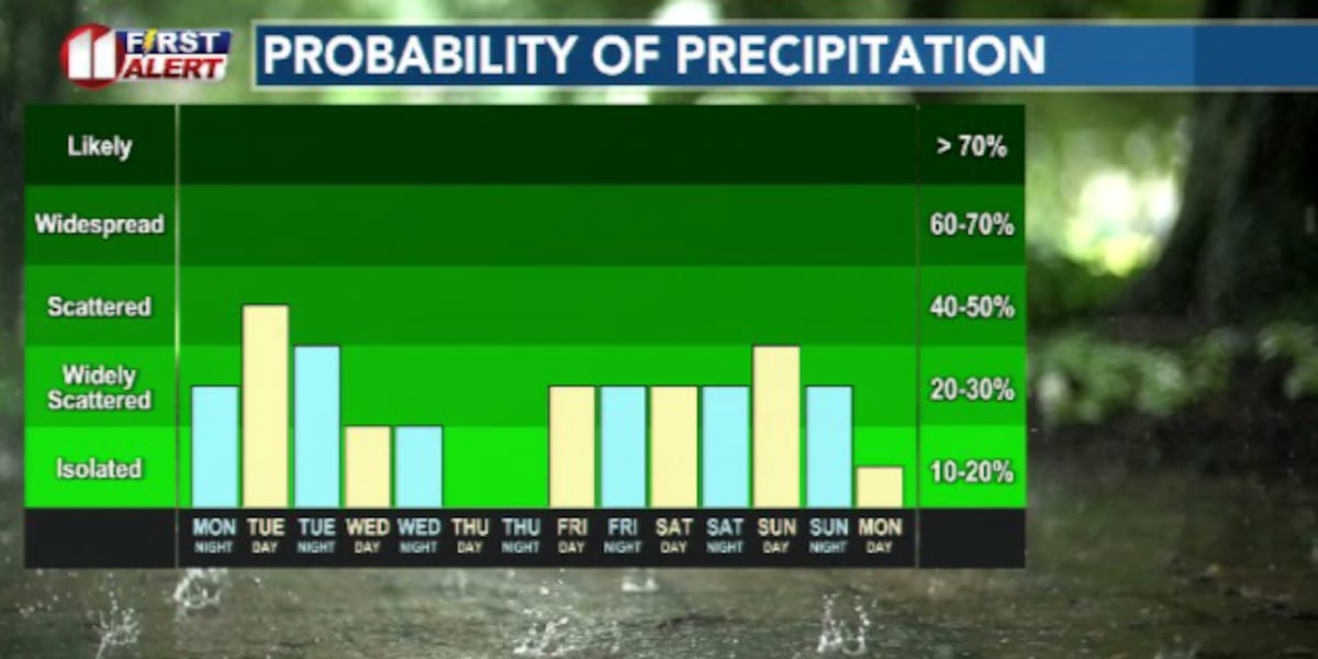
LUBBOCK, Texas (KCBD) – A beautiful, warm and sunny Memorial day is giving way to widespread showers and storms throughout the day Tuesday, with more chances of rain possible over the next 7 days.
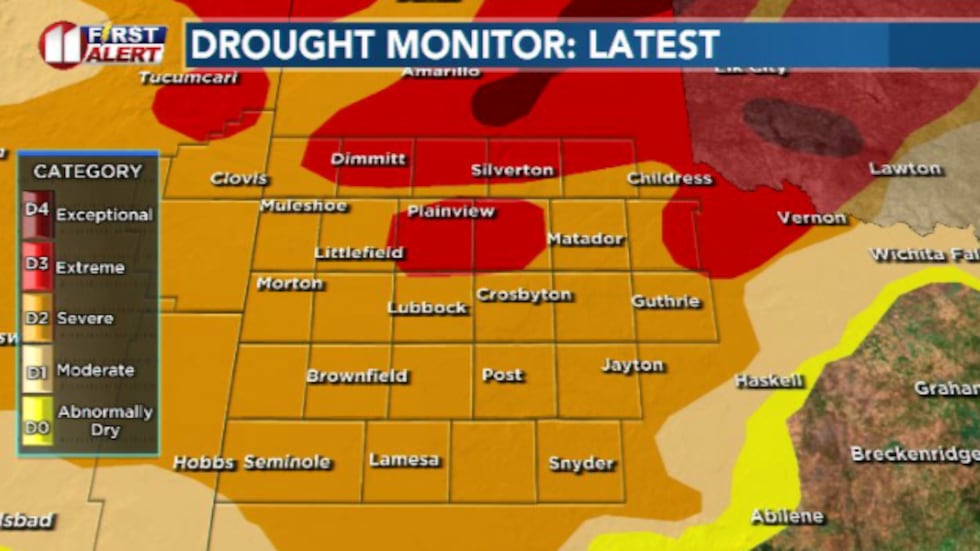 Beneficial rainfall over the last few days will likely have a positive impact on the drought monitor, which releases on Thursday(Dylan Smith)
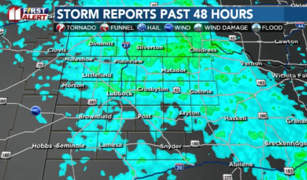 We saw a lot of beneficial rainfall and not a ton of severe weather over the past 48 hours(Dylan Smith)
TONIGHT
Showers and storms are likely to start expanding eastward out of New Mexico throughout the late night/early morning hours Tuesday.
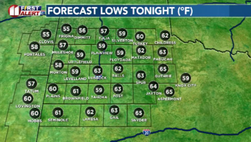 Mild and humid as we stay in the 50s and 60s(Dylan Smith)
Overnight lows will generally be in the 50s and lower 60s. I don’t anticipate much in the way of strong to severe storms overnight.
TUESDAY
While it won’t be a consistent rainfall all day, widespread to numerous showers and storms will develop and traverse the South Plains, generally from the southwest to the northeast.
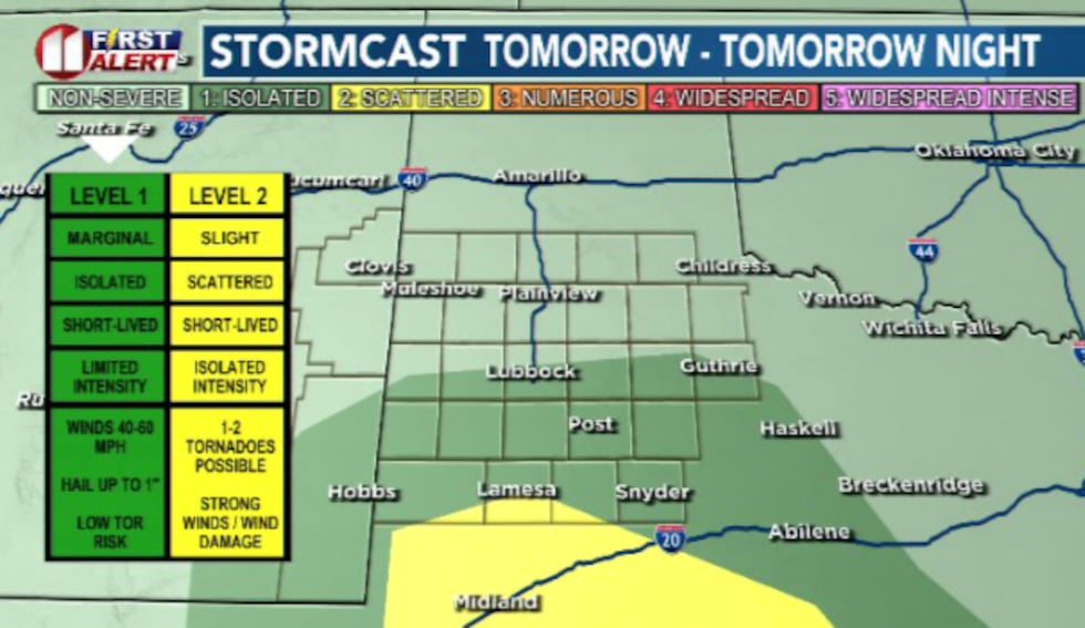 It’s not looking likely that we’ll see much significant severe weather, as flooding will likely be the biggest threat if we see some heavy downpours pile on(Dylan Smith)
The concern for severe weather is low but we could see some potential flooding and flash flooding for areas that receive some training storms and heavy rainfall.
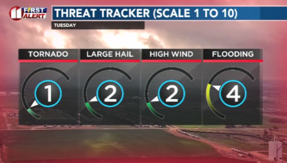 I’m not ruling out seeing strong winds and hail, but most likely if we see heavy rain, it’ll become more of a flooding threat(Dylan Smith)
EXTENDED WEATHER PATTERN
Rian chances could linger into Wednesday for some with a general drying out Thursday.
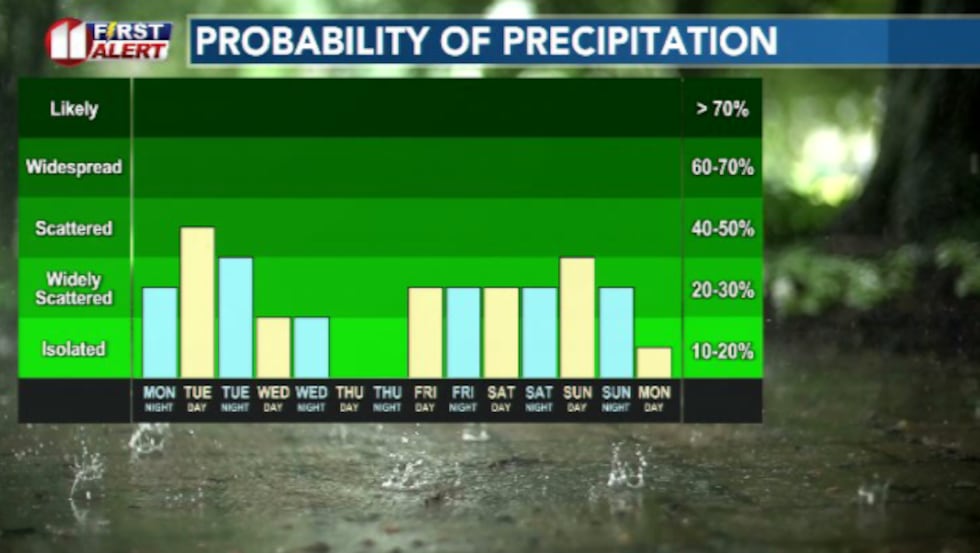 Widespread rain is anticipated Tuesday, with more chances of rain heading our way next weekend(Dylan Smith)
After that, another area of low pressure is looking to make a return to the area beginning Friday evening and will bring rain chances through at least Sunday of next weekend.
Copyright 2026 KCBD. All rights reserved.