
LUBBOCK, Texas (KCBD) – After much needed round of rain Sunday evening, the South Plains heads into a wetter weather pattern for the rest of the week.
Highs today will reach the upper 90s. Winds will shift from the southwest to the southeast this afternoon, helping pull more Gulf moisture back into the region.
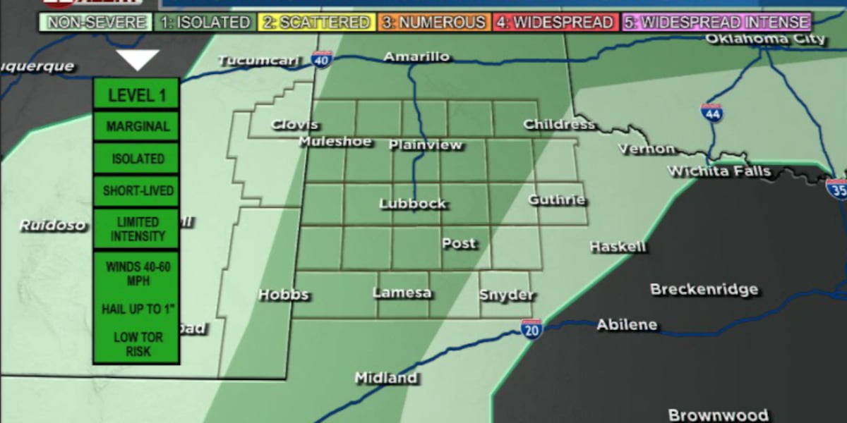
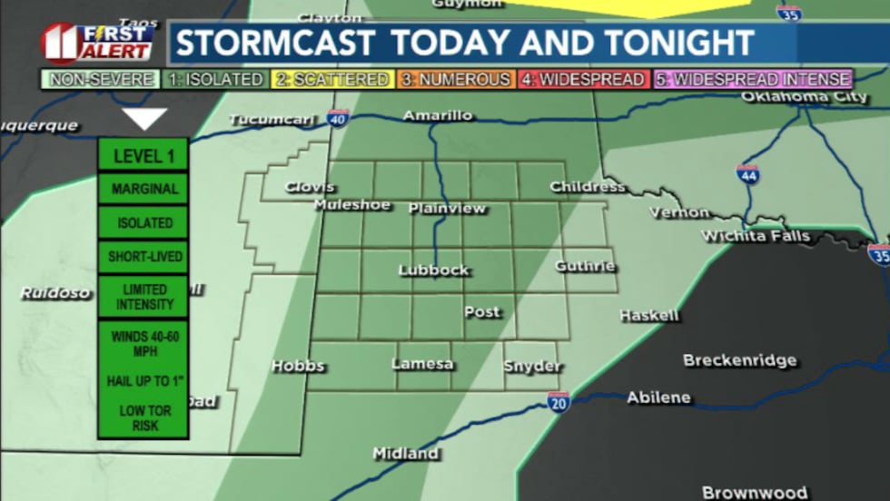 Isolated storm chances this afternoon and evening(KCBD)
Isolated thunderstorms are possible this afternoon, but coverage is expected to remain limited. Any storm that forms could produce strong winds and some hail.
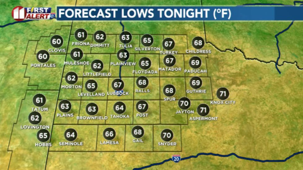 Mild tonight(KCBD)
Any storms will fade overnight, leaving a warm and mild night behind.
By Tuesday, the overall weather pattern begins to shift. Temperatures stay warm in the 90s, but increasing humidity and a passing disturbance aloft will bring better chances for showers and storms Tuesday evening into Tuesday night.
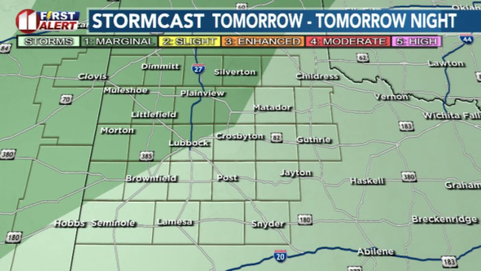 More rain chances tomorrow evening(KCBD)
Storms are expected to start in eastern New Mexico before moving east into the South Plains overnight. Severe weather potential currently looks limited, but some storms could still produce gusty winds, small hail, and periods of heavy rainfall.
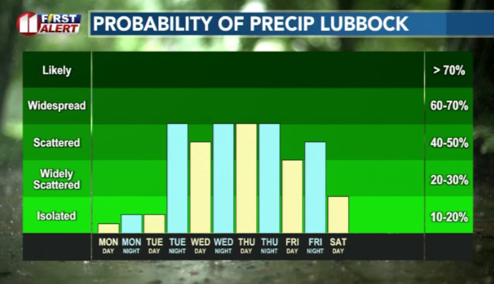 Very active wet pattern this week(KCBD)
The rest of this week features cooler temperatures and high chances of widespread heavy rainfall through the week.
The best window for rainfall is currently Wednesday but keep in mind that may change as the forecast develops.
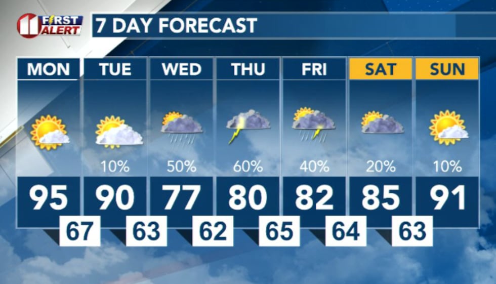 7 Day forecast(KCBD)
Copyright 2026 KCBD. All rights reserved.