Temperatures on Wednesday morning are about 5 to 6° cooler than on Tuesday, and this trend will continue into the afternoon.
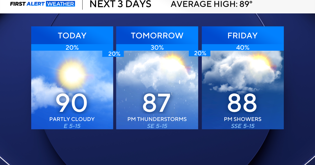
Expect a mix of clouds and sunshine, with highs around 90° and feels-like temperatures closer to the mid-90s.

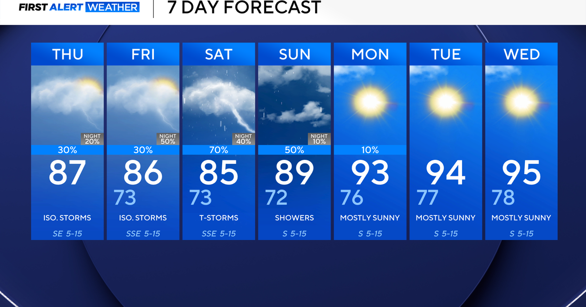
There is a 20% chance of an isolated shower or storm on Wednesday afternoon, but coverage will be lower than on Tuesday. Rain chances will quickly start to rise on Thursday afternoon, and this trend will continue into the weekend.
An upper-level low moves closer from the southwest and is the main reason for increasing rain chances. You may want to start thinking about alternative plans this weekend if you plan on being outdoors. There is a low-end level ¼ risk for flooding across North Texas from Thursday through Sunday.

Looking ahead to next week, the forecast is trending drier. With drier conditions, expect temperatures to heat right back up to the 90s, with feels-like temperatures in the triple digits by the middle of the week.