
LUBBOCK, Texas (KCBD) – We’ve had a good run of rain over the past week or two, putting a small dent in the drought for portions of the South Plains.
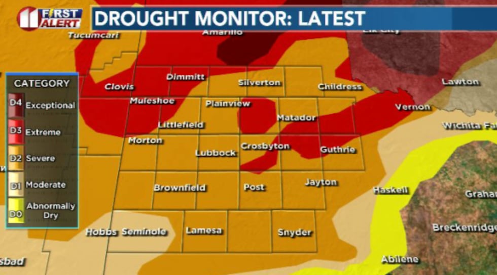 We’ve put a small dent in the drought in our southwestern counties over the past week(Dylan Smith)
Moving forward, we’ll be seeing a break in rain chances as summertime temperatures make a return to the area.
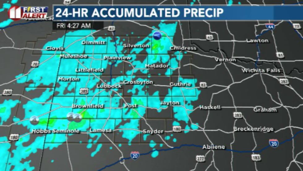 Another active rain day led to more solid coverage and rainfall totals for the area(Dylan Smith)
TODAY
Mild and generally pleasant. We’ve got chances for some isolated showers and storms today, mostly in the afternoon/evening hours.
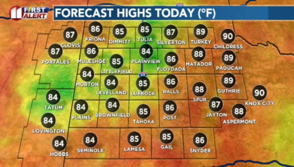 Warm/mild afternoon temperatures hit the 80s today(Dylan Smith)
High temperatures hit the mid 80s for most with partly cloud y to mostly cloudy skies.
TONIGHT
Mild and humid again as temperatures remain in the 60s for most. Rain chances remain but stay slim with some isolated showers popping up here and there.
SATURDAY
This weekend is shaping up to be two halves of a coin. Saturday will stay mild and wet at times with a 40 percent chances of showers and storms, possibly seeing some severe weather at times.
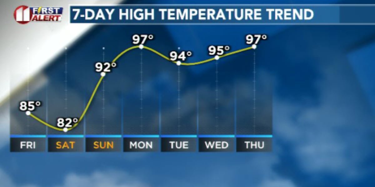
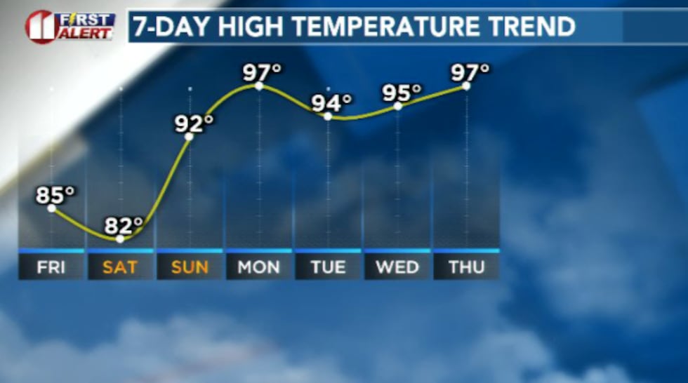 Temperatures will climb heading into the middle of June(Dylan Smith)
Temperatures remain in the low to mid 80s thanks to extended cloud cover and rain-cooled air.
SUNDAY
Sunday will be much warmer as temperatures spike in to the low to mid 90s.
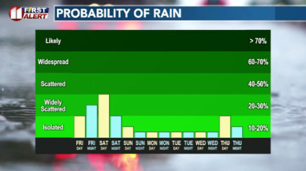 Rain will persist for today and tomorrow before generally drying up heading into Sunday/next week(Dylan Smith)
Rain chances fall off for the most part as sunny skies return.
EXTENDED WEATHER PATTERN
Next week will be a continuation of the hot and sunny skies.
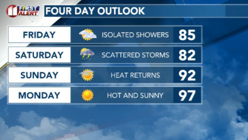 Temperatures spike after rain chances dry up Saturday night(Dylan Smith)
Temperatures stay mostly in the 90s with a mostly dry pattern setting up for the area heading into mid-June.
Copyright 2026 KCBD. All rights reserved.