
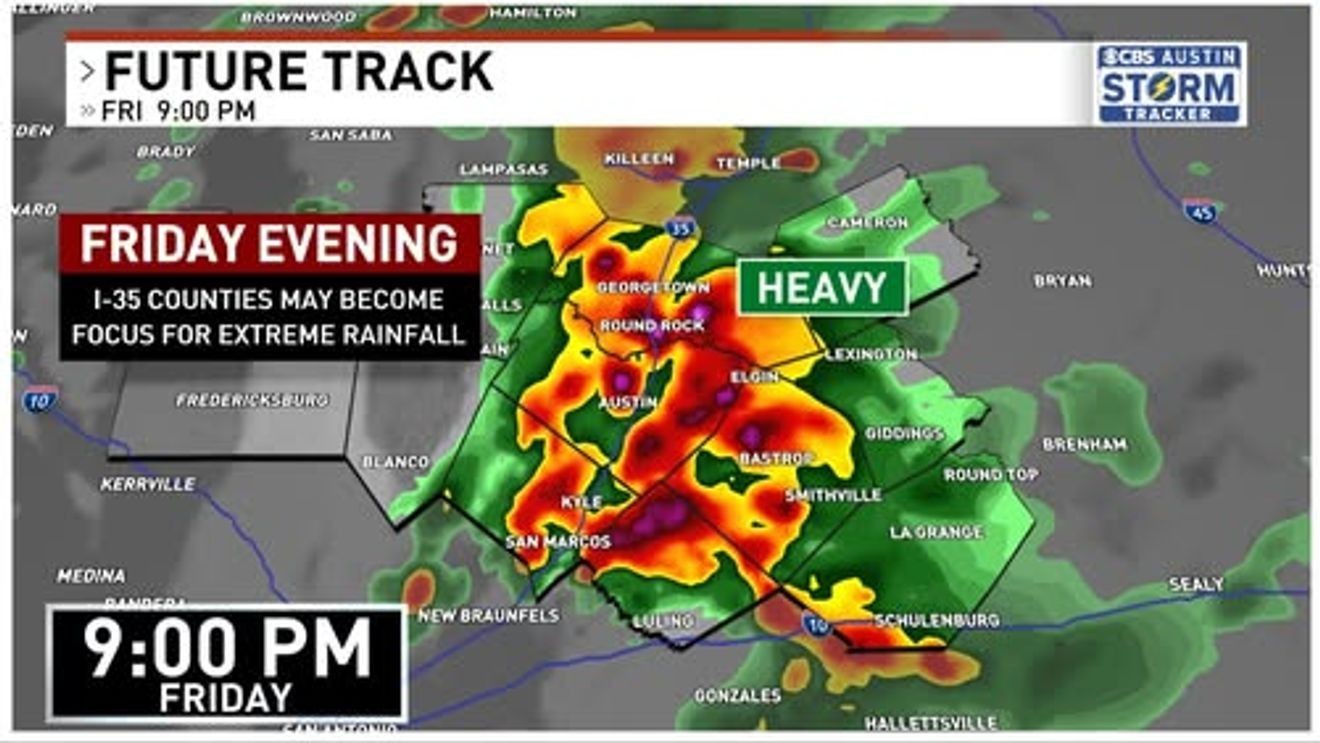
AUSTIN, Texas — Central Texas is bracing for heavy rainfall Friday night, according to CBS Austin Meteorologist Avery Tomasco.
A flood watch is in effect for eight Central Texas counties through 1 a.m. Saturday.
The National Weather Service issued the watch for Burnet, Williamson, Travis, Hays, Caldwell, Bastrop, Lee and Fayette counties. Flash flooding of roads, creeks, streams and rivers is the primary concern.
ALSO | Lockhart ISD launches initiative to cut screen time, boost recess and outdoor play
Tomasco warned that atmospheric moisture levels are at the 90th percentile for this time of year.
“This tropical moisture will lead to very efficient rainfall rates as high as 4 inches per hour,” Tomasco said Friday. “All it takes is a couple of hours of rain in one location to produce 6 inches or more of rain and rapidly developing flash flooding.”
The heaviest rain is expected between 6 p.m. and midnight Friday.
Areas along the I-35 corridor (particularly Travis, Hays and Williamson counties) are forecast to see widespread totals of 1 to 3 inches, with isolated amounts of 6 to 9 inches possible.
Early Friday afternoon, flood advisories were already issued for parts of Milam and Williamson counties after 2 to 3 inches of rain accumulated quickly. By 4 p.m., rainfall rates of 2 to 3 inches per hour were being estimated near Georgetown, Sun City and Liberty Hill in Williamson County.
Tomasco noted key differences in the setup of this storm compared to the deadly flooding over the July 4th weekend in 2025. That event featured a near-stationary remnant low-pressure system that produced hours of heavy rain in isolated locations. Friday night’s system is a larger, moving Pacific low that is expected to bring drier air into the region by Saturday morning, bringing an end to the most significant flooding concerns.
“Those floods were a lesson for everyone of how quickly a heavy rain threat can turn into a tragedy,” Tomasco said of the 2025 floods. “We live in flash flood alley. We all need to be extremely wary of situations like this.”
Rain chances drop considerably over the weekend. A 30% chance of showers or storms remains Saturday afternoon and evening, with a further reduced 20% chance of isolated storms Sunday.