
Watch a livestream of the radar in the player above.
LUBBOCK, Texas (KCBD) – The next few days will bring a familiar pattern to West Texas: hot temperatures and a few afternoon thunderstorms, some with the potential for strong wind gusts and hail. That is, the same pattern our area experienced Sunday and, as I write this, Monday.
Storm, and therefore rain chances, are expected to increase late in the weekend.
Tonight
Isolated thunderstorms developed by mid-afternoon along a dryline stretching from north to west of Lubbock. The main threats are damaging wind gusts and large hail. The strongest storms may produce microbursts—those sudden, powerful downdrafts of wind that can catch you drivers and anyone outside off guard.
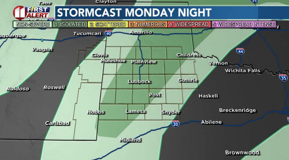 Isolated to widely scattered storms are likely until after sunset Monday.(KCBD First Alert)
Storms should taper off after sunset with calm conditions overnight. You might wake up to some low clouds and patchy fog Tuesday morning as moisture levels increase, but that should clear out by mid- to late morning as temperatures warm.
More Heat
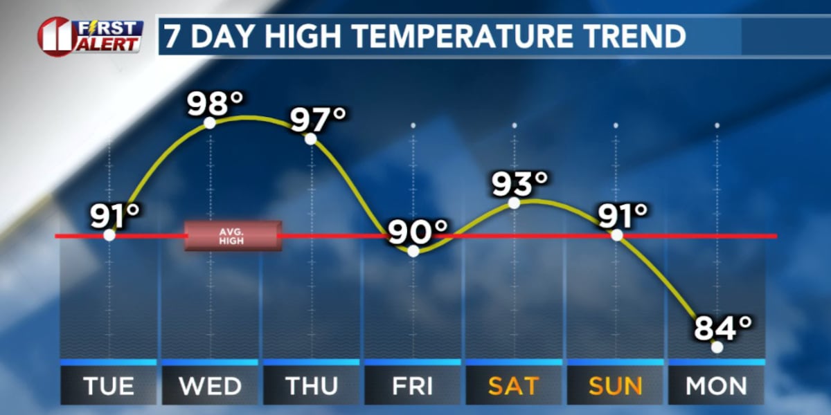
Tuesday will be hot, but not quite as hot as Monday. Temperatures will peak near average for the time of year. As noted, there will be a chance of isolated storms returning in the late afternoon through early evening. The area most likely to experience nearby storms Tuesday is the northwestern KCBD/FOX34 viewing area. Remain weather aware.
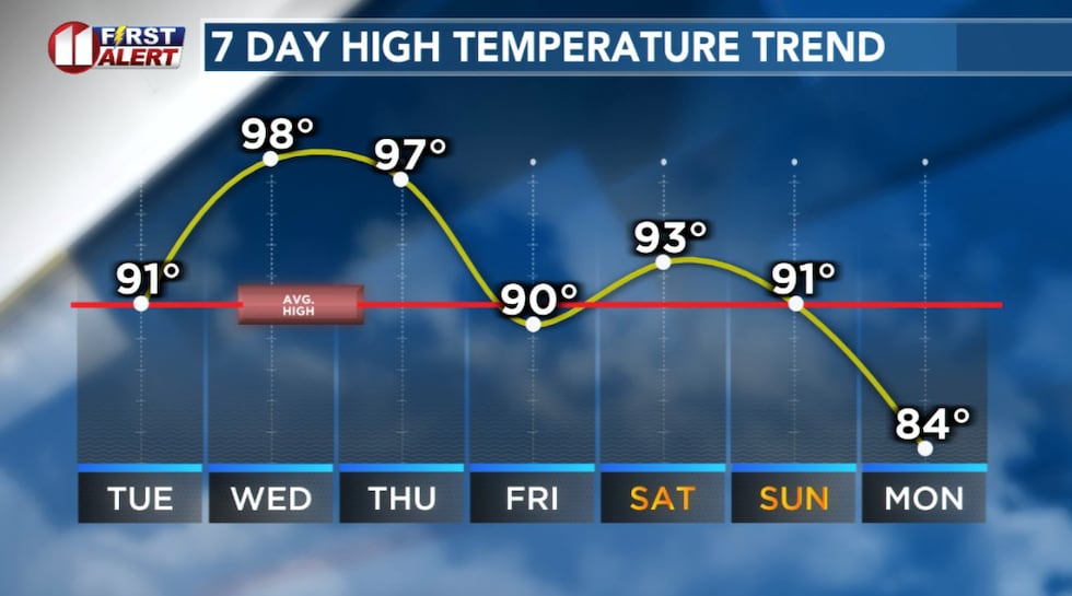 Heat and humidity through the weekend.(KCBD First Alert)
From Wednesday through Thursday, the heat really takes over. Expect highs climbing back into the upper 90s and possibly 100 degrees. Each afternoon thunderstorms may develop along the dryline — the boundary between dry air to the west and moist air to the east.
Most guidance strongly suggests storms will be limited. That said, watch for later forecasts which may include updates.
Rain Outlook
Heat and humidity will be our companions through the week.
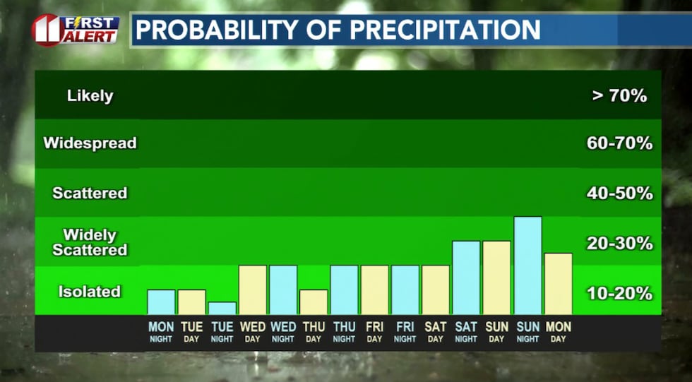 In the continuing heat and humidity, there is at least a slight chance of a storm each day this week.(KCBD First Alert)
Afternoon storms are possible most days, with a few potentially becoming severe. The best chance for more widespread rain is anticipated late in the weekend as a stronger weather system moves in.
Stay hydrated, keep tabs on the forecast, and stay with us for updates as conditions develop.
Heat Safety
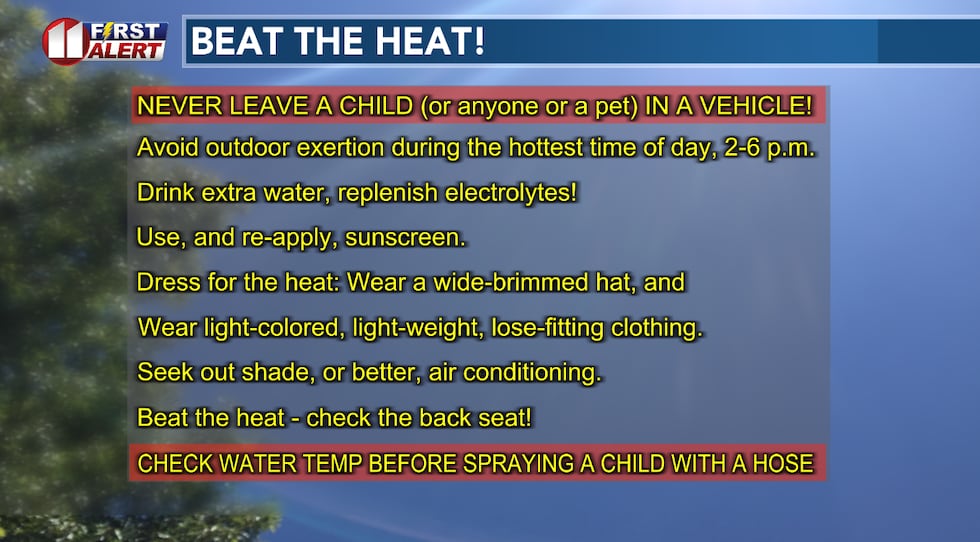 It’s the time of year to start implementing these heat safety tips.(KCBD First Alert)
Copyright 2026 KCBD. All rights reserved.