
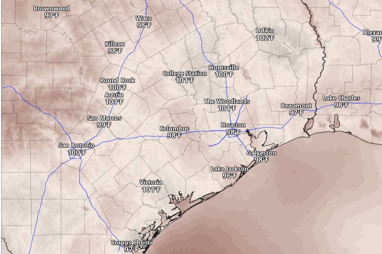
Heat index values, or humidity-driven “feels like” temperatures, could be in the triple digits in San Antonio by 5 p.m. Tuesday, according to the National Blend of Models, a composite weather forecast model.
National Blend of Models/Pivotal Weather
Starting Tuesday, San Antonio’s peak daytime temperatures are expected to reach, but not exceed, the lower 90s. However, humidity will raise dew point temperatures into the lower 70s and push heat index values, or “feels like” temperatures, to around or just above 100 degrees.

What does all that mean exactly? Let’s unpack some weather terms:
Article continues below this ad
Dew point temperatures: The dew point essentially is how cool the air has to get for dew drops to form at the ground level. It tends to increase as the air becomes more saturated with water vapor. For instance, you’ll find the air becomes uncomfortably muggy when the dew point is 65 degrees or higher. San Antonio’s dew points this week will waver roughly between 72 and 75 degrees.
Heat index values: On hot days, we rely on the evaporation of the sweat from our skin to cool down. But humid air makes evaporation harder because the air is already filled with water vapor. The heat index takes this into account and gives a more accurate description of what the body experiences, at least better than what the actual air temperature would suggest.
Why this matters: Because your body’s ability to cool down is compromised, humidity-boosted heat can become dangerous for those performing strenuous activity outside. You risk heat exhaustion or heatstroke if you don’t stay hydrated or take frequent breaks from the heat.
Tuesday’s forecast
San Antonio on Tuesday can expect partly sunny skies, according to the National Weather Service. Southeast winds of 5 to 15 mph with gusts as strong as 20 mph will be delivering moisture-rich air from the Gulf of Mexico into Central Texas. The humid air, though, will make the daytime high of 91 degrees feel more like 100.
Article continues below this ad
“With plenty of evapo-transpiration moisture available, the near-normal summertime temperatures will be combined with high dew points through the afternoons,” the weather service said in a forecast bulletin Monday. “This should add a few degrees to the heat index over what will be seen from the ambient temperatures.”
At night, the cloudiness increases and persistent gusty south-southeast winds will help keep overnight temperatures above a balmy 75 degrees before sunrise Wednesday.
In this weather satellite photo of Texas taken on Monday around 2:30 p.m., clear skies will follow in the wake of storm clouds that briefly soaked parts of the state.
Geostationary Operational Environmental Satellites/CIRA and NOAA
Wednesday and beyond
“Ridging (of high atmospheric pressure) will be the predominant feature over the area for midweek, and heat index values will continue get into the 100- to 105-degree territory through the work week,” the weather service said, adding that “while dry weather is favored, a few sea-breeze showers and storms cannot be ruled out each day,” especially farther east of the Interstate 35 corridor in the Coastal Plains.
Article continues below this ad
Wednesday: San Antonio on Wednesday is likely to be partly sunny, which should only help afternoon temperatures climb easily to 93 degrees, which would be only a degree above-normal for June 10. But the humidity will add about 10 degrees for a heat index reading closer to 103.
The warm southerly winds of 5 to 10 mph should continue to be robust, with gusts as strong as 20 mph. Nighttime temps Wednesday will likely stay above 76 degrees under partly cloudy skies and those gusty south-southeast breezes.
Thursday: San Antonio is shaping up to see a repeat of Wednesday’s weather on Thursday, which also will be mostly sunny with stout southerly winds. Forecasters expect afternoon temperatures to again reach 93 degrees, which might actually feel more like 105, thanks to elevated humidity levels. At night, the Alamo City’s skies will turn partly cloudy, as temperatures bottom out only around 76 degrees before dawn Friday.
Article continues below this ad
Friday and the weekend could include the arrival of an atmospheric disturbance that brings a surge of moisture from the Gulf Coast, forecasters said. While low rain chances would reenter the forecast for South-Central Texas, “this pattern could also become more unstable due to the upper ridge being suppressed from the north as a cold front reaches the Red River Valley,” they added.
“So for most of this week, we should enjoy mostly hot and stable summer-like days to dry out, but be prepared for possibly another round of stormy weather next week,” the weather service said.