
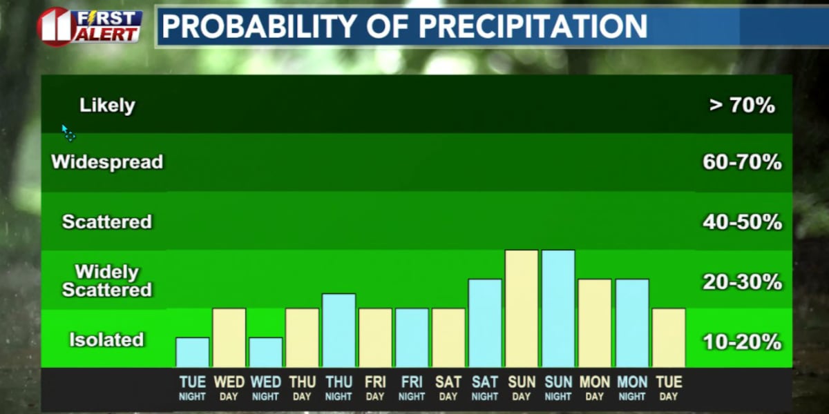
LUBBOCK, Texas (KCBD) – A slight chance of thunderstorms will move into the area late this Tuesday evening, and some may persist into early Wednesday morning. Very hot afternoons follow Wednesday and Thursday, with isolated storms possible late both days. The weekend brings slightly cooler temperatures, but afternoon and evening thunderstorm chances continue.
Late this evening into early Wednesday morning, a weak disturbance moving across New Mexico will continue to trigger thunderstorm activity over the higher terrain to our northwest. There will be just enough atmospheric instability to keep some of these of these storms going, and may drift into the northwestern KCBD/FOX34 viewing area tonight. At this time, there is only a low potential for the storms to reach the Plainview area and very little potential to reach Lubbock. If one does, it won’t be until late.
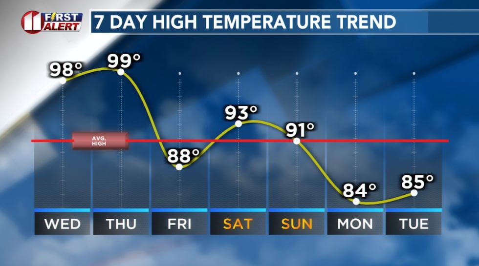 Above average highs Wednesday and Thursday followed by a slight “cooldown”.(KCBD First Alert)
The main threat from these storms will be strong to severe wind gusts, potentially greater than 60 mph. Some hail is possible, though conditions are not favorable for large hail. Don’t be surprised if you hear some storm activity late tonight or early Wednesday morning.
Wednesday will get hot across the South Plains. A large area of high pressure (aka a ridge), over the southeastern United States and building into Texas, whill help push high temperatures into the upper 90s to just over 100 degrees at some location. A dryline will mix eastward during the afternoon and may trigger isolated thunderstorms mid- to late afternoon, primarily from the south-central Texas Panhandle into the southwestern South Plains. Similar to what happened Monday.
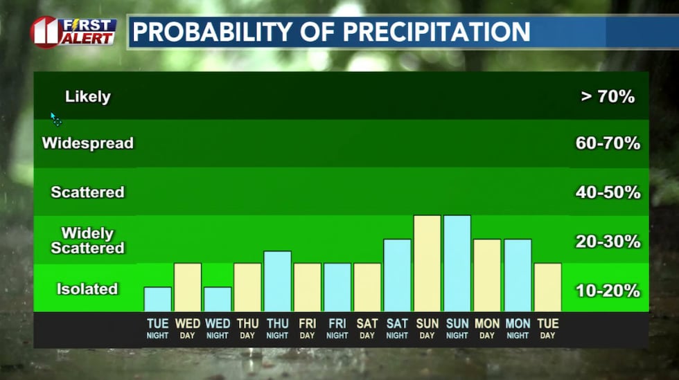 Storms are likely in the area late each day, but coverage will be limited each day.(KCBD First Alert)
The pattern will continue through Thursday, so expect another very hot afternoon with highs again in the upper 90s to around 100 degrees. And another chance of isolated afternoon and evening storms.
Strong winds and locally heavy rain are likely with some of the storm activity.
The weekend brings a slight cooldown, though “cooler” is relative. Concurrently, somewhat greater thunderstorm chances are possible during this time.
 First Alert Weather App(KCBD)
Copyright 2026 KCBD. All rights reserved.