
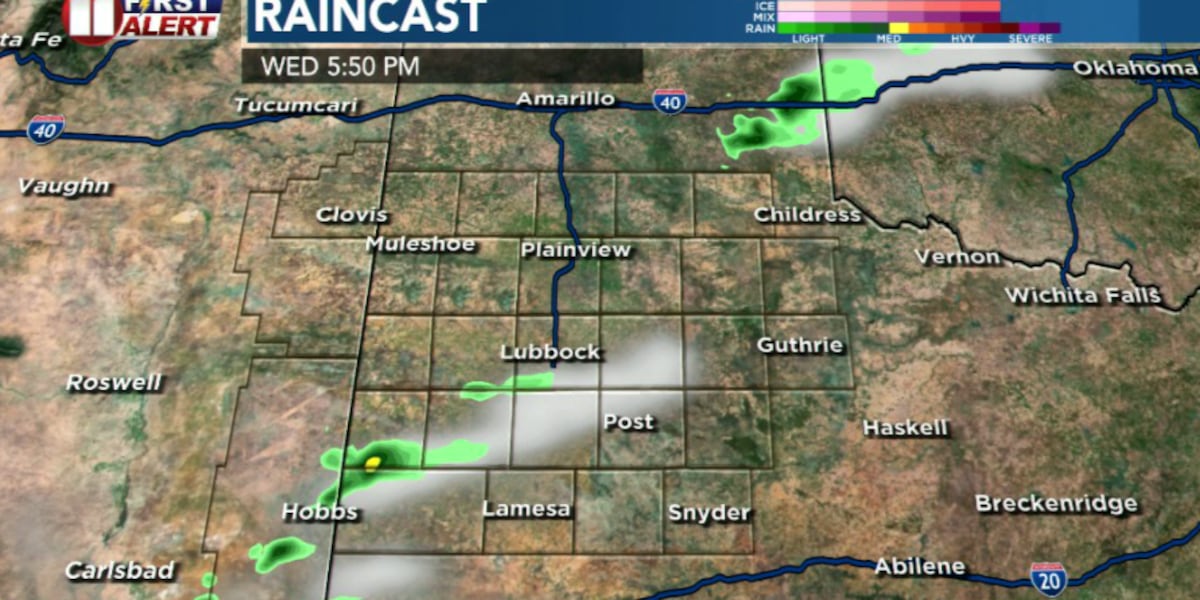
LUBBOCK, Texas (KCBD) – Scorching temperatures and a late-day storm threat will dominate the South Plains Wednesday as a weak weather system approaches from the southwest.
 KCBD(KCBD)
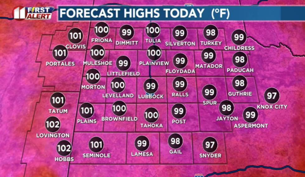
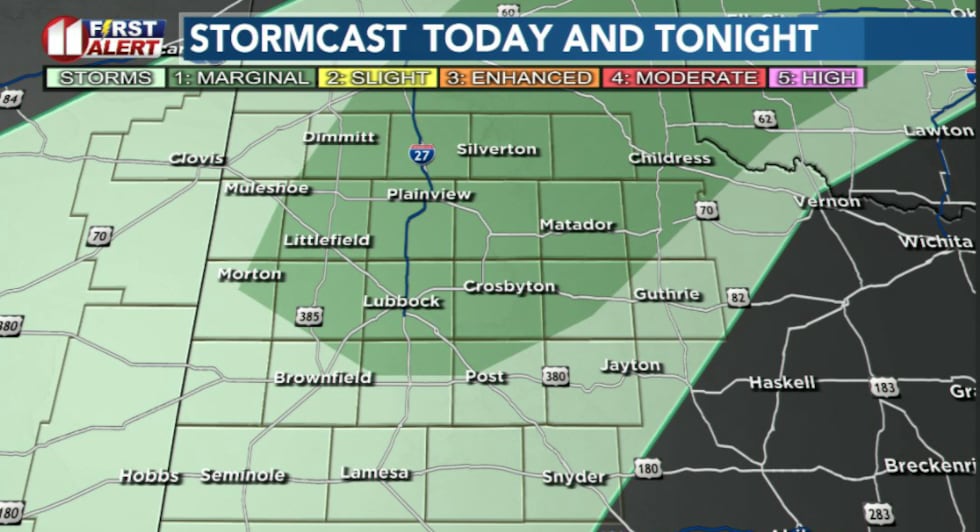
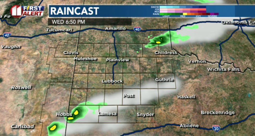
Highs Wednesday will climb into the mid-90s to near 100 degrees across the region, making it another dangerously hot day. The intense heat, combined with atmospheric instability, may trigger thunderstorm development late this afternoon and evening, mainly across the southwestern and south-central South Plains.
 KCBD(KCBD)
The storms that develop could pack a punch, storms capable of producing strong to severe wind gusts and locally heavy rain are possible, particularly from Lubbock southwestward into Far West Texas and southeast New Mexico.
 KCBD(KCBD)
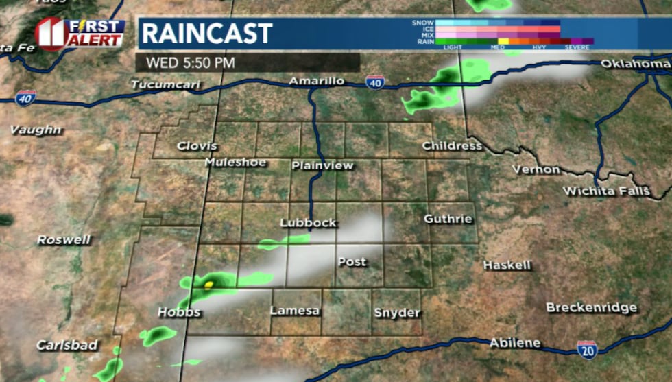
The storms are expected to develop gradually during the afternoon near heating along the dryline. Atmospheric data suggests wind shear will be weak to moderate, which could allow storms to produce damaging downbursts rather than rotating severe weather.
 KCBD(KCBD)
Activity should gradually diminish during the evening hours as the system moves through.
Thursday brings another hot day with cold front arrival
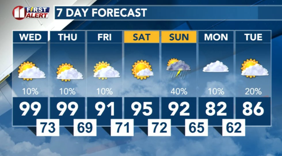
Thursday will start warm again, with temperatures climbing into the 90s before a cold front arrives late in the day. The front’s arrival will increase the chance of showers and thunderstorms, mainly across northern and eastern areas.
A cold front will push southward through Thursday and is expected to stall across the northern South Plains. Convergence along the front could support isolated to scattered thunderstorms late Thursday afternoon and evening. The Storm Prediction Center has portions off the Caprock in a slight risk for severe weather.
Severe thunderstorms with potential for strong wind gusts up to 70 mph and large hail up to quarter to half dollar size are possible with the strongest storms. However, model uncertainty remains regarding the exact location where the front stalls, which will impact storm development.
 KCBD(KCBD)
Daily thunderstorm chances and hot temperatures are expected to continue through the weekend. The pattern of afternoon and evening storms combined with triple-digit heat will persist across much of the region.
Copyright 2026 KCBD. All rights reserved.