
LUBBOCK, Texas (KCBD) – Local weather will remain very mild this week. A couple of cold fronts will pass through mid- and late-week. At this time, neither appears to bring significant changes. It’s November, so that may change.
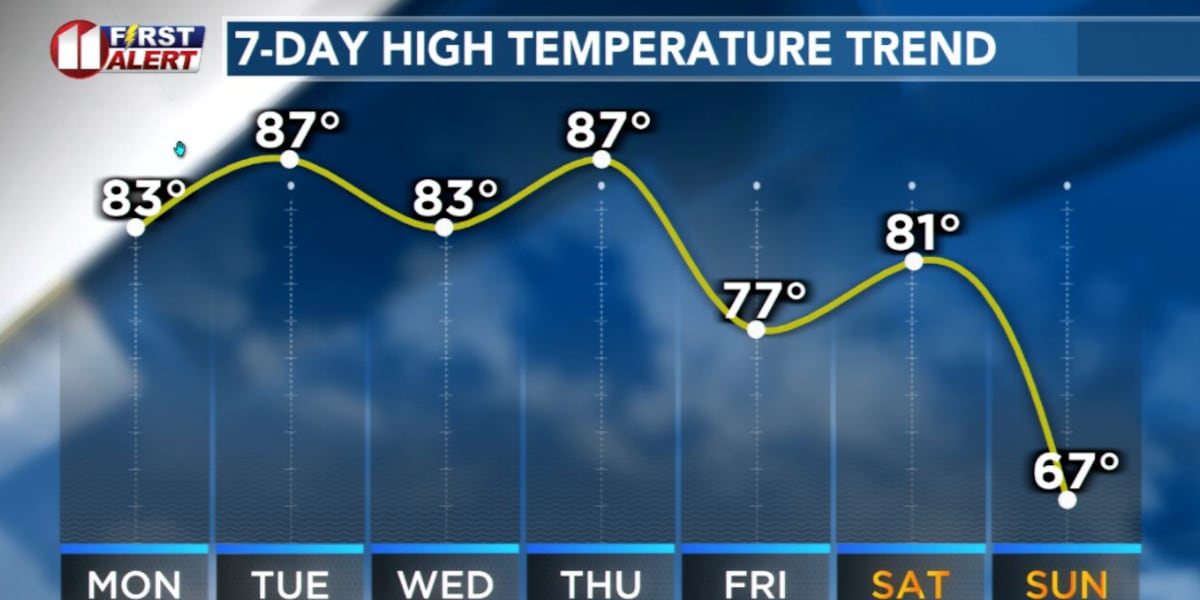
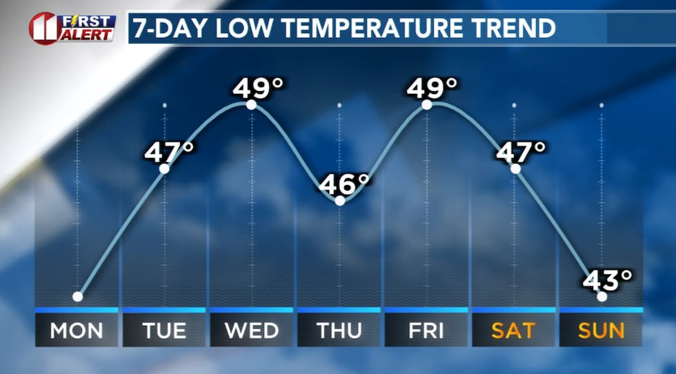
Temperatures will continue to peak above average, even with a mid-week cold front, through at least Saturday. There will be some day-to-day variation but I don’t anticipate any large swings through the work week. Plus, I don’t anticipate another freeze for Lubbock through at least the weekend.
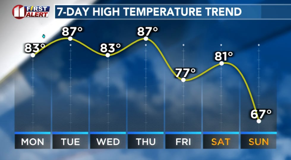 Temperatures will continue to peak above average through at least Saturday.(KCBD First Alert)
It’s a pattern that will prevent rain, or any other precipitation, from moving into or developing in the KCBD/FOX34 viewing area this week. Mostly fair skies will be the rule, not the exception.
 Some day-to-day variation in temperatures but no large swings through the work week.(KCBD First Alert)
Most days will feature a light to breezy wind. Cold fronts are expected Wednesday, early Friday, and again late Saturday.
Data available today indicates the front late Saturday will be the strongest. That said, it may only bring temperatures down to near average for early November.
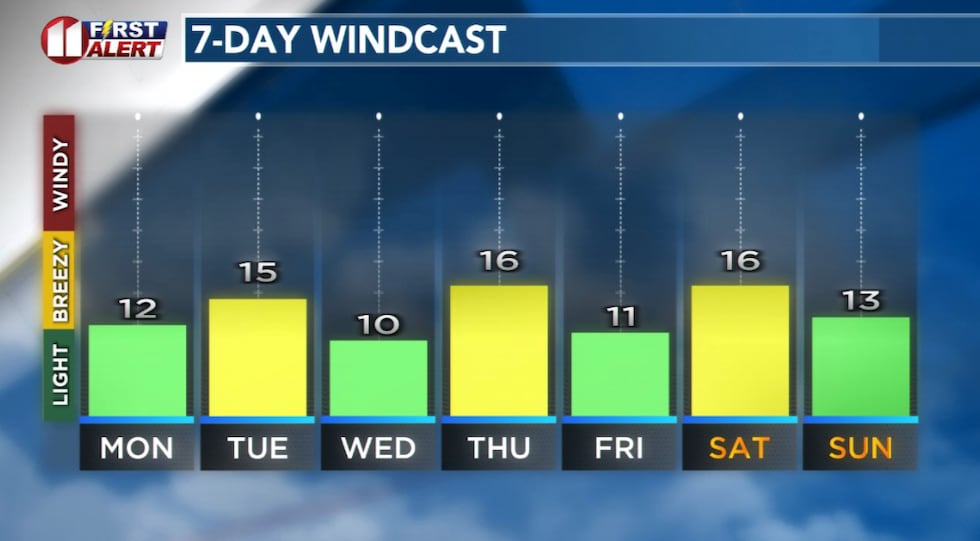 Most days will feature a light to breezy wind.(KCBD First Alert)
Lubbock’s average high for today, November 3, is 69°. The record high is 88°, set 20 years ago today. The average low is 41°. The record low is 7°, set in 1991.
Oh, and with this weekend’s time change, sunrise was at 7:08 (CST) this morning, sunset will be at 5:53 (CST) this evening.
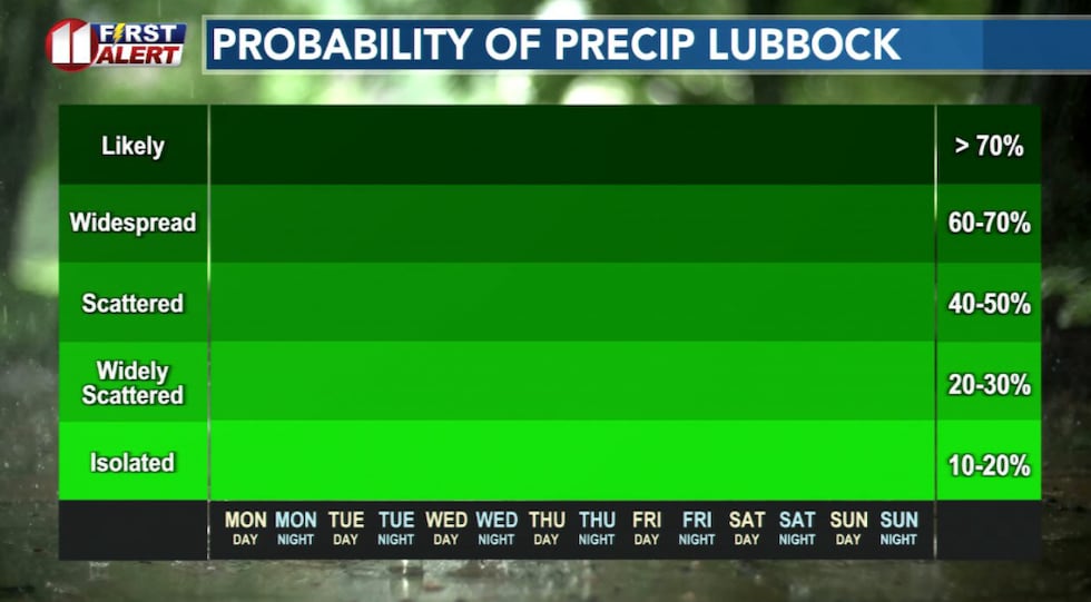 The overall pattern that will prevent rain, or any other precipitation, this week.(KCBD First Alert)
Speaking of dry, this October was the 20th driest in Lubbock’s 114 years of weather record. There were two Octobers with just a trace and another two with no rain at all observed. There were an additional 15 Octobers with less than this October’s 0.37″.
Copyright 2025 KCBD. All rights reserved.