
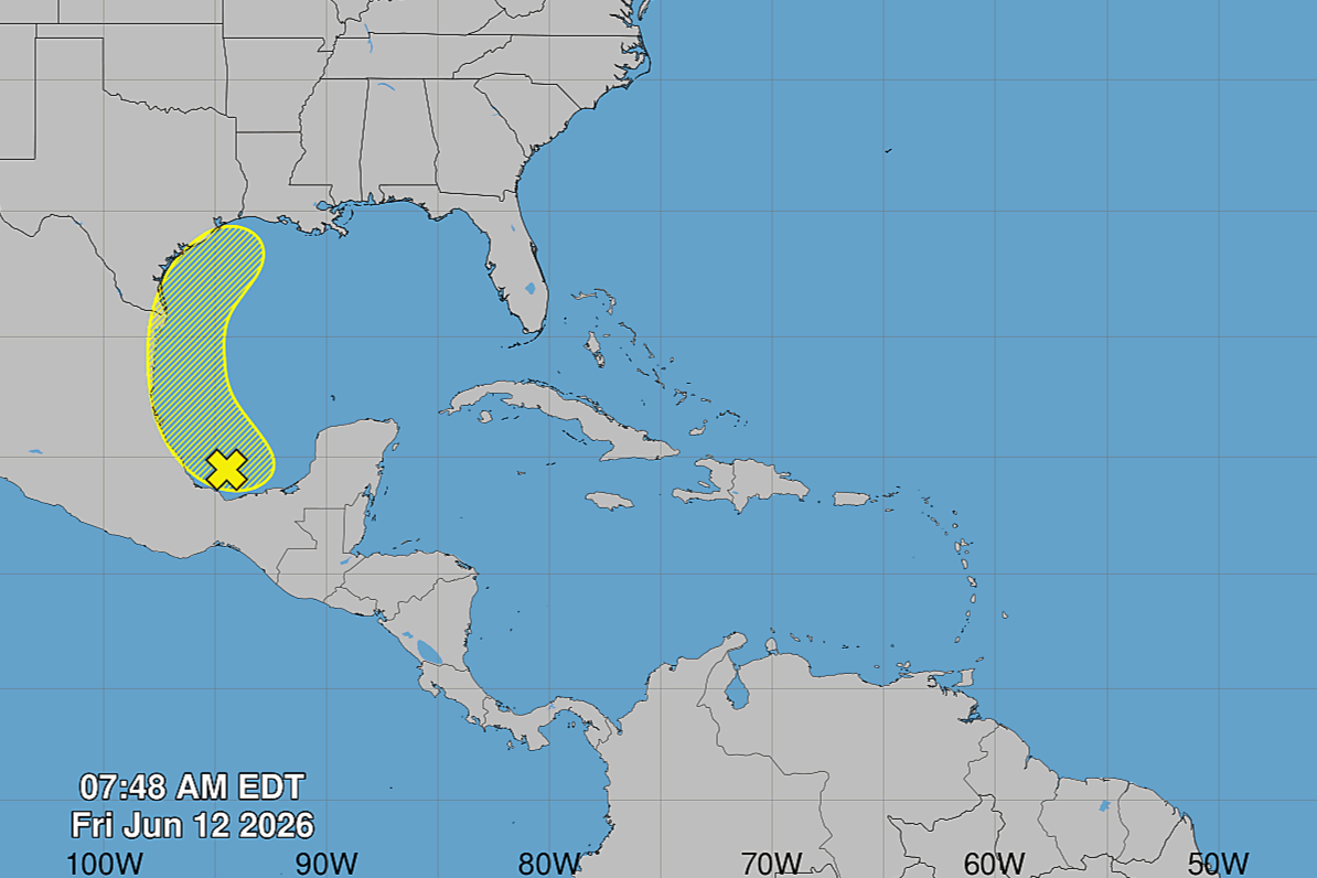
An area of low atmospheric pressure that has formed in the southern Gulf of Mexico isn’t likely to get much stronger or directly affect Houston, but it could complicate the rainy arrival of a cold front next week in Southeast Texas.
The National Hurricane Center on Friday was monitoring the area of low pressure, which was over the Bay of Campache, just west of Mexico’s Yucatan Peninsula, as it continued to produce disorganized thunderstorms. Forecasters gave the atmospheric disturbance only a 10% chance of developing into a tropical cyclone in the next 48 hours, or even the next seven days.
Sometimes, with enough heat energy and moisture, storms produced by low pressure systems can start to organize into rotating tropical cyclones. But forecasters said that would be highly unlikely this time.
“The (low pressure) system could re-emerge over the northwestern Gulf on Tuesday and Wednesday while interacting with a frontal boundary,” the hurricane center said, “but there, too, conditions are only expected to be marginally conducive for any development.”
While the high atmospheric pressure that has kept Houston hot and humid over the past few days is expected to persist across the northeastern
Gulf of Mexico through Tuesday, the broad trough of low pressure to the south will shift slowly northwestward through the weekend. The atmospheric disturbance will likely move inland across northeast Mexico and South Texas on Sunday, the hurricane center said.
By Sunday night, the cold front will be surging south towards Southeast Texas, according to the weather service.
“Model guidance shows the cold front stalling out over Southeast Texas,” the weather service said in a forecast bulletin Friday. “Too early to say where specifically, but wherever it does stall, it’ll focus convection (storm development) and amplify showers/storms along the boundary.”
The weather service’s flood forecasters at the Weather Prediction Center have placed large parts of Southeast Texas north of Interstate 10 under a level 2 of 4 risk, or at least a 15% chance, of flooding rainfall Sunday night and into Monday.
“The heavy rainfall threat also looks to continue through portions of Tuesday before tapering off into Wednesday as the frontal boundary lifts north,” the weather service said. “Rainfall totals late Sunday through Tuesday are forecasted to range from around 1-3 inches, though higher amounts to around 5 inches cannot be ruled out.”