
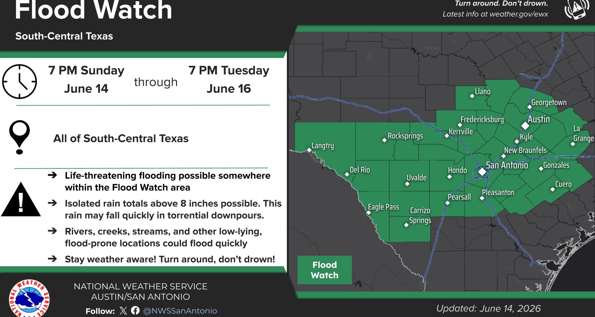
The entire San Antonio metro area is included in the flood watch, as well as Austin and the Interstate 35 corridor. The watch also extends into the Texas Hill Country, Edwards Plateau, Rio Grande Plains and Coastal Plains.
Neighboring cities, such as Fredericksburg, Kerrville, Llano, New Braunfels, Pleasanton, Pearsall, Uvalde, Seguin, Eagle Pass and Del Rio are also included in the flood watch.
About 1-3 inches of rain is expected across the flood watch area. Isolated higher rainfall totals of up to 8 inches is possible for a few spots. This is due to the abnormally high atmospheric moisture levels across South Texas, as well as the slow-moving nature of the expected thunderstorms.
Rainfall rates could exceed 2 to 3 inches per hour at times, which could cause flash flooding in a matter of minutes. Additionally, the strongest storms may also be capable of strong winds up to 50 mph, as well as small hail.
“There is a potential for life threatening flooding somewhere in the watch area,” the National Weather Service said in the statement. “Excessive runoff may result in flooding of rivers, creeks, streams, and other low-lying and flood-prone locations.”
Rainfall will not last all day. Expect long periods of dry conditions interrupted by shorter heavy bursts of rainfall. San Antonio will have about a 40% to 60% chance of thunderstorms Sunday afternoon through the evening. Rain chances are expected to rise to around 80% for Monday and Tuesday. For a look at San Antonio’s full forecast, click here.