
WATCH LIVE RADAR IN VIDEO ABOVE FORECAST HIGHLIGHTS
A Flash Flood Warning has been issued for Bexar County until 10:45 a.m. Monday
Break in the rain mid-morning
MONDAY AFTERNOON THROUGH TUESDAY: High chance for heavy rain, especially SOUTH of San Antonio
RAIN CLEARS: Late Tuesday
SOME RAIN RETURNS: Friday
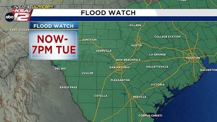
Flood Watch is in effect now through Tuesday evening. (Copyright KSAT-12 2026 – All Rights Reserved)FORECAST
Very high moisture from the Gulf moves in as a cool front approaches from the north, producing times of storms with heavy, heavy rain.
THIS MORNING
Flash flooding is ongoing as up to 6 inches of rain has fallen in some areas. This is leading to water over low-water crossings and in the many construction zones around San Antonio. If traveling this morning, use extra caution.
MONDAY AFTERNOON THROUGH TUESDAY
We should get a break from the rain around mid-morning, but redevelopment from a low pressure system south of San Antonio is likely MONDAY NIGHT THROUGH TUESDAY
This feature will likely produce very heavy rain south of town and along the Texas coast. As it moves east late Tuesday, rain chances will come to an end.
This is why the entire region is under a FLOOD WATCH until 7 pm Tuesday.
THE REST OF THE WEEK
It’ll be very hot Thursday, while rain makes a return to the forecast on Friday and into the weekend.
Extended Forecast (Copyright KSAT-12 2026 – All Rights Reserved)Daily Forecast
KSAT meteorologists keep you on top of the ever-changing South Texas weather.
QUICK WEATHER LINKS
Copyright 2026 by KSAT – All rights reserved.