
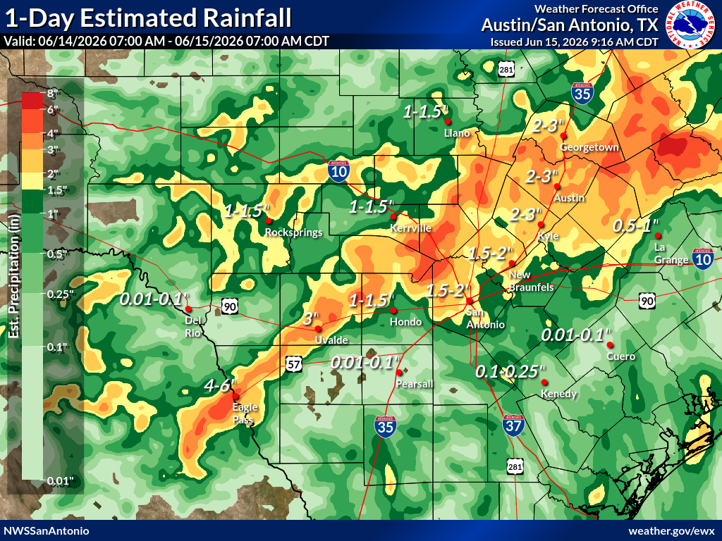
The heavy rainfall has prompted the National Weather Service to issue multiple flash flood warnings and flood advisories along the Interstate 35 corridor, while a flood watch remains in effect through Tuesday evening. A flood watch means the public should monitor weather updates for potential flooding in their area, while a warning is issued when flooding is occurring or imminent.
Top rainfall totals of at least 4 inches include:
In Austin, more than 3 inches of rain had fallen by 8 a.m., setting a new daily rainfall record. It surpassed the previous mark of 2.56 inches set in 1964.
In San Antonio, more than 2.5 inches of rain have fallen, also setting a new daily rainfall record. It beat the old one of 1.68 inches set more than 130 years ago in 1894.
Because of the heavy rainfall over the past 24 hours, the Highland Lakes managed by the Lower Colorado River Authority are feeling the effects. The LCRA has opened a floodgate at the Tom Miller Dam, which forms Lake Austin, and will result in higher stream flows and raised lake levels in Lady Bird Lake.
Deep volumes of tropical moisture combined with a stalled cold front will continue to fuel multiple rounds of heavy rainfall and thunderstorms across Central Texas through Monday.
Widespread rain is expected to persist for the next several hours, although the corridor of heaviest rainfall is forecast to gradually shift farther south by this evening.
Abundant moisture will remain in place overnight, and the latest high-resolution models continue to show pockets of heavy rainfall developing across the region through Tuesday.
This setup can produce rainfall rates of 2 to 3 inches per hour, with some locations in South Texas potentially picking up more than 8 inches of rain by Tuesday evening, when the flood watch is set to expire.