
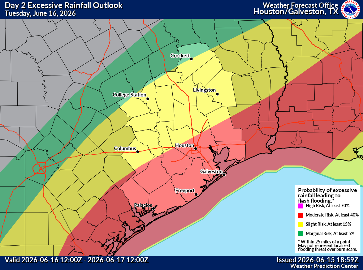
A tropical disturbance could move into the Gulf of Mexico near the Texas coast late Tuesday or Wednesday, but whether it becomes a tropical storm or not, Houston faces an increasing threat of heavy rainfall and flooding in the days ahead.
The National Hurricane Center is monitoring a broad area of low pressure over northeastern Mexico that continues to produce disorganized showers and thunderstorms. The system was designated Invest 90L on Monday, meaning the hurricane center has begun running specialized forecast models to assess its development potential.
Once over water, environmental conditions could become marginally favorable for development. The hurricane center says the disturbance could organize after emerging into the northwestern Gulf late Tuesday or Wednesday and continues to give the system a medium chance of development during the next several days. If it reaches tropical-storm strength, it would be named Arthur, the first named storm of the 2026 Atlantic hurricane season.
Tropical storm watches or warnings could be required for portions of the upper Texas coast as early as Tuesday if the system becomes better organized.
For Houston and Southeast Texas, the more important forecast question is not whether the disturbance becomes tropical, but how much rain it produces. Houston’s flood risk will be driven primarily by rainfall totals and repeated storms this week rather than whether the disturbance earns a tropical designation.
The disturbance remains disorganized and lacks a well-defined center of circulation, but development could become more likely once it reaches the Gulf. Any strengthening would likely be gradual, though the system could briefly organize into a tropical depression or tropical storm before moving inland.
The hurricane center emphasized that the greatest concern is not tropical development itself, but the potential for widespread and potentially life-threatening flash, urban and river flooding across portions of Texas, Louisiana and Mississippi.
Even so, the system bears watching because it will help funnel more tropical moisture into an already saturated weather pattern across Texas and the western Gulf Coast.
Regardless of development, the system is expected to contribute to periods of heavy rainfall, localized flash flooding and gusty winds across eastern and southern Texas through the week. That moisture will interact with a stalled weather pattern already in place across the region, supporting more rounds of thunderstorms.
The current flood watch only accounts for the initial round of heavy rainfall. As the disturbance approaches the Texas coast and draws additional tropical moisture northward, flooding concerns could increase later this week, with the National Hurricane Center warning that repeated rounds of intense rainfall could lead to widespread flooding regardless of whether the system becomes a named storm.