
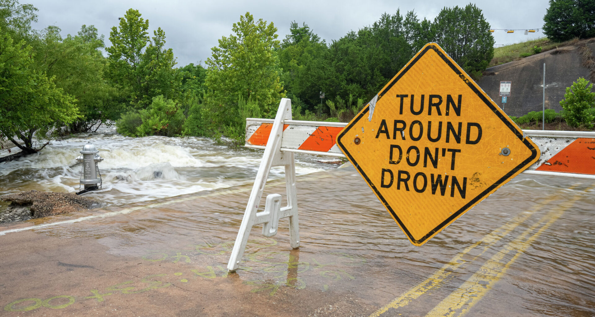
A sign blocks a water crossing on Old Spicewood Springs road after heavy rain on Monday in Austin.
Aaron E. Martinez/Austin American-Statesman
We’re halfway through June, and Austin has already exceeded the normal monthly rainfall of 3.68 inches, with at least 5.7 inches of rainfall recorded so far in the past 15 days. That puts this month’s start in eighth place among Austin’s top 10 wettest Junes on record. The wettest start to June remains in 1981, when 12.92 inches fell during the first half of the month.

A bit more rain could be added Tuesday, but the heaviest axis of rainfall has shifted southeast of Austin into the Coastal Plains and Winter Garden region. A flood watch issued by the National Weather Service remains in effect for counties east of Interstate 35 and south of U.S. 90.
Article continues below this ad
A flood watch continues for areas south and east of Austin, according to the National Weather Service.
National Weather Service
Warm and muggy air will continue to dominate the region with morning temps on Tuesday dipping only into the mid-70s and then climbing into the mid- to upper 80s, with humidity-driven heat index readings soaring into the mid-90s.
Despite the rain chances in South and Central Texas, heat and humidity will take over even if we only see a little bit of sunshine.
Pivotal
Rain chances on Tuesday will be around 40% with more scattered showers, rather than the widespread heavy rainfall seen on Monday. Not everyone will see rainfall, but where showers do develop, they could quickly drop an inch to 2 inches before moving out.
Article continues below this ad
With soil already saturated, any new rainfall will mostly turn into runoff, raising the risk for localized flooding in a few spots.
The heaviest rainfall continues to shift southeast, leaving only scattered thunderstorms in the forecast for Tuesday. However, even a brief downpour could quickly lead to localized flooding in Austin, as the ground remains saturated from recent heavy rains. #txwx pic.twitter.com/KqH8urvVbj
— Mary Wasson (@Mary_Wasson) June 15, 2026
Rain chances will continue, at least on the lower end, as a mid-level atmospheric disturbance meanders across Mexico and creeps northeastward.
“There still remains considerable uncertainty regarding this tropical disturbance and where its remains eventually end up during midweek,” meteorologists at the National Weather Service wrote in their latest forecast discussion. “If it tracks closer to our area rain and storm chances would likely increase further westward through the week whereas a track more along or just off the Texas Coast would keep chances mainly confined over our Coastal Plains areas.”
Article continues below this ad
Depending on how the disturbance evolves and shifts by Wednesday, the forecast might need to be adjusted. Either we could see more seasonable temperatures with lingering rain chances, or we could face hazardous heat and peak heat index readings, or “feels like” temperatures, ranging from 100 degrees to 106 degrees.
The trend of drier weather won’t last long, as another upper-level atmospheric disturbance is expected to move into the Texas Panhandle later in the week, before sliding south into Central Texas Friday into Saturday. This could bring another round of moderate to heavy rainfall on already saturated soil and increase flooding risks across the region as we head into the weekend.
Another storm system will move into Austin later this week with the possibility of more moderate to heavy rainfall.
National Weather Service
Did you hear the flood warning alerts?
The National Weather Service offices in Austin and San Antonio issued several flash flood warnings Sunday night and early Monday, triggering wireless emergency alerts on mobile devices across the region. Some residents noticed multiple alerts as warnings were extended and questioned whether the warning criteria had changed or become more sensitive.
Article continues below this ad
“While there have been no recent changes to our issuance procedures for flash flood warnings, an integrated warning team consisting of NWS meteorologists, broadcast meteorologists, and core emergency management partners routinely meets to look for ways to improve flood messaging,” said Jason Runyen, warning coordinating meteorologist at the regional weather service office for Austin and San Antonio.
Runyen also noted that some people may have noticed recent changes in how alerts appear or sound on their phones.
“A recent Apple iOS update introduced enhanced safety alerts to provide more detailed information about imminent threats, including maps of affected areas, links to additional safety guidance, and different alert tones,” he said.
Article continues below this ad
If you receive a wireless emergency alert for a flash flood warning, officials urge you to take it seriously and follow these safety precautions:
Turn around, don’t drown: Never drive through flooded roadways. If possible, delay travel until conditions improve.
Move to higher ground: If you are near a river, creek, stream, or other flood-prone area, move to higher ground immediately.