
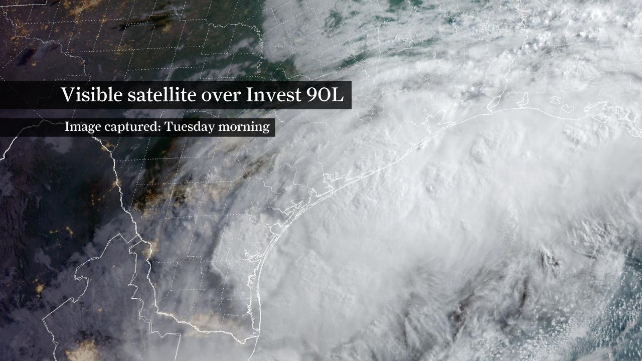
A tropical disturbance hugging the Texas coastline could strengthen into a tropical storm during the next day or two as it moves into the northwestern Gulf of Mexico.
The National Hurricane Center gave the system a 60% chance of becoming a tropical cyclone in its Tuesday morning update. Regardless of whether it becomes a named storm, widespread heavy rainfall and flooding remain the primary threats across portions of the Gulf Coast in the next 48 hours.
The disturbance is a broad area of low pressure, designated Invest 90L on Monday, that remains centered over South Texas and is producing widespread showers and thunderstorms. As the system moves over warm Gulf waters later Tuesday, it could briefly organize into the season’s first tropical storm, taking the name Arthur before tracking northeastward along the Gulf Coast.
Any tropical development would likely be short-lived, but residents from Texas to Louisiana should continue monitoring weather updates closely.
Regardless of whether the disturbance earns a name, the primary concern is a prolonged period of intense tropical rainfall from Southeast Texas into portions of Louisiana and Mississippi. A flood watch remains in effect through Thursday morning for much of Southeast Texas, including the Houston metro area, where life-threatening flash flooding is possible.
The flood threat is being driven by the potential for 4 to 7 inches of rainfall across much of Southeast Texas through early Thursday, with isolated totals topping 10 inches in areas that experience repeated rounds of thunderstorms. Parts of Southeast Texas have already recorded 4 to 6 inches of rain in the past 24 hours, matching or exceeding what some communities typically receive during an entire month of June. More rainfall will fall onto increasingly saturated ground, heightening the risk of flash flooding.
Bands of rain are expected to develop and persist through Wednesday, with some precipitation potentially lingering into Thursday depending on the system’s track. The flood forecasters at the National Weather Service’s Weather Prediction Center have placed Southeast Texas and much of Louisiana as the corridor most vulnerable to excessive rainfall through midweek.
Repeated rounds of thunderstorms could quickly overwhelm drainage systems, leading to widespread flash flooding, urban flooding and rapid rises on area rivers, particularly in locations that have already received several inches of rain.
The system’s track near the coastline creates uncertainty regarding how much time it will spend over water and how much strengthening can occur. Even so, the weather service said it might need to issue tropical storm watches or warnings along portions of the northwestern Gulf Coast later Tuesday.
Residents also should prepare for gusty winds, rough surf and pockets of coastal flooding, particularly along vulnerable stretches of the Texas and Louisiana coasts.
The next 24 to 36 hours will determine whether the disturbance can organize enough to become a named tropical storm. Either way, weather hazards are expected to increase across the northwestern Gulf Coast through Wednesday, with flooding remaining the hazard of greatest concern.