

LUBBOCK, Texas (KCBD) – Wednesday’s high temperatures hitting the 105°+ mark qualifies for a First Alert Weather Day (FAWD) for the South Plains.
 Excessive Heat moves in Wednesday afternoon(Dylan Smith)
Excessive heat will invade for the afternoon before cooling off for the second half of the week ahead.
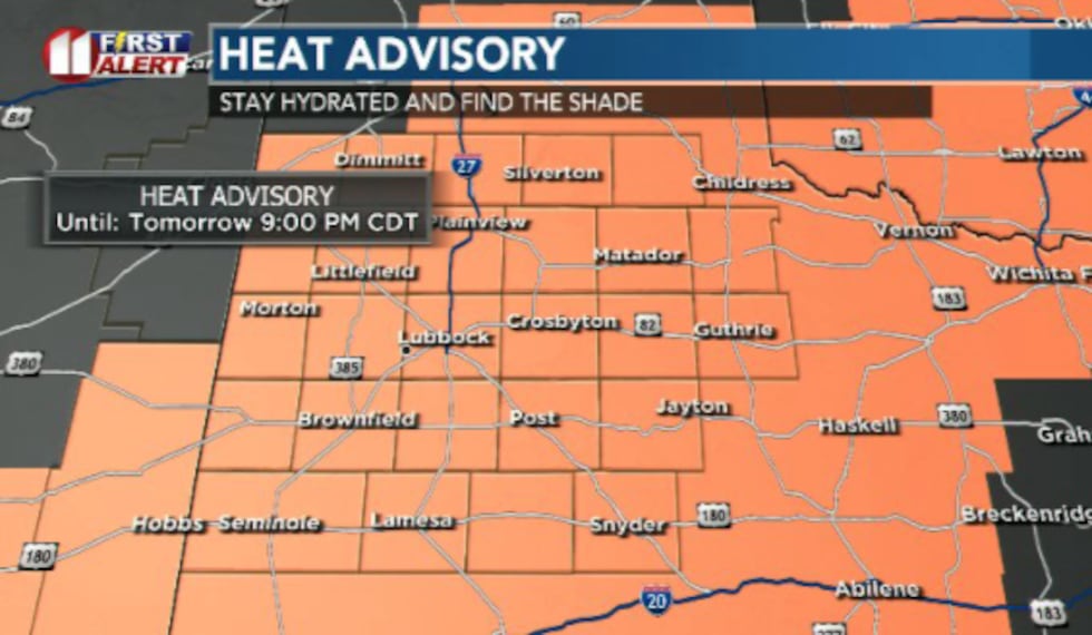 Excessive heat has triggered heat advisories for the entire area Wednesday afternoon(Dylan Smith)
A heat advisory has been issued for the entire area until 9:00pm Wednesday.
TONIGHT
Mild weather resumes as we look ahead to the overnight hours.
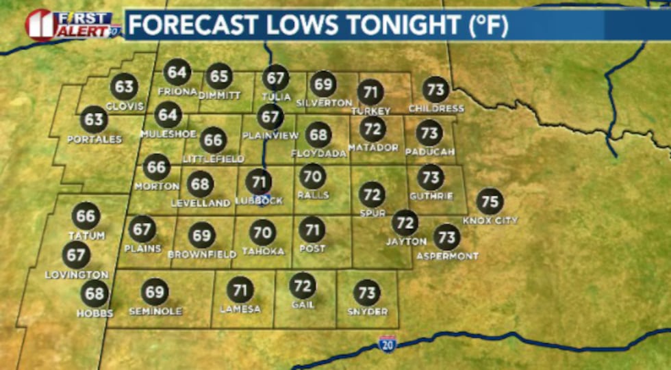 Mild and humid night as most stay above average for this time of year(Dylan Smith)
Low temperatures are going to stay in the low 70s and upper 60s with a light breeze of around 5 to 15 mph.
WEDNESDAY (FIRST ALERT WEATHER DAY)
Excessively hot. High temperatures will waste little time heating up, as we’re anticipating upper 90s by lunchtime and high temperatures reaching into the 103°-108° range for most of the area.
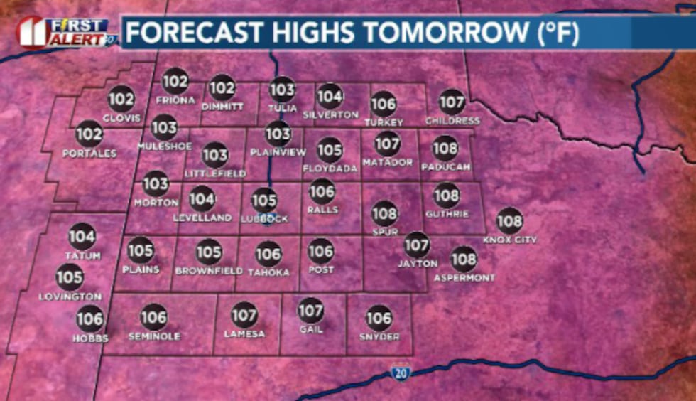 Excessive heat moves in Wednesday afternoon, sending temperatures will past the century mark for most of us(Dylan Smith)
Winds stay breezy out of the southwest around 10 to 20 mph, gusting around 30mph at times. Rain chances stay slim with an isolated shower or two at best.
EXTENDED WEATHER PATTERN
Worry not, summer has not fully arrived early.
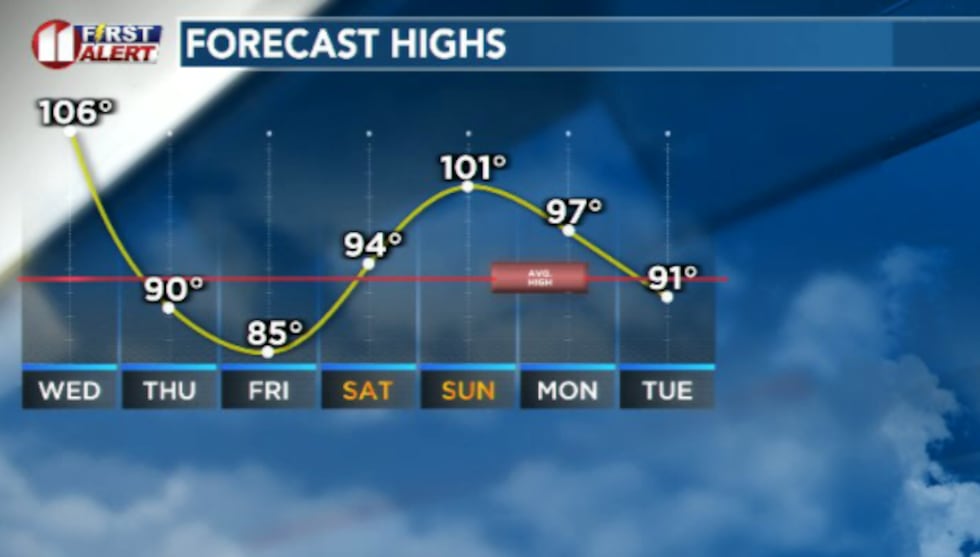 Scorching hot day Wednesday will be followed by a cold front Thursday to cool us off for the second half of the week(Dylan Smith)
A cold front snakes through the area Thursday morning, bringing with it a reprieve from the 100s and for some, even the 90s as high temperatures will settle out around the 90 degree mark Thursday. We’ll continue a downward trend heading into Friday (Juneteenth) before we rebound by next weekend and kick off the summer season on Sunday nice and hot!
Copyright 2026 KCBD. All rights reserved.