
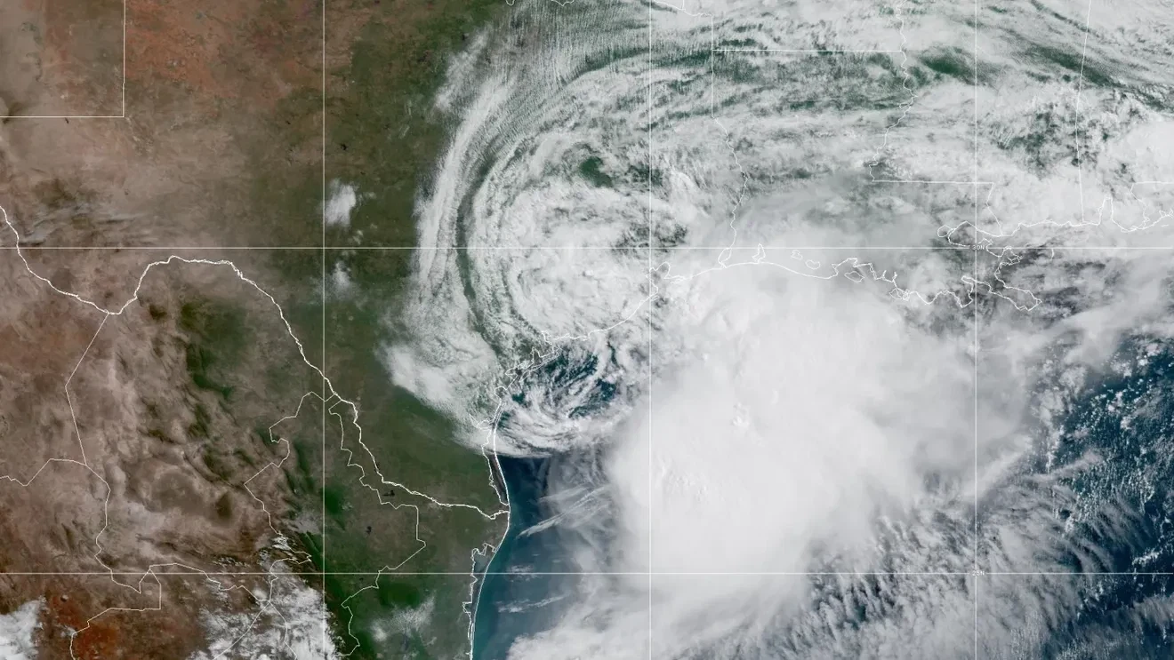
BIRMINGHAM, Ala. (WBMA) — Tropical Storm Arthur has formed along the Texas coast, and while the storm itself is not expected to bring damaging winds to Alabama, it is expected to increase the threat for flooding rainfall across the state through the end of the week.
The National Hurricane Center upgraded the system to Tropical Storm Arthur on Wednesday morning after Hurricane Hunter aircraft confirmed tropical-storm-force winds near the center. Arthur is expected to move inland across Louisiana before weakening, but forecasters say its tropical moisture will continue spreading eastward into Alabama.
As a result, the National Weather Service has issued a Flood Watch from Thursday morning through Friday evening for much of Central Alabama, including Birmingham, Tuscaloosa, Montgomery, Auburn, Anniston, Shelby County, and surrounding communities.
Flooding Rain Is The Main Concern
The biggest threat from Arthur for Alabama is not wind — it’s rain.
Forecasters expect an additional 3 to 6 inches of rainfall across Central Alabama through the end of the week, with some locations receiving even higher totals.
The National Hurricane Center says widespread rainfall amounts of 5 to 10 inches, with isolated amounts approaching 20 inches, are possible across portions of the Deep South through Friday.
Heavy rainfall could lead to flooding of creeks, streams, low-lying roads, poor drainage areas, and other flood-prone locations. The Flood Watch means conditions are becoming favorable for flash flooding and residents should closely monitor forecast updates.
Timing Of The Heaviest Rain
Rain chances will continue Wednesday, but the greatest impacts are expected Thursday and Friday as tropical moisture associated with Arthur interacts with an approaching cold front.
Forecasters say the combination could lead to repeated rounds of heavy rain and thunderstorms capable of producing very high rainfall rates in a short amount of time.
Even after Arthur weakens inland, tropical moisture will remain in place across the Southeast, allowing periods of heavy rain to continue through Friday.
Highest Flood Risk Shifts South
The latest guidance from the Weather Prediction Center has shifted the corridor of greatest flooding concern farther south, focusing the highest risk across southern Alabama, the western Florida Panhandle, and portions of southwest Georgia.
While Central Alabama remains under a Flood Watch and faces a continued flooding threat, forecasters now believe the most significant flash flooding could occur closer to the Gulf Coast and across southern sections of the state where repeated bands of heavy rain are expected.
That means locations along and south of Interstate 85 and areas closer to the Gulf Coast should pay especially close attention to forecast updates through the week.
Severe Weather Also Possible
In addition to heavy rain, forecasters are monitoring a low-end risk for severe weather on Thursday.
The National Weather Service has placed parts of Central Alabama under a Marginal Risk (Level 1 of 5) for severe storms. The primary concerns would be isolated damaging wind gusts and brief tornadoes that can sometimes develop within tropical rain bands.
Gulf Coast Travelers Should Stay Alert
The system could also affect thousands of Alabamians traveling to Gulf Coast beaches.
Arthur is expected to generate rough surf, dangerous rip currents, and periods of heavy rain along portions of the northern Gulf Coast through the end of the week. Beachgoers should pay close attention to warning flags and local forecasts before entering the water.
What Happens Next?
Arthur is expected to weaken quickly after moving inland across Louisiana, but Alabama’s weather impacts will continue well after the storm’s center dissipates.
Forecasters stress that residents should focus less on the storm’s wind strength and more on the potential for flooding rainfall.
The Weather Authority will continue tracking Arthur and provide updates as rainfall forecasts and flooding concerns become more refined over the coming days.