
It’s been quite the rainy spring across Southeast Texas. Since the start of April, Houston has recorded 22.02 inches of rain, which is about 70% more rain than average for that period. It’s been due to very high Gulf moisture levels interacting with an abnormally active upper-atmospheric weather pattern.
However, a major change in the weather pattern is coming, as hotter and drier weather is expected to take hold across Southeast Texas. Coincidentally, the transition coincides with the summer solstice on Sunday, marking the official start of summer.
However, a few scattered thunderstorms are still possible on Sunday, especially during the first half of the day. Here’s a close look at the upcoming forecast.
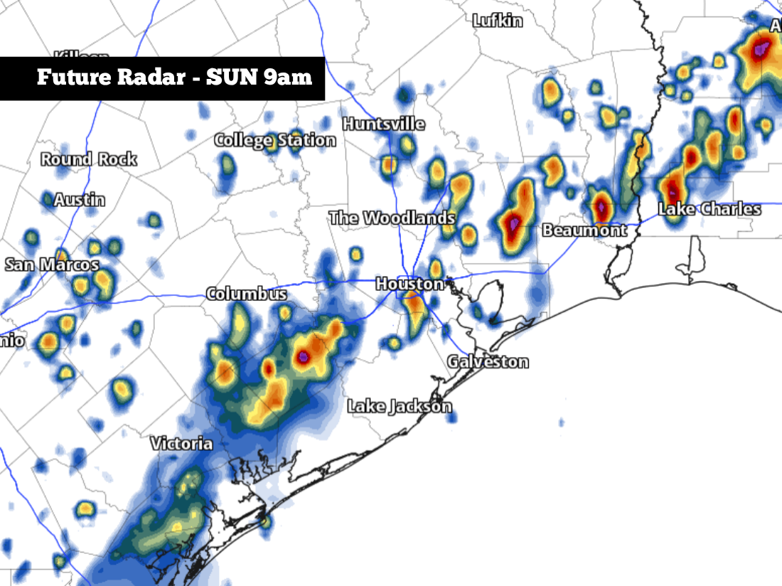
Scattered rain is expected to develop across parts of Southeast Texas early Sunday morning, especially from 7 to 11 a.m. Houston’s overall rain chance will be around 40%, meaning that not everyone will see rainfall. Rain chances will drop to around 20% by the afternoon.
If you do encounter a storm, rainfall is not expected to last long; likely for just 30 minutes or less. Additional rainfall totals will be light, with most areas picking up less than a half-inch of rain. However, if caught under a heavy downpour, a few isolated locations could see up to an inch of rain.
Aside from the morning rain chances, Sunday is expected to be hot and humid across Houston. Temperatures will rise into the upper 80s by noon before topping out in the low 90s by the late afternoon. Winds will also be breezy, coming in from the south at 10-15 mph.
If you have any outdoor plans for Father’s Day, be prepared for extremely humid conditions as well. With dew point values expected to hover in the upper 70s, the “feels like” temperature will surge to about 105 degrees throughout the afternoon. Drink plenty of water, wear loose-fitting and light-colored clothing, and take frequent breaks in air-conditioned spaces.
A high pressure system is expected to start building across northern Mexico and the southern half of Texas this week, leading to an extended break for storm chances.
Even though rain is not expected, the humidity is still expected to remain very high. On Monday, afternoon high temperatures rise into the mid-90s with heat index likely topping out between 105 and 110 degrees. Tuesday will bring similar weather, with highs reaching the mid-90s yet again.
The weather will stay remarkably consistent through the rest of the week, as well. From Wednesday through Friday, Houston high temperatures will stay in the low to mid-90s, while heat index values will range between 103 and 106 degrees.
An isolated shower or two may form along the coastline each day, but the majority of areas will stay completely dry. Houston’s rain chances will stay under 10% each day this week. Moving forward, long-range weather models indicate that dry conditions are likely to continue for the remainder of June.