
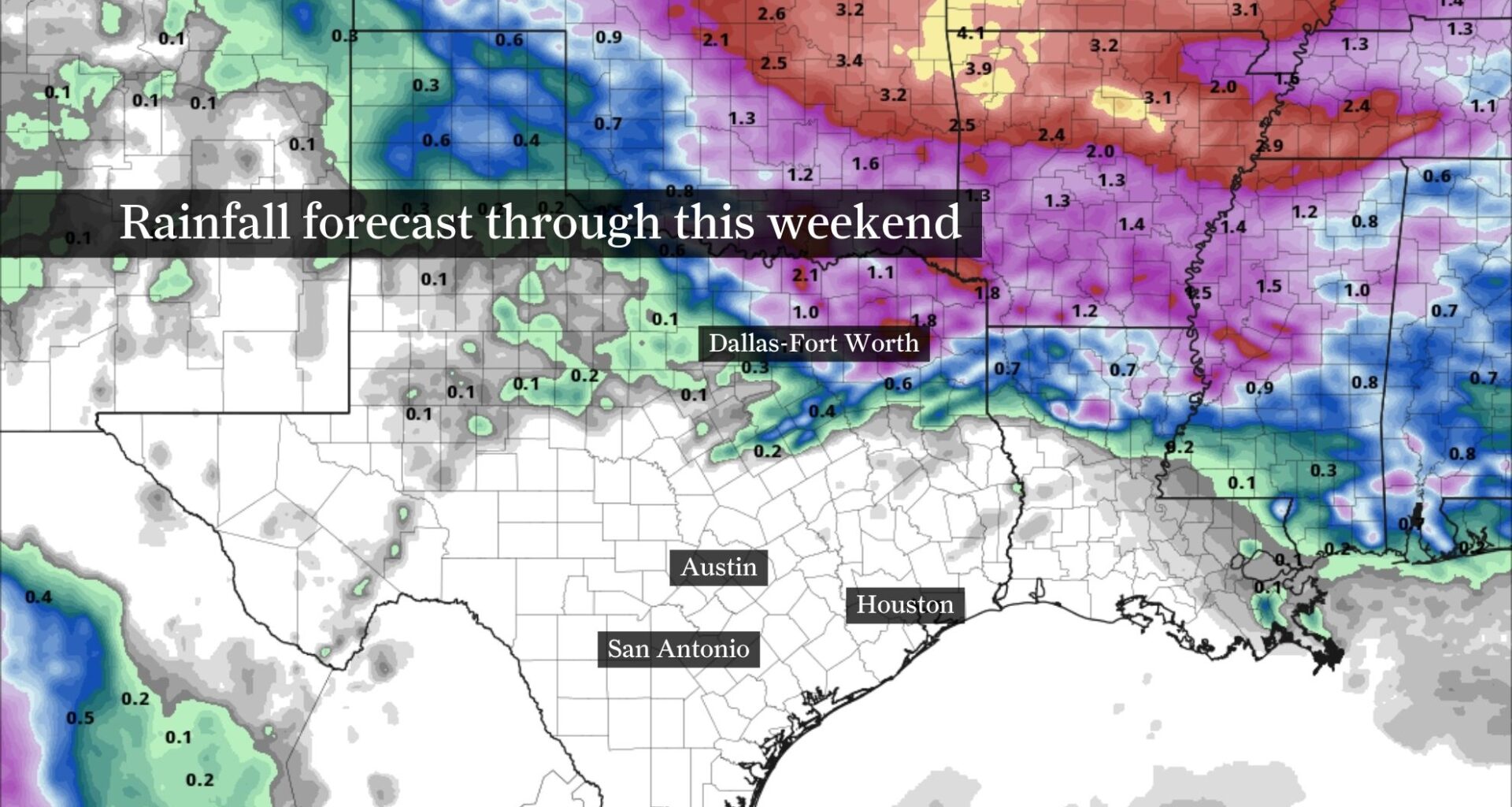
Aside from a few thunderstorm complexes that could bring heavy rainfall to North Texas, much of the state will stay dry through the upcoming weekend as a heat dome settles overhead. Rain chances in Southeast Texas remain nearly nonexistent through Wednesday.
NOAA’s Weather Prediction Center / Pivotal WeatherSoutheast Texas will see a prolonged stretch of dry weather this week, with rain chances near zero through the weekend.Afternoons will consistently reach the lower to mid-90s, with heat index values topping 100 degrees and possibly approaching 108 in some inland areas.Overnight temperatures will stay in the upper 70s to lower 80s.
Houston’s weather forecast has settled into a familiar summer rhythm: hot afternoons, muggy mornings and little chance of rain. The transition away from the recent pattern of daily downpours is now nearly complete.
While storm systems may continue tracking across North Texas through the week, Houston’s weather pattern will be dominated by dry weather created by high atmospheric pressure, temperatures in the lower to mid-90s and humidity-driven heat index values topping 100 degrees each afternoon.
Article continues below this ad
At this point, the more notable aspect is the persistence of the heat rather than its intensity. Houston is not staring down an exceptional late-June heat wave, but the city is entering the kind of repetitive, humid summer pattern that can wear people down over several days.
Typical summer heat expected this week
Tuesday marks the beginning of a weather pattern Houston residents know all too well: afternoons in the low to mid-90s, mornings in the mid to upper 70s and little day-to-day change in sight. If we’re lucky, it might come to an end by September, but only time will tell.
RAIN COMPARISON: Houston has been soggy so far this June. How does this month compare to other soggy Junes?
For now, Houston’s weather pattern continues through the weekend. Some inland communities, particularly west of the Brazos River Valley, could flirt with afternoon temperatures in the upper 90s by late in the week. Heat index values will continue reaching the low to mid-100s during the afternoon. By midweek, heat index values could approach 108 degrees in some locations, potentially prompting the National Weather Service to issue heat alerts.
Article continues below this ad
This week’s heat isn’t out of the ordinary for Houston in late June, but the bigger story might be the consistency. Rather than one brutally hot day, Houston appears headed for several consecutive afternoons in the lower to mid-90s with little relief from the heat.
Rain chances dry up as humidity lingers
The atmosphere will still contain plenty of moisture flowing inland from the Gulf of Mexico, but that moisture is unlikely to translate into rainfall.
The same ridge of high pressure responsible for the hotter weather is also acting as a barrier against thunderstorm development across Southeast Texas. Any storm complexes that develop farther north are expected to weaken or remain north of the region before reaching Houston. A stray shower may reach areas near and north of Huntsville, but that’s about as far south as any rain will get through Wednesday.
Article continues below this ad
HOUSTON HEAT EXPLAINED: Why did Houston get so darn hot after Tropical Storm Arthur? There’s science behind it.
As a result, rain chances remain near zero this week, making it one of the driest forecast periods the area will see this month.
Will Houston challenge any heat records?
For now, daily record highs at Bush Intercontinental Airport — Houston’s official climate observation site — appear safe.
Article continues below this ad
Forecast highs generally remain in the lower to mid-90s through the weekend, while record temperatures for June 23-28 range from 101 degrees on June 23, 2022, to 105 degrees set on June 26, 2012. Any daily record that does get tied or broken would more likely involve warm overnight lows, which generally range from the upper 70s to lower 80s through late June.