
June has been one of the wettest months Austin has experienced since last July, when catastrophic floods hit Central Texas. However, as we head into the final week of the month, the weather pattern is set to shift, with typical summer heat returning and an extended stretch without rain through the first few days of July.
While portions of Texas will continue to see rainfall from a stalled frontal boundary near the Red River, Central and South Texas will remain under the influence of rain-suppressing high atmospheric pressure. One ridge of pressure will be positioned over the Gulf of Mexico to our southeast, while another will be anchored across northern Mexico to our southwest.
As a result, our region will be dominated by a hot and humid air mass with limited opportunities for rain. Expect plenty of sunshine, persistent southeast winds, and elevated humidity levels that will push heat index values to between 98 and 103 degrees for the rest of the week.
Clouds will be thick through the morning, with overcast skies lingering for the first few hours after sunrise. Predawn temperatures will remain warmer than average, only falling into the upper 70s to around 80 degrees.
By midday, clouds will gradually break apart, allowing for increasing sunshine and temperatures to warm into the upper 80s. A stout south wind of 8 to 12 mph will add a bit of a breeziness before winds come with occasional gusts of 20 mph in the afternoon.
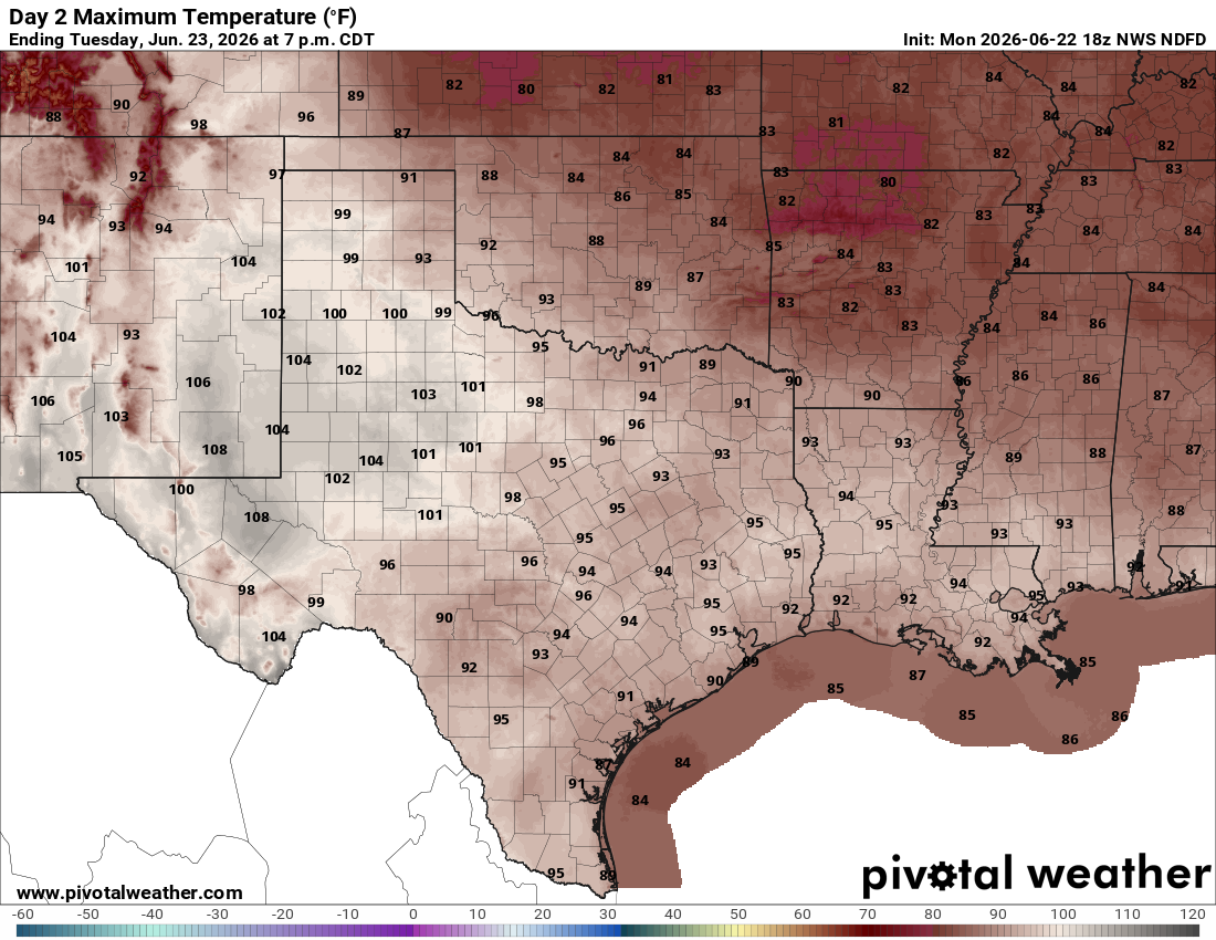
Afternoon temps will climb into the mid-90s, but with the added humidity, the air will feel more like triple-digit heat across much of the area.
The weather across Central and South Texas will feel hot and humid, with morning clouds giving way to sunshine during the afternoon. South winds will be lighter in the morning but will become stronger later in the day, with gusts reaching up to 25 mph. Morning temperatures in the upper 70s will quickly warm into the mid-90s, with humidity-driven heat index values of around 100 degrees.
The hazy skies we’ve seen recently will continue through the week as smoke and aerosols from agricultural burning across Mexico continue to filter into and spread across South Texas, the Coastal Plains, and portions of South-Central and Southeast Texas.
Dry and warm weather are expected across South-Central Texas through the end of the work week and into the upcoming weekend.
The typical summertime weather pattern, characterized by an upper-level ridge centered over the southwestern United States and northern Mexico, will dominate the region and block rain-making atmospheric disturbances from the north from reaching the area through most of next week. As a result, afternoons will remain in the 90s, while overnight temps stay in the 70s.