
Click the player above to watch live coverage.
LUBBOCK, Texas (KCBD) – update 8:33 p.m. – Good, soaking rain has moved across Lubbock. Thankfully, there were no reports of large hail in the city. There were some reports of pea-sized hail over NW Lubbock. The warning expired at 8:15.
Scattered storms are moving across the area. There is a small cluster of severe storms to the southwest, around Seagraves.
update 7:35 p.m. – The National Weather Service has issued a severe thunderstorm warning for NE Hockley and Lubbock counties until 8:15 p.m.. This includes much of the city of Lubbock.
update 7:30 p.m. The storm that prompted a warning over the northern half of Lubbock has quickly moved northeast, toward Idalou. It is not severe at the moment. There are scattered showers and storms elsewhere across the South Plains.
We are watching a storm showing a hail and wind threat just west of Lubbock, approaching Wolfforth.
update 7:03 p.m. – A severe thunderstorm warning has been issued for Lubbock and parts of NE Lubbock County. A storm over NW Lubbock could produce 1″ hail and 60mph gusts.
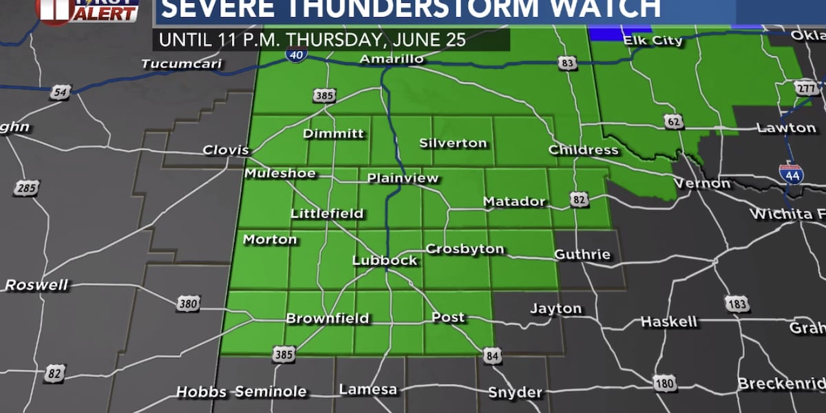
The Storm Prediction Center has issued a severe thunderstorm watch, in effect until 11 p.m. for Lubbock and most of the area. The watch is shown in green below.
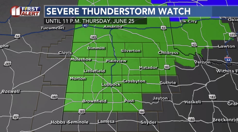 Severe thunderstorm watch in green(KCBD)
The watch is issued for the potential for severe weather late today into tonight. Warnings are issued when severe weather is happening. The primary risk today is damaging wind. Gusts of 60mph will be possible, with the potential for isolated gusts to 80mph.
Hail up to the size of golf balls will also be possible.
Since it is so hot today, cloud bases are fairly high off the ground. This leads to the wind threat. But there is still enough support for some hail today.
Timing
A few storms may develop through the afternoon. Meanwhile, storms have already formed in New Mexico. These are moving east, and will cross the state, moving to the western South Plains through 7 p.m.
Below is one computer model’s timing:
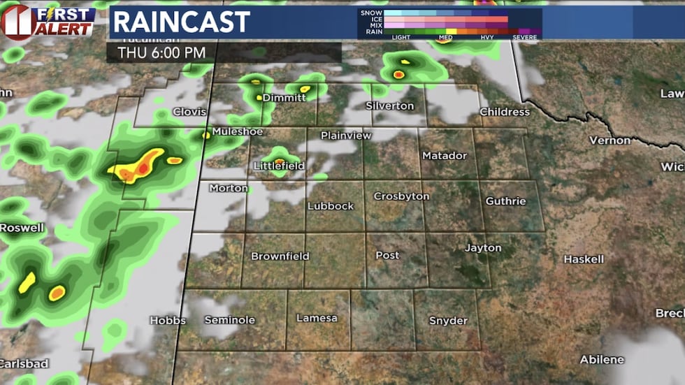 Computer model projection Thursday evening(KCBD)
Then the storms will move across the central South Plains, including along I-27, this evening, before pushing father east later tonight.
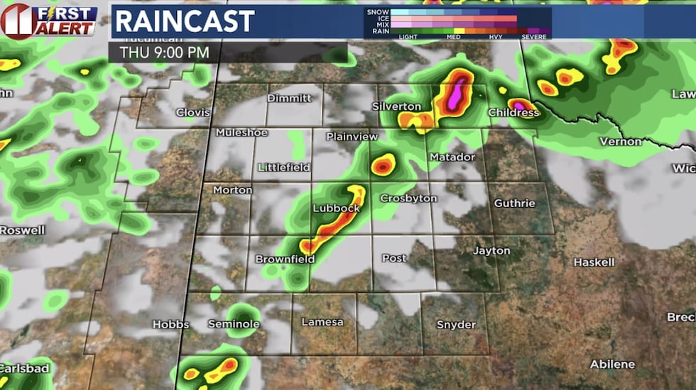 Computer model projection Thursday night(KCBD)
There may be another round of storms that develops in the Texas Panhandle then pushes south into our area late tonight.
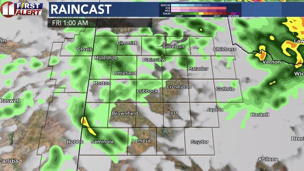 Computer model projection early Friday(KCBD)
There is a level 2 out of 5 risk for severe weather across our area today into tonight. The greater risk for severe weather is across the Eastern Panhandle, into Oklahoma, where a tornado watch has been issued.
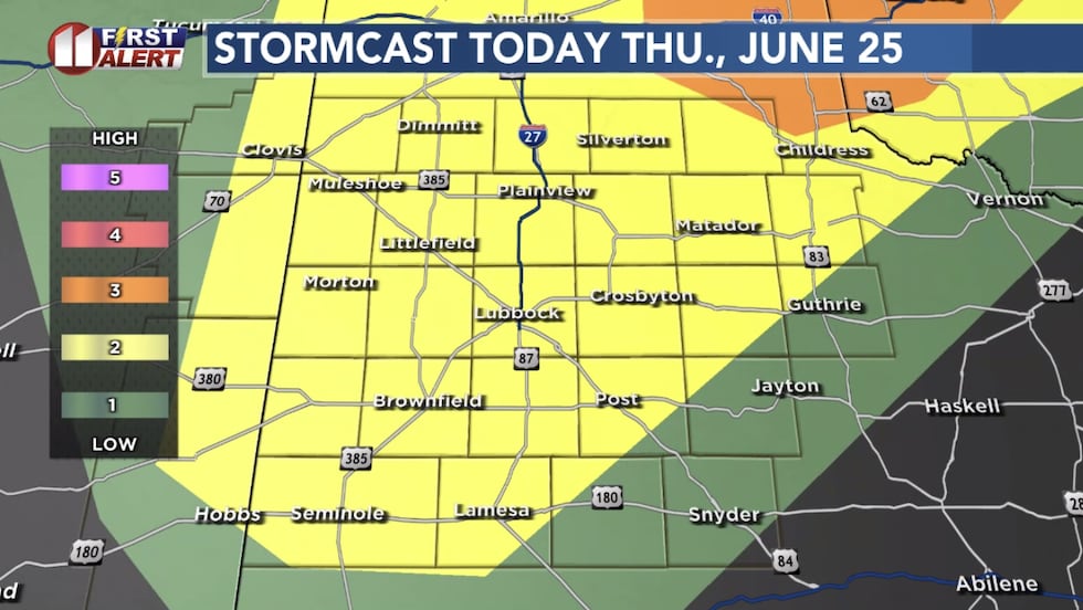 Storm Prediction Center outlook Thursday(KCBD)
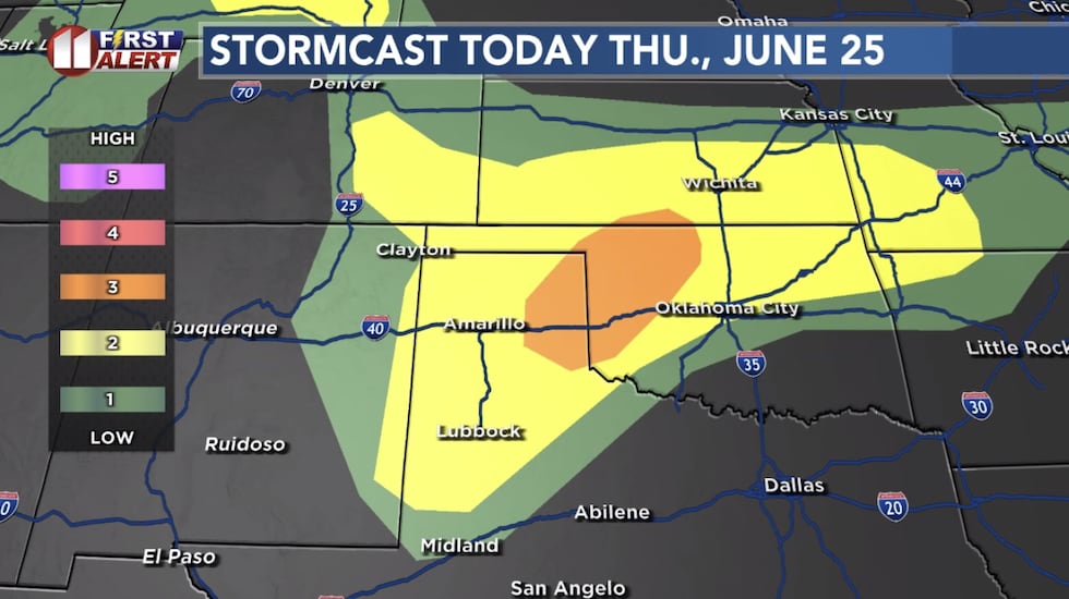 Storm Prediction Center outlook Thursday(KCBD)
The storm chance is lower tomorrow. But since it will be so hot, if a storm can form, it may become strong to severe, with the primary risk being damaging wind.
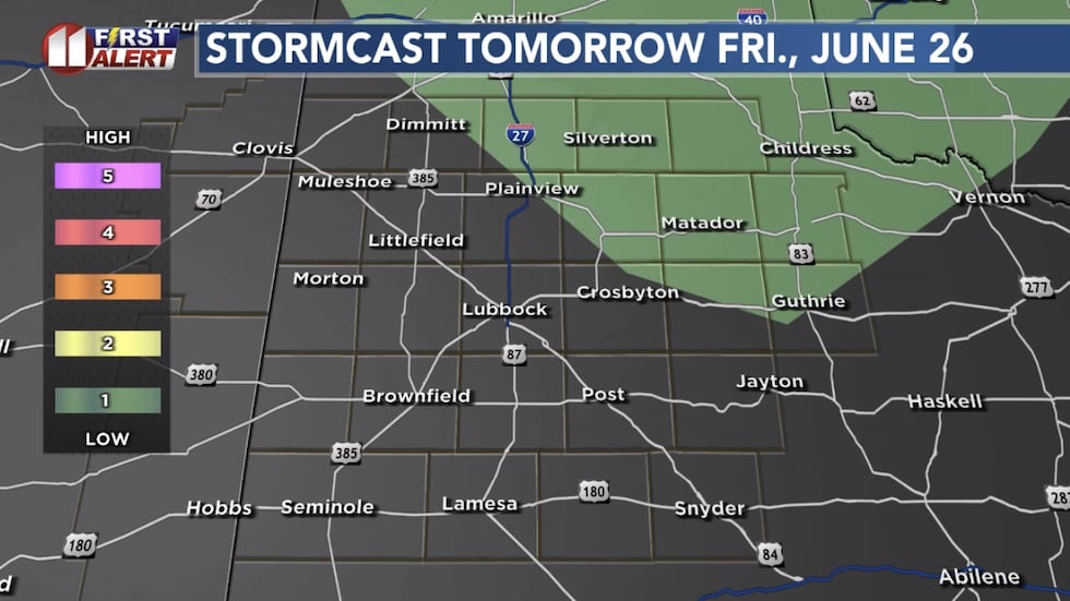 Storm Prediction Center outlook Friday(KCBD)
Looking ahead
It will be a hot weekend. The next better chance for thunderstorms is late Monday.
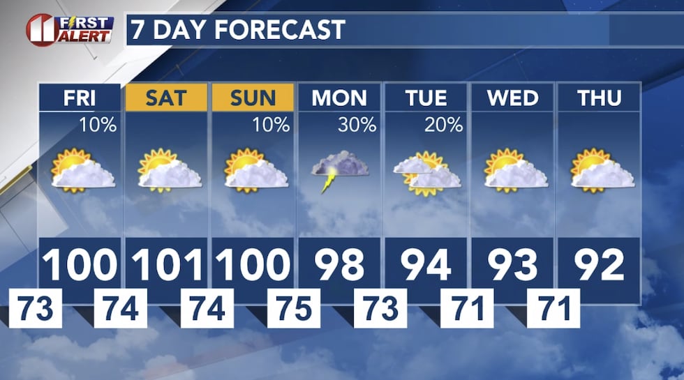 KCBD First Alert Forecast(KCBD)
Weather app issues?
If you have had a problem with our weather app not displaying radar or crashing, please check for an update (if you don’t have your phone set to auto-update). There was a bug in version 6.1.
Version 6.2 should fix the radar problem. We apologize for this issue. If updating the app doesn’t work, try deleting the app then re-installing.
Copyright 2026 KCBD. All rights reserved.