
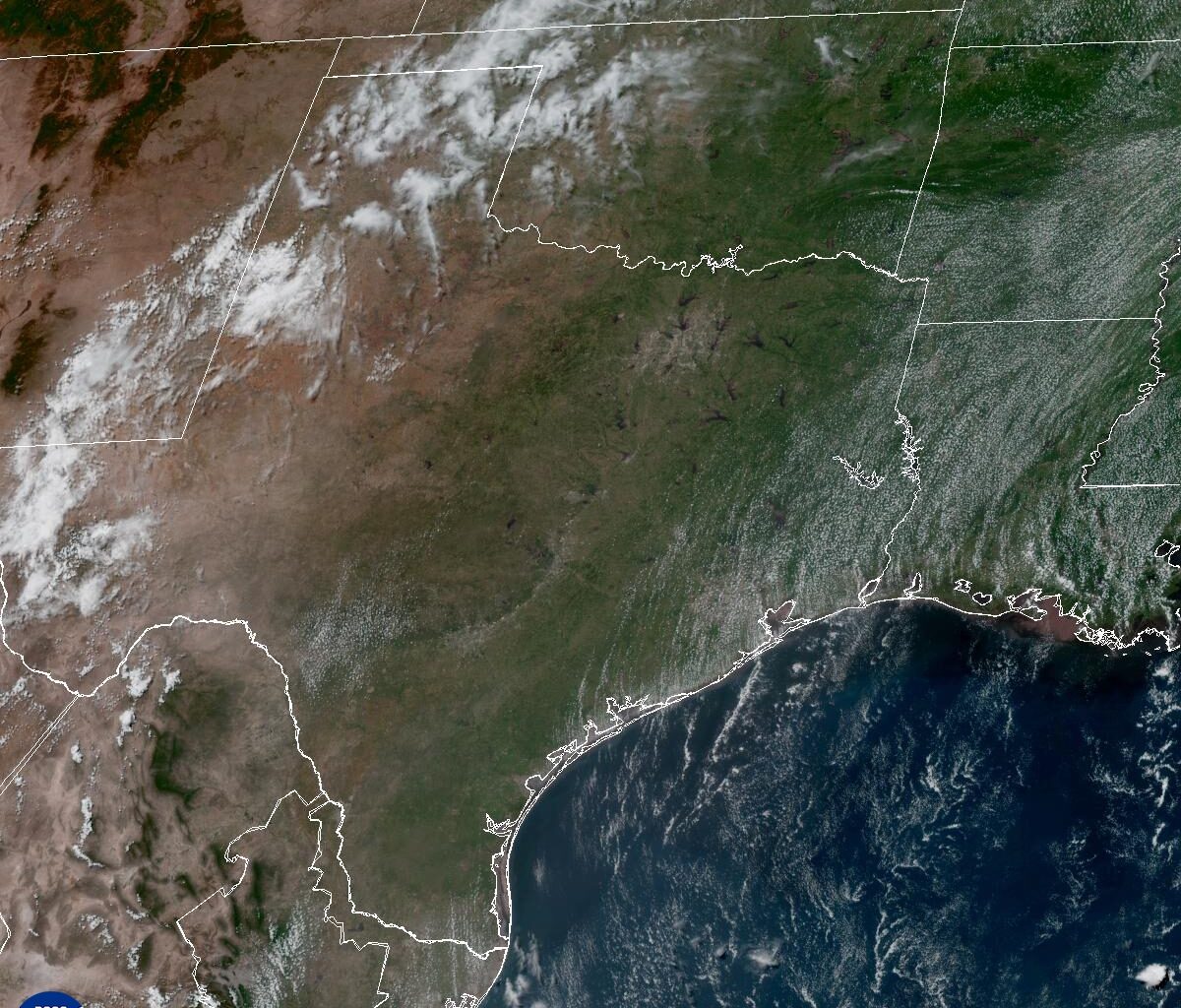
This weather satellite photo of Texas taken on Monday shows plenty of sunshine over the Lone Star State, even as Saharan dust made skies hazy.
National Weather Service
Texas is caught between two dominant weather systems: a broad area of low atmospheric pressure over the Rocky Mountains and a strong system of high air pressure anchored over the southeastern United States.

The heat dome created by the high pressure acts like a pot lid on the atmosphere, suppressing rain chances and keeping warm air trapped closer to the surface. Within the high pressure system, air sinks rather than rises. That sinking air heats up as it compresses, allowing temperatures to climb day after day.
Article continues below this ad
West Texas could see some showers and thunderstorms on Tuesday but the rest of Texas will still be under the influence of high air pressure, indicated by the large blue H on the map.
Weather Prediction Center
While we’d love to tap into the cooler air — and even some of the snow — falling in the Rockies, the high pressure to our east will remain the dominant weather maker through the rest of the week. That means South Texas can expect hot and dry weather, and hazy skies, with Saharan dust continuing to linger overhead.
Tuesday forecast
Tuesday will begin with mostly cloudy skies, light winds, and morning temperatures a few degrees above the late June average of 74.
Article continues below this ad
By the afternoon, skies will turn mostly sunny with breezy and hot weather. High temperatures will climb to around 95 degrees in San Antonio, which is near normal for this time of year. Combined with the humidity, however, those temps will feel more like 98 to 103 degrees across the Hill Country and along the Interstate 35 corridor.
Winds won’t be as strong as they have been over the past several days, but afternoon and evening gusts could still reach 25 mph, especially around sunset.
As the sun sets each evening, southerly winds in Texas will increase, with some gusts topping 20 mph.
Pivotal
Wednesday forecast
Morning clouds will give way to plenty of sunshine by lunchtime on Wednesday. Winds will continue to blow from the south and southeast but remain light, below 12 mph. Expect another hot day, with morning temperatures in the middle to upper 70s and afternoon temps in the upper 90s. Humidity, though, will make the air temps feel more like 100 to 102 degrees.
Article continues below this ad
While the afternoons may be starting to feel unbearable, it’s worth putting the heat into perspective. San Antonio has yet to reach 100 degrees this year, and the hottest temperature so far has been 98 degrees, recorded on March 15. By this point last year, we’d already experienced three triple-digit days, along with several afternoons that reached 98 and 99 degrees.
The rest of the week will remain below the 100-degree mark. However, on average, San Antonio’s first 100-degree day typically occurs on June 30.
Rain chances coming back?
Rain chances will be hard to come by this week as high pressure to the east becomes more firmly established.
Article continues below this ad
However, Texas will sit along the southwestern edge of the high pressure. Because of clockwise flow of air around the high pressure, moisture-rich air from the Gulf of Mexico will begin streaming inland later this week, allowing a few sea-breeze showers to develop again in the Coastal Plains east of the Interstate 35 corridor.
Rainfall totals through the weekend will be limited in South Texas but areas near Big Bend and along the Texas coast will have higher rain chances.
Pivotal
While San Antonio is not expected to see any immediate rainfall, this pattern shift could help bring isolated showers back to the area by early next week. We’re also watching the West Texas dry line, which separates dry and humid air masses. That could spark showers and thunderstorms near Big Bend before they start tracking east toward the Hill Country.