
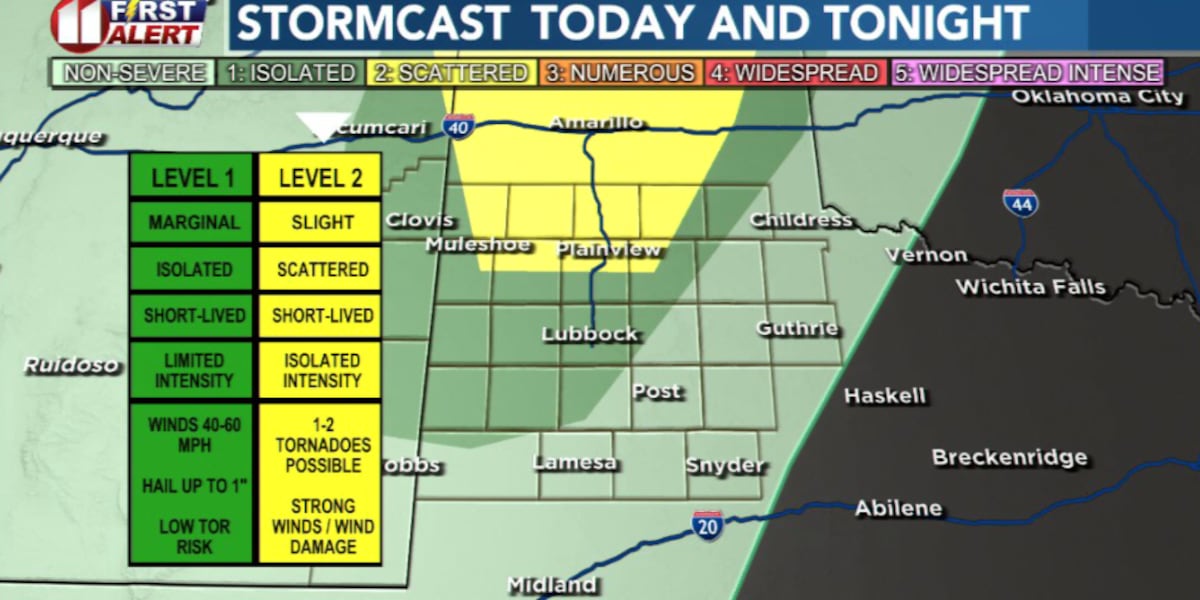
LUBBOCK, Texas (KCBD) – Another round of storms is expected to develop across the South Plains this evening with the greatest chance for rain along and west of Interstate 27.
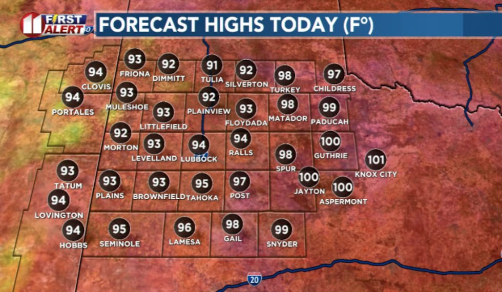 High temperatures today will reach the mid 90s(KCBD)
The set up is pretty similar to what we saw Monday. Moist air flowing north from the Gulf of Mexico will combine with warm temperatures and an upper-level disturbance moving across the western U.S. will combine to trigger storms near the Texas-New Mexico state line. That activity is expected to move northeast through the evening.
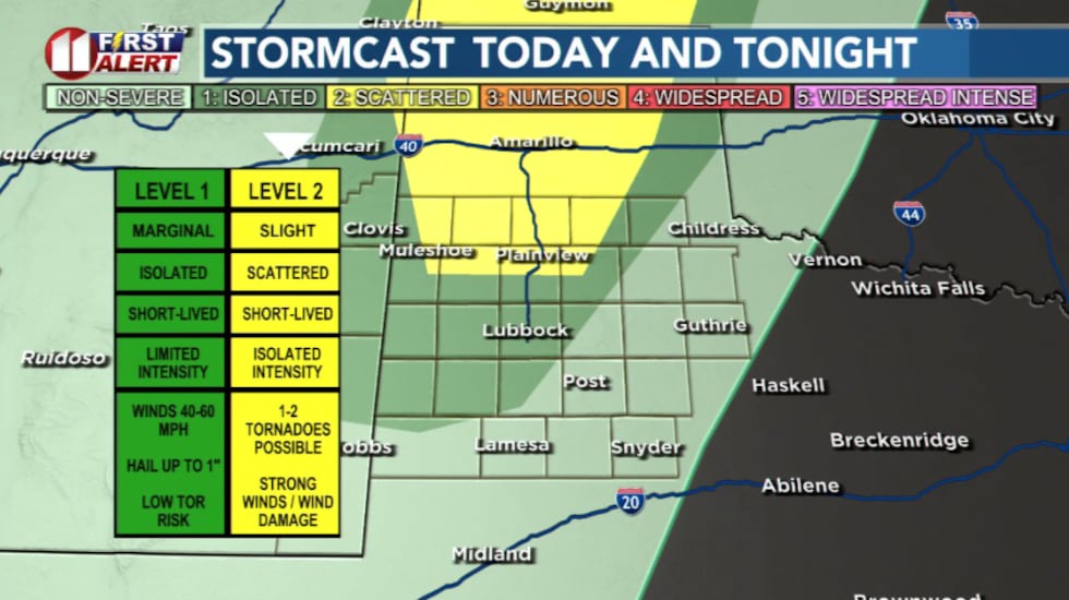 Best chance for severe weather remains to the north of Lubbock in the yellow shade.(KCBD)
Not everyone will see rain, but the storms that do develop could pack a punch.
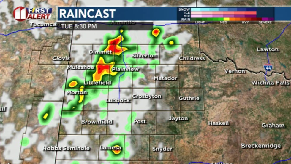 Showers and storms expected to develop this afternoon and push to the northeast(KCBD)
With a few becoming strong to severe, capable of damaging winds gusts up to 60 mph, quarter-size hail, and brief heavy downpours.
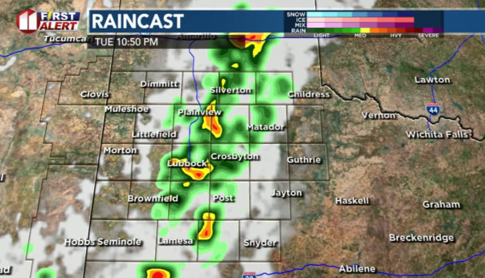 Isolated storms possible(KCBD)
Most storms should weaken after sunset and come to an end by early Wednesday morning.
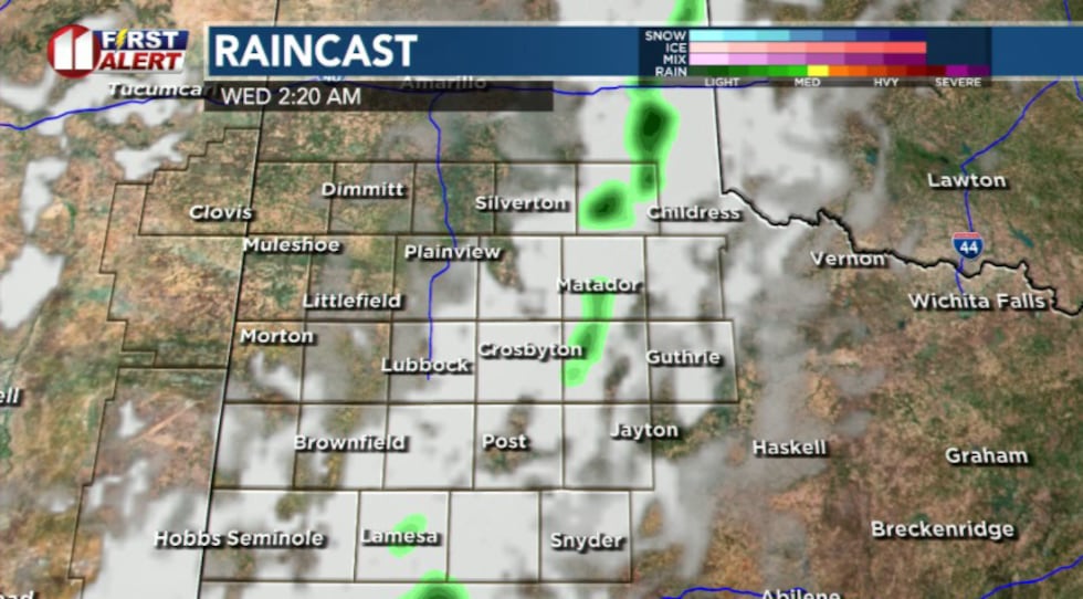 Any activity should diminish after midnight(KCBD)
Another chance for isolated storms returns Wednesday evening before the weather pattern shifts.
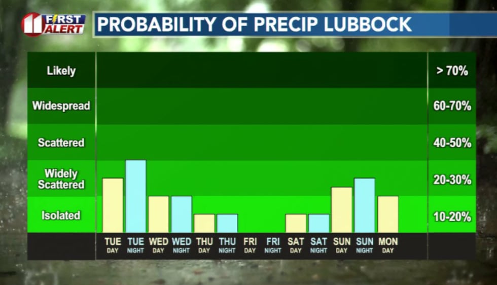 Active pattern will taper off by the end of the week(KCBD)
High pressure is expected to build back into the region late this week, causing storm chances to diminish while temperatures climb back into the upper 90s.
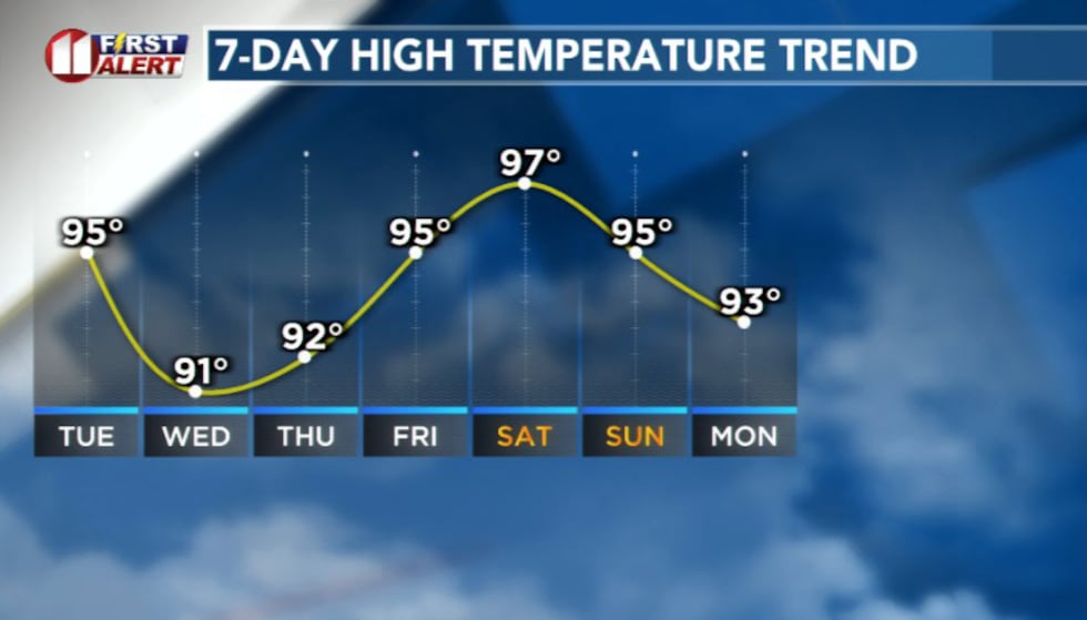 Temperatures will warm up by the weekend(KCBD)
At this point, the Fourth of July forecast looks hot and dry, with only a slight chance for overnight showers returning early next week.
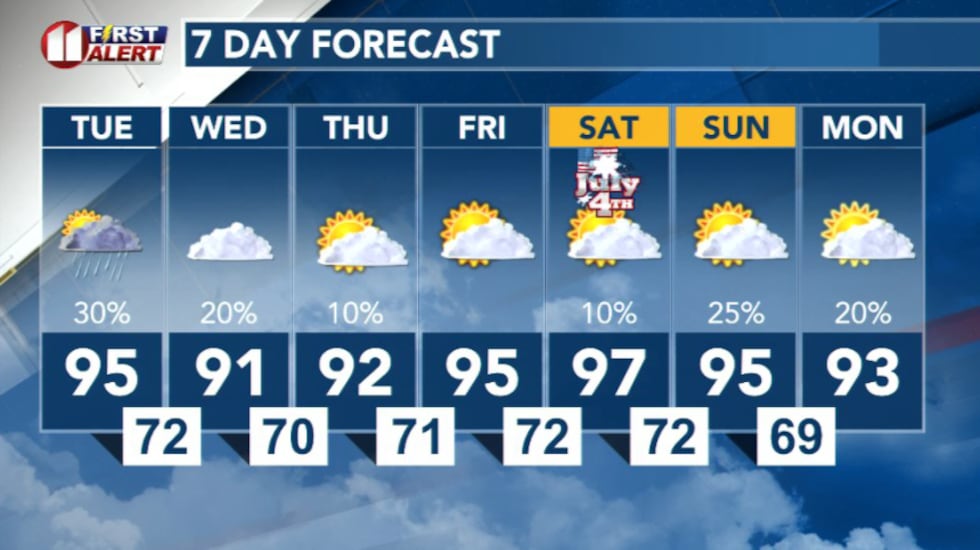 7 Day Forecast(KCBD)
Copyright 2026 KCBD. All rights reserved.