
The Fourth of July is here, and for many of us, it means cooking out, hanging by the pool, and watching the fireworks. However, if you’re planning on spending the day outdoors, here’s a few things to be aware of.
ONE YEAR LATER: Why the Hill Country flood became one of Texas’ worst disasters ever
First, the largest threat across Southeast Texas will be the heat, as the combination of high temps and humidity will result in heat index values greater than 100 degrees. However, while most of the region will stay dry, few isolated thunderstorms may still develop during the second half of the day, bringing lightning and brief downpours.
Fourth of July forecast
The day will start with mild temperatures in the upper 70s under partly cloudy skies. Houston temperatures will rise steadily through the middle of the day, reaching the low 90s by noon.
Northern parts of the metro area, from Bush Intercontinental Airport to The Woodlands, will see high temperatures near 96 degrees. A bit farther south, highs are likely top put between 92 to 95 degrees from downtown and toward Sugar Land and Pasadena.
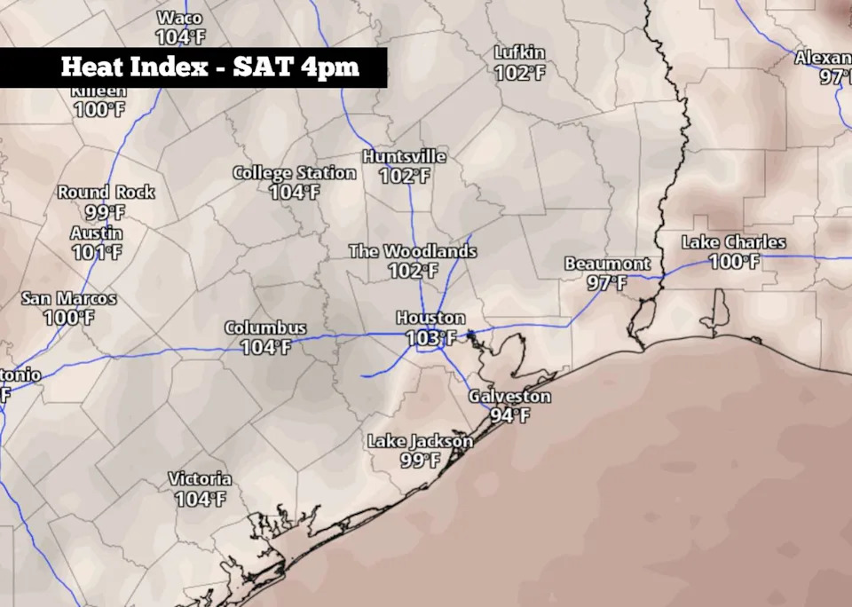
Shown are the expected heat index values, or humidity-driven “feels like” temperatures, across Southeast Texas at 4 p.m. Saturday, according to the ECMWF weather model. (Pivotal Weather)
The humidity will stay elevated across the region, leading to maximum “feels like” temps between 101 and 103 degrees across Southeast Texas.
If you plan to spend part of Independence Day outdoors, be sure to stay hydrated. It’s fine to enjoy a few alcoholic drinks, but drink water between them, as alcohol can speed up dehydration. Also, wear lightweight, loose-fitting clothing and take frequent breaks in the shade or indoors to cool off.
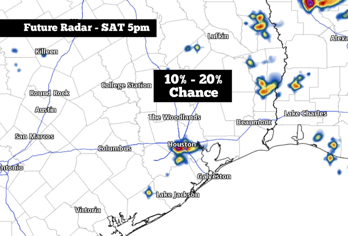
A few storms: Weather models indicate that a few pop-up showers and storms may be possible during the late afternoon and early evening, especially between 3 and 7 p.m. This activity will be few and far between, though, leaving only a 10% to 20% chance of rain in Houston. If you do encounter a storm, it would likely be very brief, lasting 20 minutes or less.
By late Saturday night, the weather will be favorable for fireworks. The small rain chances will end, and temperatures will drop into the mid-80s by 9:30 p.m.
What’s coming next?
With high atmospheric pressure still expected to sit over the southern U.S. over the next few days, Houston’s weather will stay remarkably consistent. From Sunday through Tuesday, afternoon temperatures are expected to stay in the mid-90s with morning temps generally sitting in the upper 70s.
A weak disturbance may form along the Rio Grande, bringing slightly enhanced rain chances across the state. Still, afternoon and evening rain chances will only be around 20% in the Houston metro area. Storms are not expected to bring any flooding concerns or severe weather.
Rain chances will decrease again by the second half of the week, with overall chances generally less than 10% from Wednesday and into next weekend. Temperatures won’t change much, still expected to sit in the mid-90s each day.
Long-range weather models show the potential for even hotter weather – potentially reaching the triple digits – by the July 13-16 timeframe.
Subscribe
There’s more to Houston with the Chronicle. Subscribe today for just 25¢.
This article originally published at A few thunderstorms are possible in Houston for the Fourth of July. Here’s when..