
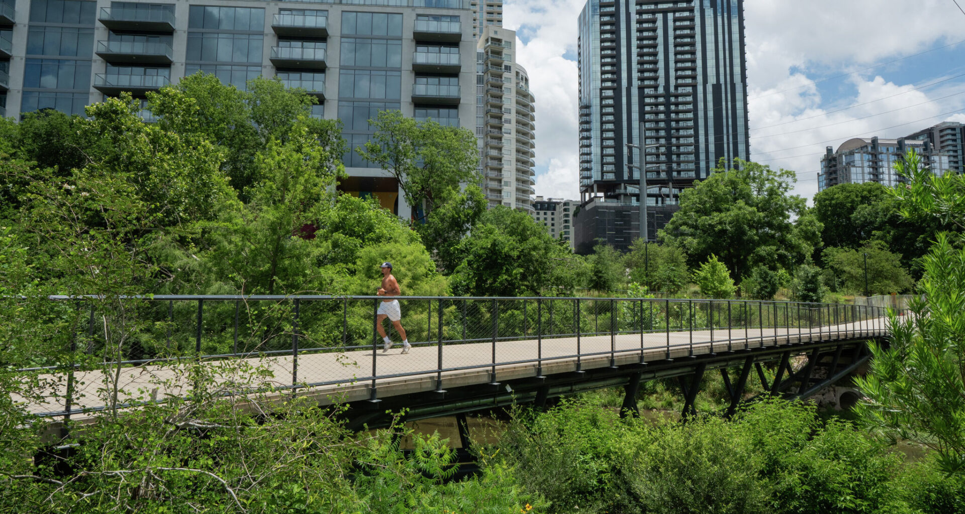
A man runs on the bridge that connects the hike and bike trail to the Confluence, a trail along lower Waller Creek. The Waterloo Greenway recently opened 13 acres of restored parkland along the creek.
Mikala Compton/Austin American-Statesman
Fifty years ago, Austinites set out to give the nation something extraordinary: a city where residents could walk or bike from their front door, through a corridor of trees and flowing water, to Town Lake. That vision became Austin’s bicentennial gift to itself and to the United States.

The proposal, called Austin Creeks, was produced by Austin’s Horizons ’76 Committee. It positioned the city’s creeks as infrastructure. Eighteen creek corridors radiating from the Colorado River would form a continuous network, enabling children to reach school without crossing traffic, adults to commute along tree-lined trails, and families to visit libraries and markets on foot or by bicycle.
Article continues below this ad
The creeks were not decorative. They were the city’s circulation system.
Attention to the creeks was not new. In 1839, Mirabeau Lamar sited the Texas Capitol between Shoal Creek and Waller Creek. Austin’s major city plans, from Koch and Fowler in 1928 onward, depicted the creeks as a unified greenbelt. But by the bicentennial, the creeks were newly recognized as an inheritance, an opportunity and a responsibility.
The analysis and planning were led by architect Sinclair Black and his students at the University of Texas. Black had earlier studied Austin’s creeks and urban design under a National Endowment for the Arts research grant. The work moved quickly. Within two years of the City Council’s million-dollar appropriation in 1974, Austin had completed trails along Shoal, Boggy and Blunn Creeks and begun redevelopment of Waller Creek. A 1975 bond election added nearly $8 million more for creek-related parkland.
RELATED: A forest in downtown Austin? Inside Waterloo Greenway’s new Confluence
Article continues below this ad
Some of the Austin Creeks vision has come true, and some is finally coming true. The Waterloo Greenway recently opened 13 acres of restored parkland along Waller Creek, including a biofiltration pond that manages stormwater and improves water quality. At Pease Park, riparian restoration is underway with the Shoal Creek Conservancy.
These achievements are worth celebrating, but they underscore how long some promises took to keep. Waller Creek was described in 1976 as having “tremendous economic potential” comparable to the San Antonio River Walk, yet it remained a neglected flood channel for most of the intervening 50 years. Progress came this century through a combination of investments: in civil engineering to make development feasible, in landscape architectural design to make development desirable, and in a public-private partnership to make development achievable.
A cyclist rides along the Shoal Creek Trail. Some of the Austin Creeks vision has come true, and some is finally coming true, Allan W. Shearer writes.
Mikala Compton/American-Statesman
The report also warned that Shoal Creek faced being converted into nothing more than a concrete drainage pipe without upstream retention. It was a warning not heeded until serious damage had been done.
Article continues below this ad
The plan’s core argument was simple: creek corridors must be acquired before development arrives, when land is cheap. “There is probably no single act that could have more overall positive impact on the future suburban environment,” the report stated. That remains true, but it understates the benefits.
SIGN UP FOR THE AUSTIN ANGLE and get Statesman commentaries in your inbox
In 1976, creeks were understood as parks, paths and flood channels. The 50 years since have revealed far more: they filter runoff, recharge aquifers like the one feeding Barton Springs, manage floodwaters, cool the urban heat island, clean the air, support pollinators, provide wildlife corridors, sequester carbon, and improve residents’ mental health.
These are not decorative amenities. They are essential infrastructure.
Article continues below this ad
Austin is transforming again. Land along Onion Creek, Williamson Creek and upper Boggy Creek is being absorbed into development. Once those corridors are gone, so are the services they provide, and restoring them will cost an order of magnitude more than protecting them would have.
The Waterloo Greenway and Pease Park demonstrate what is possible when Austin treats its creeks as infrastructure. The next step is to extend that commitment citywide by adopting a green infrastructure strategy to protect and restore the eastern and southern corridors that have waited the longest, and to measure the dollar value of flood protection, water quality and urban cooling that healthy creeks provide as part of the comprehensive plan update.
Fifty years ago, Austin imagined its creeks as the framework of the city. The question now is whether we will finish what was started for future generations. The vision is still inspiring. The creeks are still here. So is the chance — but not indefinitely.
Article continues below this ad
Allan W. Shearer is the Potter Rose Professor in Urban Planning and the Associate Dean for Research and Technology in the University of Texas School of Architecture.