
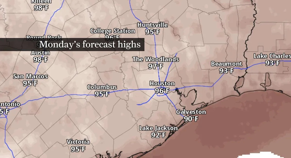
Houston could flirt with its first 100-degree day of 2026 later this week.
Daily thunderstorm chances will continue through Tuesday before a drier pattern allows temperatures to climb back into the upper 90s by midweek. If the city reaches the century mark, it would arrive close to the historical average. Even so, climate records show Houston’s first 100-degree day offers only limited clues about how long – or how intense – the rest of the summer will be.
Houston storm chances continue through Tuesday
Scattered showers and thunderstorms will remain in the forecast Monday and Tuesday as a weak upper-level trough drifts across Southeast Texas.
The best chance for rain will come during the afternoon and evening hours, when the sea breeze interacts with lingering outflow boundaries from earlier storms. Any storms that develop could produce brief downpours, gusty winds and frequent lightning.
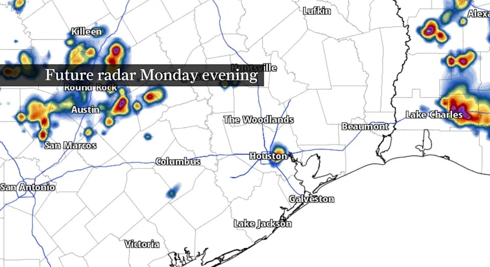
A few isolated storms may develop Monday evening across Southeast Texas, as shown by this future radar snapshot. (Pivotal Weather)
The weak disturbance is expected to move away by Wednesday, allowing rain chances to decrease for the middle of the week. Another weakness in the upper-level pattern could return more typical summertime showers and thunderstorms by next weekend.
Houston turns hotter later this week
Cloud cover and scattered storms should hold daytime highs down a degree or two Monday and Tuesday compared with recent days. That brief break won’t last long.
By Wednesday and Thursday, strengthening high pressure is expected to rebuild across the region, pushing afternoon temperatures back into the mid and upper 90s. Combined with humidity, conditions will feel even hotter despite only modest changes in actual air temperatures.
ONE YEAR LATER: How the Texas Hill Country flood became one of the state’s deadliest disasters.
The hotter pattern could bring Houston close to its first 100-degree reading of the year before rain chances increase again by the weekend.
Houston’s first 100-degree day isn’t a forecast for the rest of summer
If Houston reaches 100 degrees later this week, it would occur close to the city’s long-term average first triple-digit day of July 19. Climate records dating back to the late 1800s show Houston’s 100-degree season lasts about 23 days, on average, between the first and last century mark.
Still, the timing of the first 100-degree day has offered few clues about how the rest of the season unfolds. Houston’s record-breaking summer of 2011 began with its first 100-degree day on June 2 and went on to produce 46 triple-digit days, the most on record. By contrast, the city didn’t reach 100 until July 1 in 2024 and still recorded nine triple-digit days, while 2025’s first 100-degree day didn’t arrive until July 22, followed by eight days at or above 100.
For now, the bigger takeaway is that Houston’s hottest stretch of the summer is likely still ahead.
Subscribe
There’s more to Houston with the Chronicle. Subscribe today for just 25¢.
This article originally published at Houston could flirt with its first 100-degree day this week. Here’s what history says.