
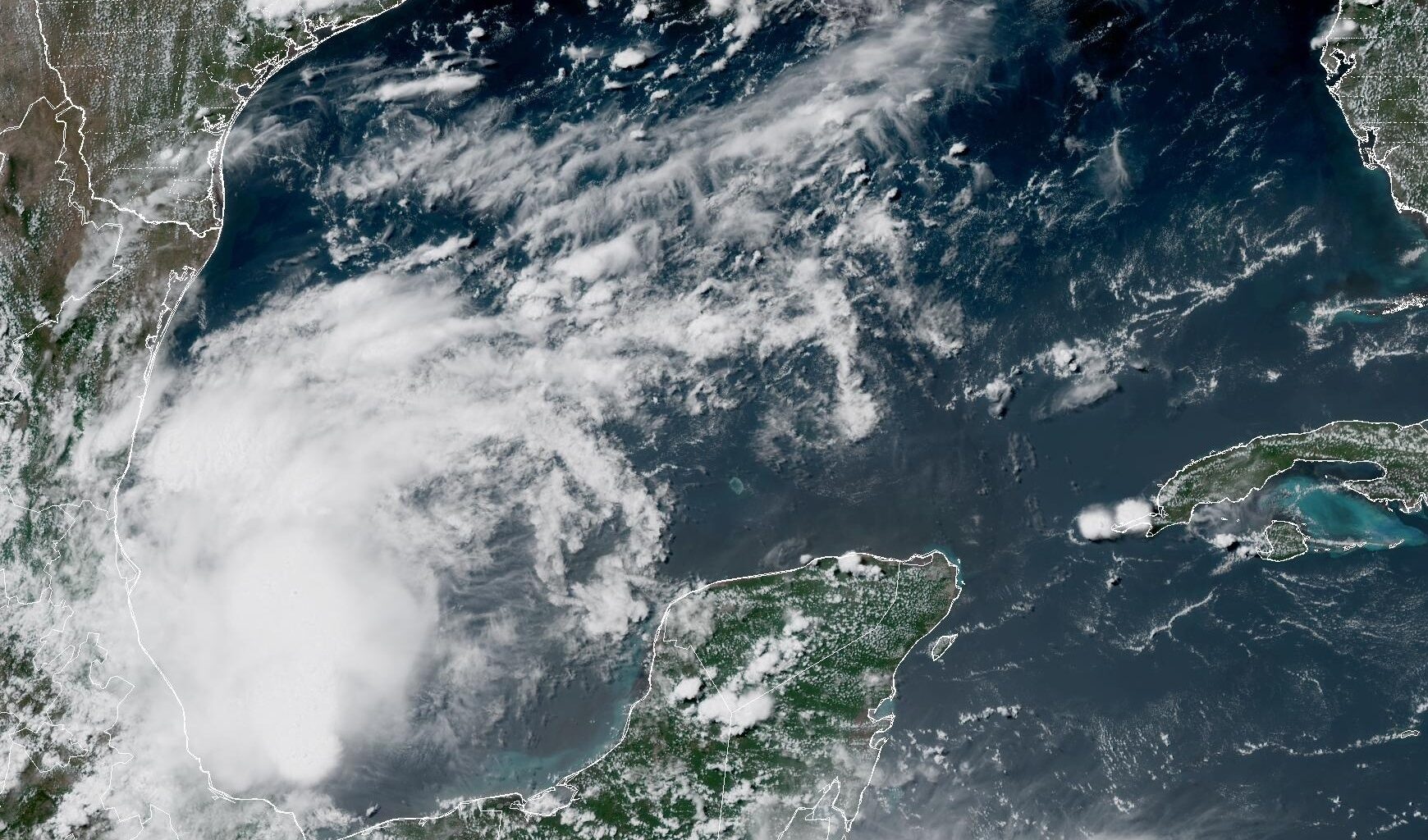
A weak atmospheric disturbance has formed in the western Gulf of Mexico. This system will continue north and bring scattered showers and storms into South Texas on Friday and into the weekend.
NOAA
From April 1 through June 20, San Antonio recorded 19.84 inches of rainfall, which was more than double the average total (8.74 inches) for that time period. Since then, no measurable rainfall has been recorded, with the Alamo City’s dry streak extending to 18 days as of Wednesday.

A slight change in the weather pattern, though, may bring San Antonio its best rain chances in weeks, as a weak atmospheric disturbance from the Gulf of Mexico pushes northward. This system will bring more moisture-rich air into South-Central Texas, resulting in scattered tropical downpours from late Friday and into Saturday.
Article continues below this ad
What are San Antonio’s overall rain chances looking like through this weekend? Here’s an overview of what to expect.
Thursday’s forecast
Before changes arrive across the San Antonio area, quiet weather is expected to continue for much of Thursday. Morning temperatures are expected to hover in the mid- to upper 70s under mostly sunny skies, with temps likely to rise quickly into the mid-80s by 10 a.m.
Article continues below this ad
San Antonio temperatures will reach the 90-degree mark by noon before likely topping out at around 95 degrees by the later afternoon. Elevated humidity levels will continue to be prevalent, resulting in “feels like” temperatures rising to near 100 degrees.
As the weak gulf disturbance moves northward, a few scattered showers and storms will be possible along the Texas coast during the afternoon, particularly from Brownsville to the Corpus Christi area. However, San Antonio is expected to stay dry and sunny throughout the day.
Shown are the expected heat index values, or humidity-driven “feels like” temperatures, across South Texas at 5 p.m. Thursday.
Pivotal Weather
Weather is expected to stay very warm through the evening, as temperatures are not expected to drop into the upper 80s until after 8 p.m. Winds will be breezy as well, with some gusts up to 20 mph.
Article continues below this ad
Rain chances to rise
Scattered showers and storms are expected to develop across South Texas by Friday afternoon and evening. However, San Antonio’s overall chance of rain will only be at around 20% to 30%, meaning that many locations will stay dry.
That said, the storms that do form may be capable of frequent lightning, gusty winds, and heavy, tropical downpours with rainfall rates potentially exceeding 2 inches per hour. However, because storms will be isolated to scattered, the overall flood threat will remain low.
Rain chances will increase slightly on Saturday, with a 30% to 40% chance of storms across the San Antonio metro area. The timing of storms remains uncertain, with the greatest potential expected during the afternoon and early evening. However, isolated showers could also develop during the morning or overnight with the abundant tropical moisture in place.
Article continues below this ad
Also because of higher moisture and rain chances, daytime temperatures are expected to fall slightly Friday and Saturday, likely topping out between 92 and 94 degrees in San Antonio. Despite the slightly cooler readings, heat index values are still expected to climb to near or slightly above 100 degrees.
By early next week, high atmospheric pressure is expected to build across the middle of the country. However, the center of the high pressure will be displaced well north of Texas, allowing scattered storm chances to continue across the Lone Star State. Slight rain chances are expected to continue in the San Antonio area through at least Wednesday.