
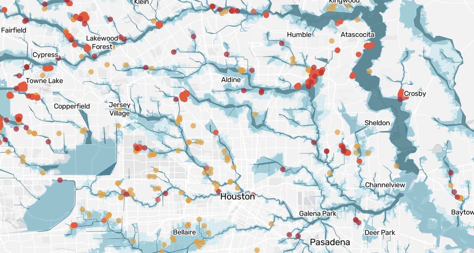
Click the dots to learn more about each removed property.
Across Harris County, thousands of homes have quietly disappeared from FEMA’s floodplain maps.
Over the past decade, developers and property owners have used a little-known federal appeal process to remove at least 6,556 homes from official floodplains, a Houston Chronicle investigation found.
The Chronicle found that the successful appeals have clustered in newer subdivisions and more affluent neighborhoods, especially in suburban communities near Katy, Cypress, Humble and Tomball. The typical removed home was worth about $100,000 more than the median single-family home in Harris County, according to the Chronicle’s analysis of FEMA records and Harris County Appraisal District data.
“You often have to spend money on a surveyor or engineer, and that’s out of reach for a lot of people,” said Sarah Pralle, a Syracuse University professor who focuses on environmental policy.
These map changes occurred through two types of FEMA processes. A Letter of Map Amendment, or LOMA, is used when an owner shows that a structure or lot naturally sits high enough to be removed from the floodplain. A Letter of Map Revision Based on Fill, or LOMR-F, is used when the owner has brought in dirt to raise the ground under the house.
A third type, called a Letter of Map Revision, or LOMR, can redraw the floodplain across a subdivision or wider area. The Chronicle did not include LOMRs in this analysis because they are broader changes, and the records are not directly comparable.
Explore the map to see where homes have been removed from Harris County floodplains, which FEMA process was used and how much those homes are worth.
 A morning newsletter that keeps you connected to Houston in 5 minutes or less.