
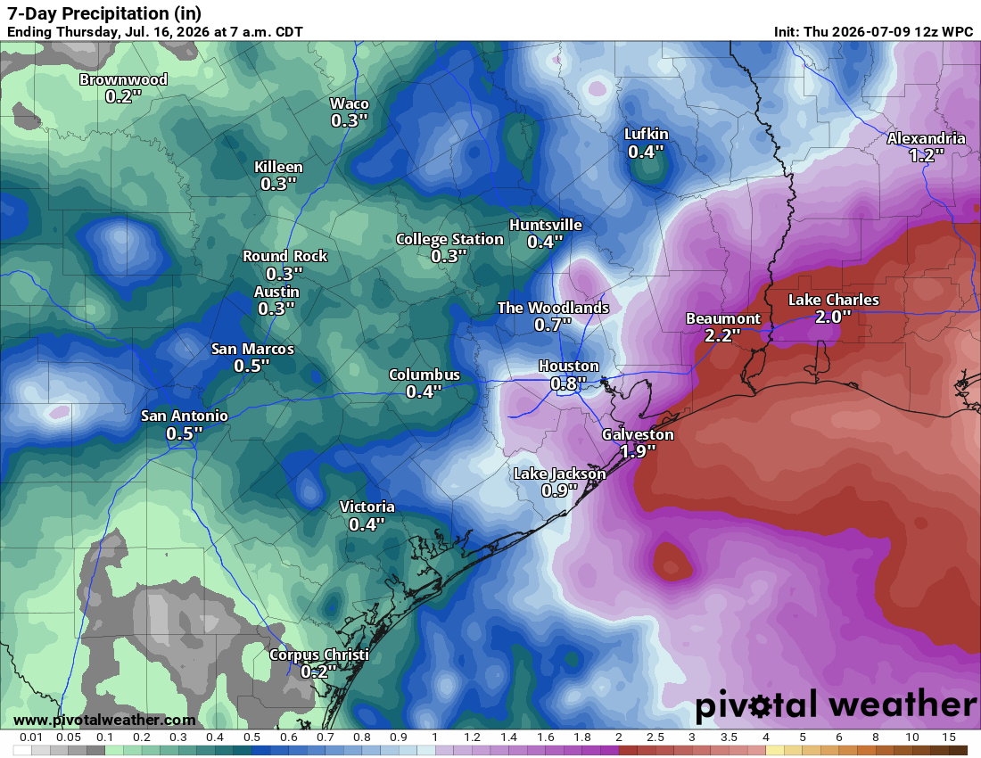
The ridge of high air pressure that allowed Austin temperatures to hit 100 degrees on Wednesday — our first 100-degree day of the year — will weaken and shift west Friday, opening the door for an atmospheric disturbance to move in from the south. Also, the Saharan dust that has kept our skies hazy, but also cloud-free for a few days, will be replaced by more moisture-rich tropical air through the weekend.
Are we in a fever dream or what? This is July, after all, when Central Texas usually settles into the dog days of summer with relentless heat and little relief. Instead, Mother Nature seems to have other plans — but we’re not complaining.
Friday will begin with partly cloudy skies, light south winds below 10 mph, and morning temperatures in the upper 70s. Clouds will increase through the late morning as temperatures climb into the low 90s, but it will already feel like the middle to upper 90s because of the humidity.
As tropical moisture continues to build and an upper-level atmospheric disturbance moves into the region, scattered showers and thunderstorms are expected to develop Friday afternoon and continue into the evening, with the greatest coverage between 1 p.m. and 8 p.m.
The increasing cloudiness and scattered rainfall will help keep afternoon temps closer to our average daily maximum temperature for mid-July of 96 degrees. South winds will become breezy at 10 to 15 mph, with occasional gusts of up to 20 mph.
“A few strong storms, mainly wind producers could develop as early day heating could create some good air contrasts as the rain cooled air spreads north,” meteorologists at the National Weather Service wrote in their daily forecast discussion for Central Texas. “With the high PWat (precipitable water) environment and expected northward storm motions of around 20-25 mph, some areas could see a quick 2-inch rainfall amount which could lead to some low-end flooding concerns.”
Scattered showers and thunderstorms will remain possible through the rest of the weekend as the upper-level atmospheric disturbance weakens and becomes less organized. Even so, it will provide enough lift to maintain a 30% to 40% chance of rain on Saturday and a 20% chance on Sunday.
Like Friday, the atmosphere will contain plenty of moisture, allowing some storms to produce brief, heavy downpours. Localized rainfall totals of an inch to 2 inches will be possible beneath the strongest storms.
Temperatures will remain manageable both days, with afternoon highs in the lower to mid-90s.
The subtropical ridge will shift north of Texas early next week, putting the Lone Star State in a favorable position for more rounds of showers and thunderstorms. Several upper-level atmospheric disturbances will ride along the southern edge of the ridge, boosting rain chances across Central and South Texas from Monday through Wednesday.
The timing couldn’t be better. The abundant rainfall we received this spring and early summer has erased much of our moisture surplus, and many areas are beginning to trend drier than average. This round of beneficial rainfall will definitely help replenish soil moisture and keep drought levels at bay. And, to top it off, temperatures will be cooler than normal.