
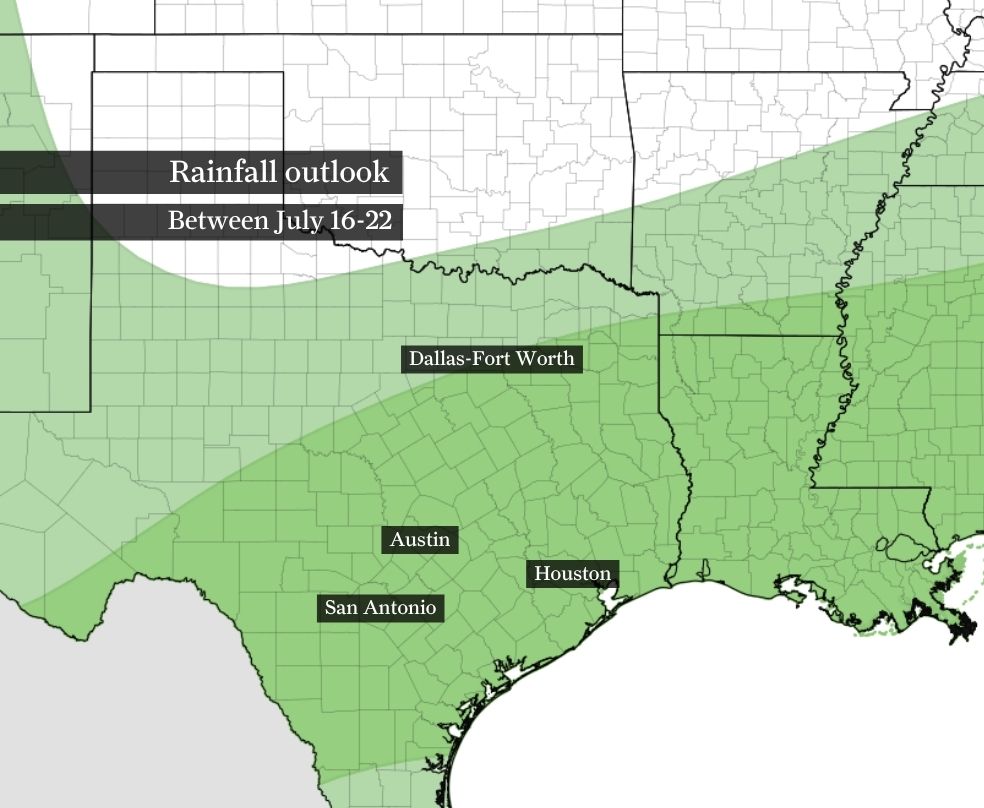
An unsettled weather pattern will keep daily storm chances going across Southeast Texas through next week, a pattern highlighted by NOAA’s Climate Prediction Center in this rainfall outlook. Green indicates where above-normal rainfall is expected.
NOAA’s Climate Prediction Center / Pivotal Weather
Along with wetter weather through July 22, the temperature outlook from NOAA’s Climate Prediction Center shows above-normal temperatures likely. Even if daily maximum temperatures remain near average, warm and muggy nights will contribute to the above-normal outlook.
NOAA’s Climate Prediction Center / Pivotal Weather
The hottest weather is about to ease as tropical moisture brings more downpours to Houston.
Don’t mistake the cooler temperatures for a break from summer. More frequent showers and thunderstorms will knock afternoon temps back into the lower 90s on many days through next week, but sticky humidity isn’t going anywhere.
Houston rain chances climb this weekend
The pattern shift begins Friday as tropical moisture deepens across Southeast Texas, increasing the coverage of showers and thunderstorms.
Article continues below this ad
Expect scattered showers and thunderstorms to develop mainly south of Interstate 10 during the morning. The potential for heavy rainfall should spread into the Houston area by the early afternoon, with lightning accompanying the most intense downpours.
That daily cycle is expected to continue through at least the middle of next week, with rain chances ranging from 30% to 70% through Tuesday. You’ll have a better chance of seeing a shower or thunderstorm each day, even though many hours will remain dry. Instead, expect the familiar summertime mix of dry stretches interrupted by slow-moving downpours that can quickly drench one neighborhood while leaving another nearly untouched.
HURRICANE OUTLOOK: Strong El Niño reshapes hurricane season outlook for Texas and Gulf Coast. Here’s how.
The tropical air mass will allow some storms to produce heavy rainfall in a short amount of time. Widespread flooding isn’t expected because no strong weather system will organize storms across the region, but isolated street flooding remains possible wherever the heaviest downpours repeatedly develop, especially near and east of Houston by Monday.
Article continues below this ad
The unsettled pattern should persist into next week as several weak atmospheric disturbances ride westward beneath a broad area of high air pressure centered over the central United States.
Storms ease Houston heat, not humidity
Friday will still deliver classic July heat, with afternoon temperatures climbing into the mid- to upper 90s. Combined with high humidity, it will feel more like 100 to 106 degrees during the hottest part of the day.
Beginning this weekend, increasing clouds and more frequent showers should shave a few degrees off afternoon highs, with most days topping out in the lower 90s.
Article continues below this ad
The cooler temperatures won’t eliminate the mugginess. Humidity levels will remain high, so it will still feel uncomfortable anytime the sun breaks through. Continue taking heat precautions by drinking plenty of water, wearing lightweight clothing and limiting strenuous outdoor activities during the afternoon, especially on days when the rain holds off.
What’s a 30-70% chance of rain in Houston?
The forecast calls for more opportunities to see rain over the next several days, but the percentages attached to those forecasts are often misunderstood.
Those percentages have a name — probability of precipitation — and they don’t describe how long it will rain or what percentage of the Houston area will get wet. Instead, they represent the likelihood that at least 0.01 inch of rain will fall at any given location in the forecast area.
It’s based on two factors: a meteorologist’s confidence that rain will develop and how much of the forecast area is expected to see it.
Article continues below this ad
For example, a 60% chance of rain doesn’t mean it will rain for 60% of the day or cover 60% of Houston. It means any one location — whether that’s your home, office or favorite park — has a 60% chance of receiving measurable rainfall. And because many people travel throughout the day, your odds of running into rain increase with the more ground you cover.
The bottom line: Expect more opportunities for rain than we’ve seen recently, but not an extended washout. Many hours will stay dry, yet with daily storm chances lingering into next week, chances are you’ll eventually run into a typical Houston summer downpour.