
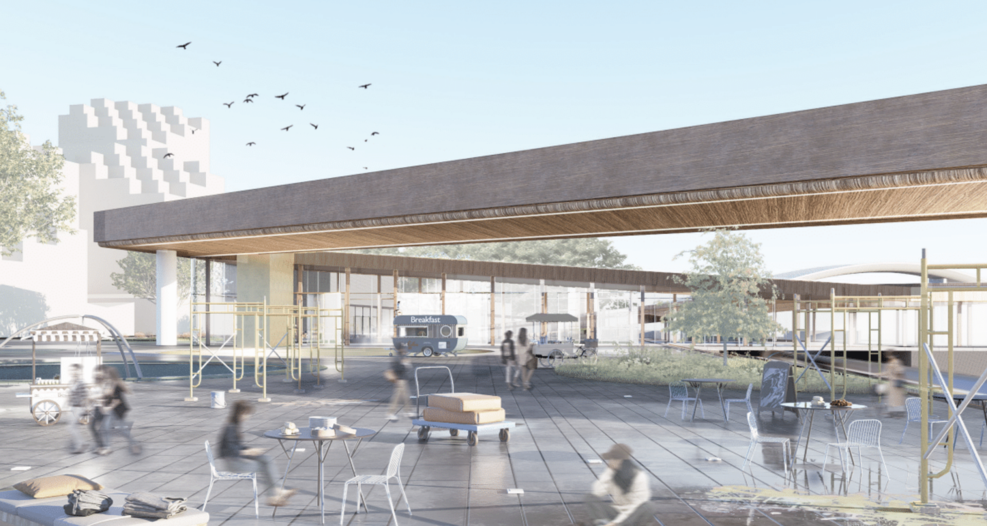
It’s three miles between the Lake Merritt BART stop and the next stop to the east, in Fruitvale. For a decade, residents have been advocating for a stop in between, in the neighborhood of San Antonio. As that process inches forward, slowly gaining the support of regional planners, a group of design students took it upon themselves to envision that future.
That work, by students in a studio design class at San Francisco’s California College of the Arts, required more than imagination alone. It took conversations with neighbors, historical research, and consideration of budgets and laws.
According to the professor who led the effort, the students came up with designs that offer exciting possibilities.
The San Antonio BART station, a project being pushed by the San Antonio Station Alliance, an advocacy group made up of transit professionals and people who live in or near the San Antonio neighborhood, has been stuck in its nascent stages for most of this decade. The idea only recently gained verbal support from local and state government officials, who are seeking to include it in a regional plan called Link21. The plan also calls for a new BART stop on a second cross-bay tunnel between San Francisco and Oakland, which still awaits many stages of approvals and financing.
Neeraj Bhatia, the director of the Urban Works Agency research lab at CCA, was the architecture professor who ran the spring semester studio class. He asked his students to investigate the complex factors involved in designing a new station atop the existing train tracks and next to the 880 freeway, including how a new station located at the south end of 14th Avenue could serve as a hub for new housing.
“We wanted to take a holistic approach, and the research allowed us to do that,” Bhatia said. “We were never just looking at the BART station. We were always looking at larger questions within about a half-mile to one-mile radius from the BART station and understanding that as the entire project.”
The participants were mostly architecture students in the final years of their professional bachelor’s degrees or master’s degrees.
“That’s a really incredible aspect of the two programs because it allows those students to mix, learn from each other, and work together,” he said. “There aren’t many other opportunities within the program for them to collaborate in that way.”
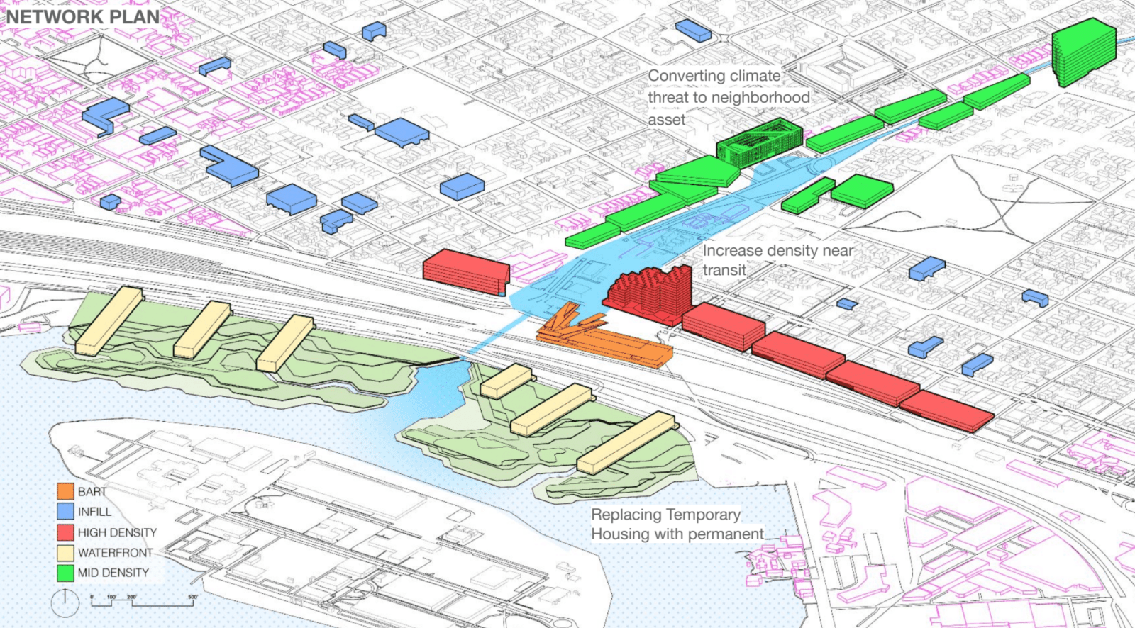 Among several design ideas the students came up with was daylighting and restoring Brooklyn Creek under Oakland’s 14th Avenue, and creating new housing on infill at the shoreline. Credit: Canyon Allan, Alex Riedel, Anhelina Rozum, students at CCA
The idea for the class came from Mitchell Schwarzer, the Oakland architect and author of “Hella Town,” which covers Oakland’s planning history and its history of displacement and gentrification. Schwarzer, a CCA professor emeritus, and Bhatia thought it would be instructive for architecture students to learn how change in the physical environment can come about from community advocacy — such as that of the San Antonio Station Alliance.
With the college set to close in 2027 and become a satellite of Vanderbilt University, the opportunity to study a project thousands of people in Oakland care about was too good to pass up, Bhatia said. He could do things with students in an academic setting that are more challenging in private practice.
“The academic setting allowed us to step back and research the neighborhood, spending three weeks doing different strands of research: looking at the history of the neighborhood, precedents and case studies around transit-oriented development, how housing operated in this neighborhood and continues to operate, ecological systems, who lives there and what their values are,” he said. “If we were commissioned to design a station, we’d be given a very specific site and parameters on behalf of a client, with their interests in the foreground.”
Flooding is a future risk
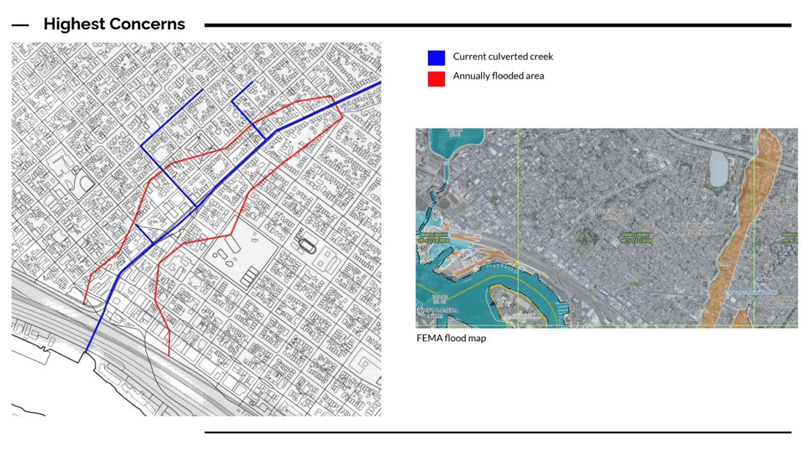 One group of students created a multi-decade assessment of flooding risks in the area surrounding the potential transit station, finding it could affect a large area of the San Antonio neighborhood. Credit: FEMA, CCA, City of Oakland
As research progressed, one of the major questions the student teams encountered was how much land in the San Antonio neighborhood could be affected by flooding. The 14th Avenue arterial road, they found, is built on top of Brooklyn Creek, which risks overflowing as storms and atmospheric rivers become more frequent. They found that the embarcadero on the south side of the highway will also be affected by sea-level rise.
“That was something that was very eye-opening, as you have these collisions of water coming from two different directions, with the BART station essentially sitting in the middle of it,” Bhatia said.
Students Kaleb Bourne and Laurel Applegate used FEMA flood map analytics and other tools to find that over the next 70 years, sea level is likely to rise 7 feet, which would affect up to 10 blocks on and around 14th Avenue. The students recommended helping residents pay for retrofits such as permeable pavement, new stormwater planters, and watershed features. They also imagined a larger change: tearing up part of the road and opening up the creek, or daylighting it.
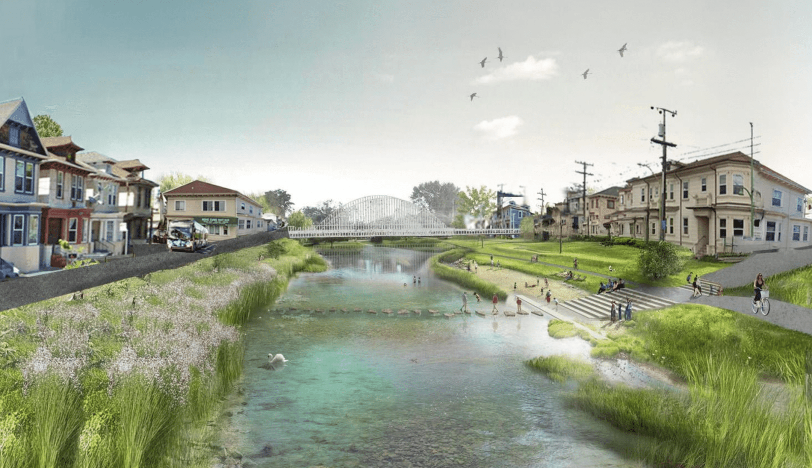 The student proposal to daylight the creek beneath 14th Avenue could unlock a new natural resource for East Oakland residents. Credit: Laurel Applegate, student at CCA
In their proposal, Bourne and Applegate imagined a restored creek with a marsh environment that absorbs rainwater, encourages wildlife, and yet appears approachable to pedestrians. They imagined a widened creek, with small birds wading by, crisscrossed by small pedestrian bridges, and a road for vehicles along the creekbed.
“By opening up the creek and giving it room to return to a more natural state, you allow the water and surrounding land to function more like a sponge,” Bhatia said. “It absorbs more water over a larger area and reduces flooding pressure.”
On the other side of the freeway, to prevent sea flooding, the students envisioned infill development including a manufactured beach with docks and such amenities as amphitheaters, playgrounds, and community parks. Some of the sediment removed to restore the creek would be used to fill in areas under the docks, according to their presentation.
Bhatia said the students working on the housing plans near the transit station — Canyon Allan, Berk Kip, Alex Riedel, and Anhelina Rozum — also had to consider sea-level rise. Many transit stations around the country, including many in California that are being considered in the aftermath of a law that makes it easier to build around them, don’t take that risk into account, he said.
“With high flood zones, we need to think through that as part of the larger master plan,” he said.
So this student team came up with plans to stabilize the shoreline and imagined housing that could be built on smaller lots and be resilient to floods.
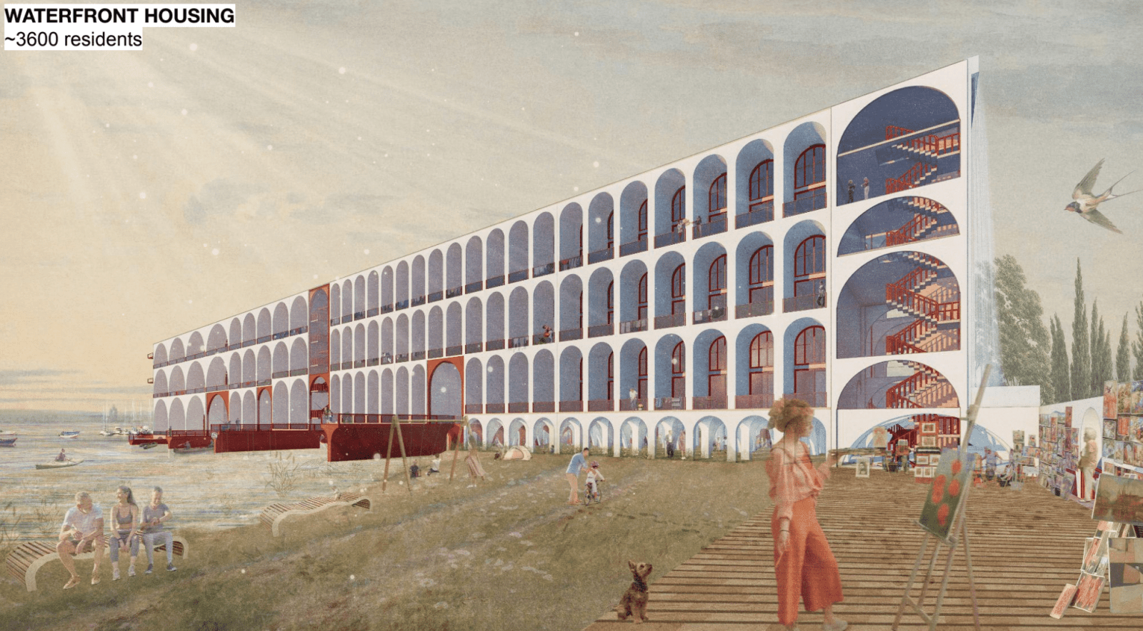
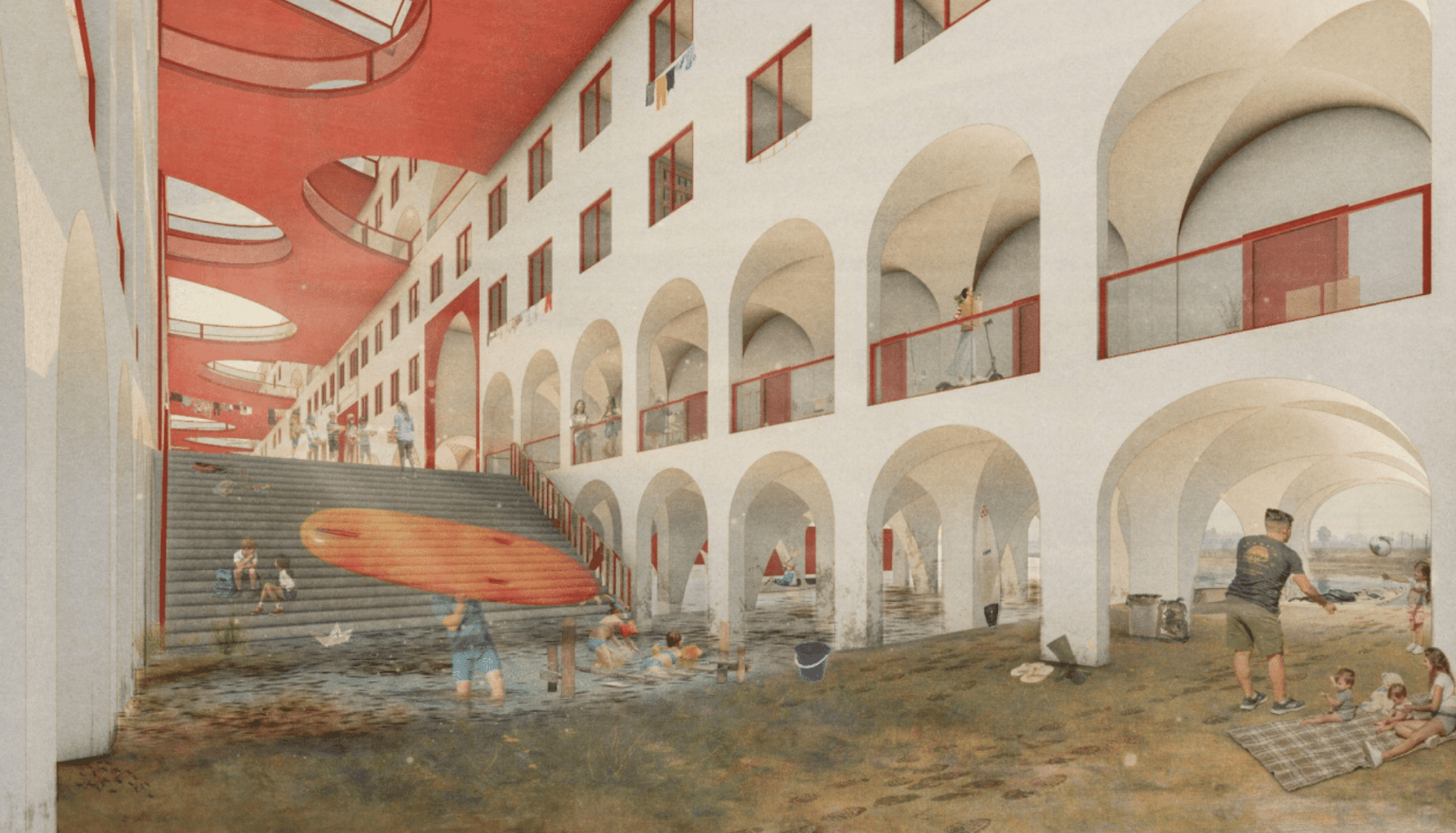 The students said that constructing several buildings at angles to the shoreline could mitigate the risks of sea-level rise, provide new housing in the area, and serve as a hub for recreation. Credit: Anhelina Rozum, student at CCA
One of the more striking designs they came up with was several long, three-story buildings to be placed on the shoreline, modeled on groyne sediment fields, which stabilize shorelines. The students’ early models would provide housing for up to 4,000 residents.
Some of the other students imagined structures that could be built around or on top of the freeway, or created designs for the actual BART station, taking into account the community’s needs, including infrastructure to protect pedestrian and bicycle traffic.
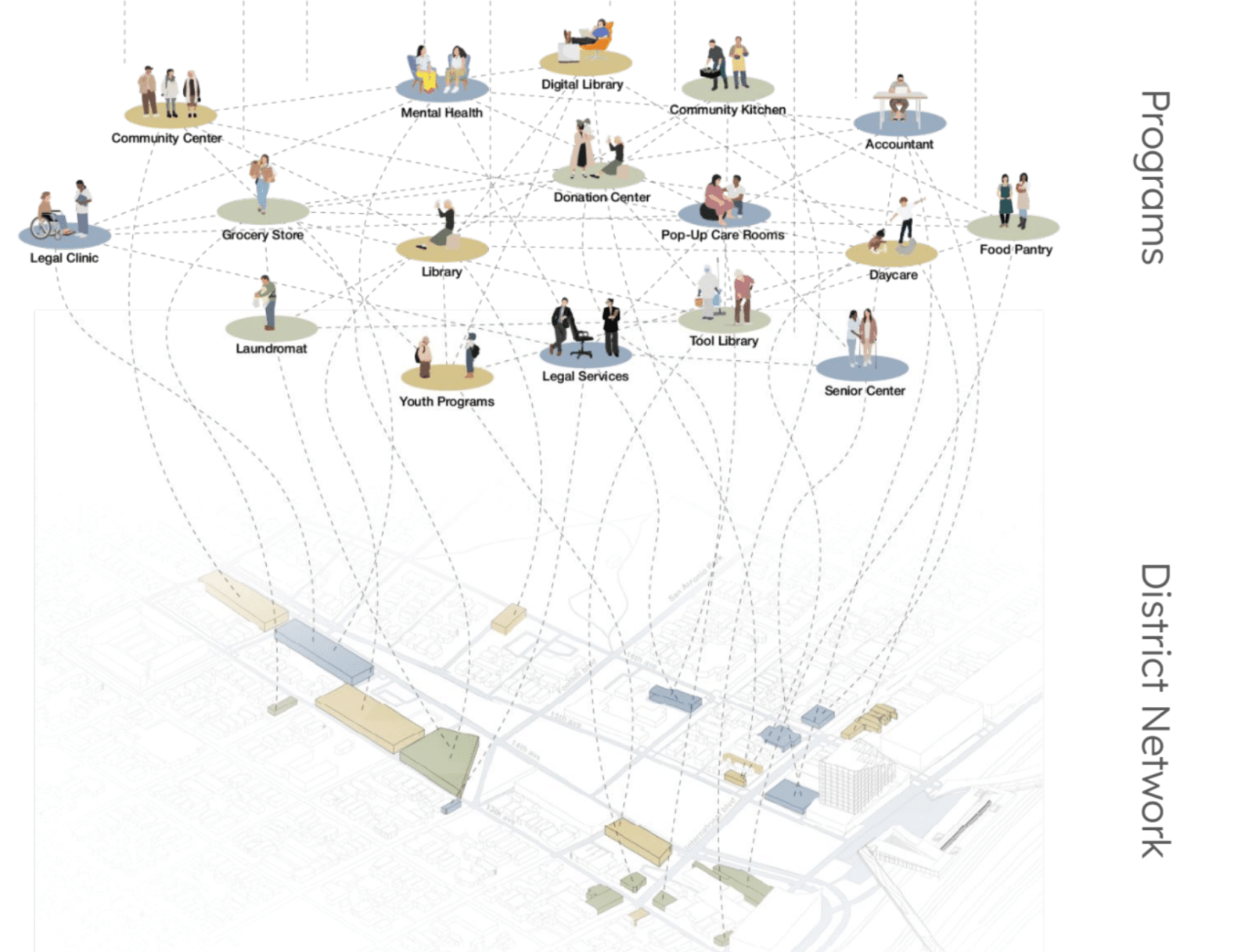 Students proposed surrounding the station with community-centered services, such as daycares and food pantries, to serve the community. Credit: Karrie Blackford, student at CCA
Using the designs for future advocacy
Sara Rowley, an advocate with the San Antonio Station Alliance, said public images of the students’ work have sparked more attention and excitement around the possible station.
“We’ve gotten a lot of interest on social media — much more than we normally do,” she said. “People are clearly very interested.”
Rowley said Schwarzer showed up at one of the alliance’s meetups, which led to conversations between them about next steps. Those conversations informed Schwarzer’s proposal for a studio class, where students would have “imaginary millions of dollars” to approach the station concept from a design point of view.
“They also made a concerted effort to study the community, learn history, understand the current challenges” Rowley said, “which I thought was really cool.”
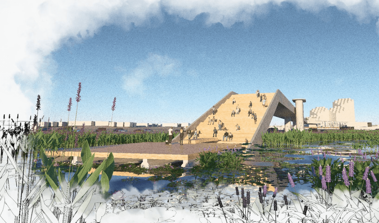 The students envisioned a wide pedestrian land bridge that would allow people to cross the freeway and enjoy the redesigned shoreline. Credit: Loel Quevedo and Michael Plesnicher, students at CCA
Rowley and another of her alliance colleagues, Ben Matlaw, a transit professional who has lived in Oakland for over 10 years, presented their own research on the neighborhood’s history to the class. Rowley said she stressed to them that residents wanted the BART station to serve as a hub for community connections, not just a place people walked through every day. “A place for pop-up shops, playgrounds, gatherings, and everyday community life,” she said.
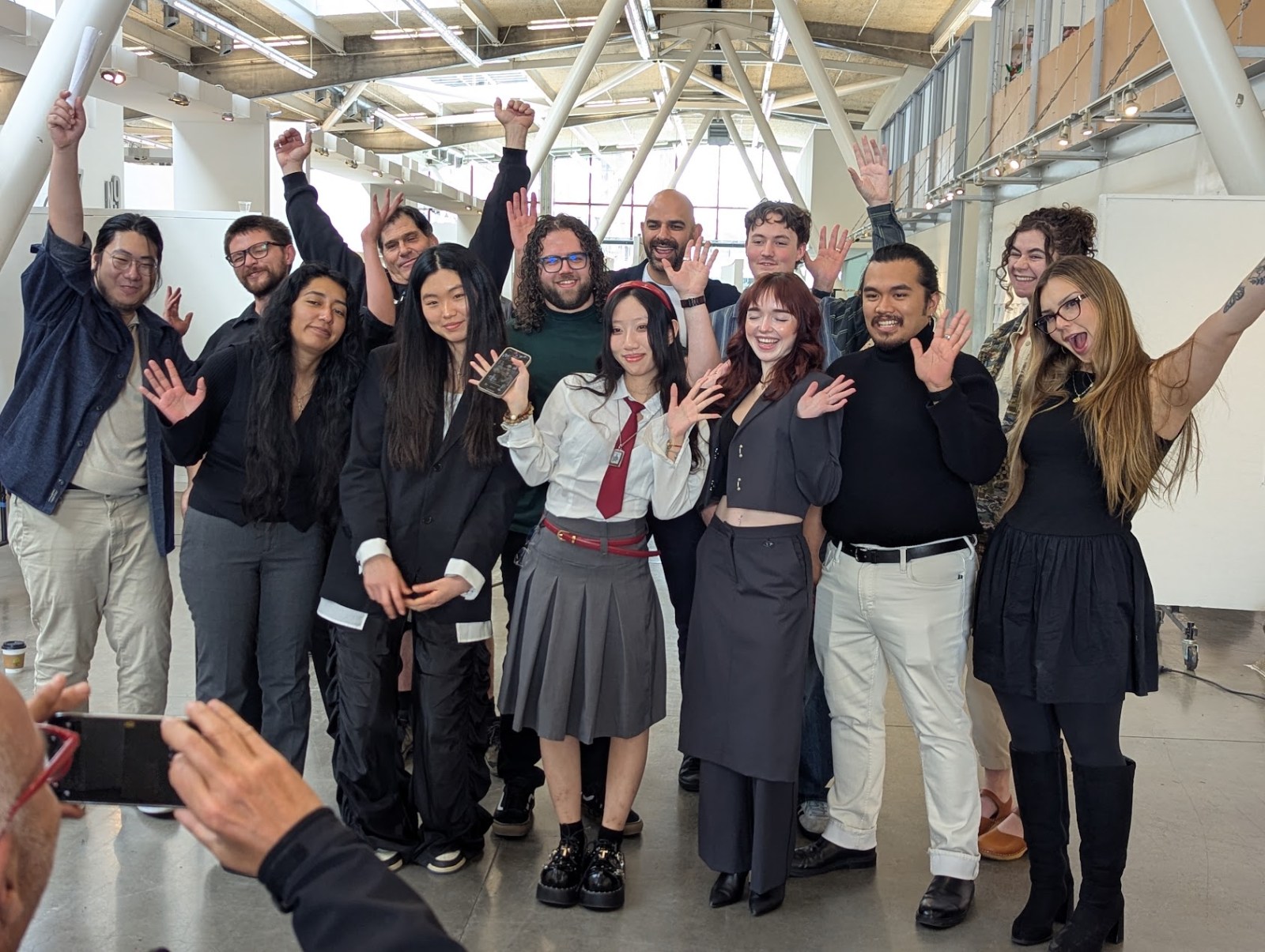 The CCA design students after completing their studio program in spring of 2026. Credit: CCA design
The students incorporated that history and feedback, along with their own research, which included walking tours of the community, into their work. That informed the types of businesses the plans were designed to include, such as a bookstore, a childcare center, a healthcare pop-up, and places where local food trucks and vendors could sell their wares, rather than storefronts for corporate chains.
Working with the San Antonio Station Alliance, Bhatia said, “allowed us to come up to speed with years of conversations and community outreach, to get a handle on what the community was enthusiastic about, what they were fearful about, and how they were thinking about their neighborhood.”
“*” indicates required fields