
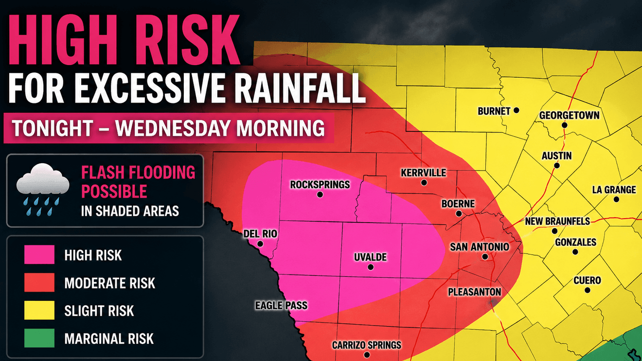
SAN ANTONIO – A High Risk for excessive rainfall outlook for parts of South-Central Texas has been issued. Warning of another round of torrential rain could trigger life-threatening flash flooding are expected to develop tonight into Wednesday morning.
Concern is increasing that areas already flooded by recent heavy rain—particularly along the U.S. Highway 90 corridor, the western Hill Country, southern Edwards Plateau and the Rio Grande region—could receive an additional 10 to 20 inches of rainfall where thunderstorms repeatedly move over the same locations tonight.
CLICK HERE for the latest weather forecast…
That rainfall would occur on top of an already saturated landscape. Radar estimates indicate many locations in Medina, Uvalde and Bandera counties have already received more than 12 inches of rain during the past several days, leading to numerous flooded roads, swift-water rescues and rapidly rising creeks and rivers.
CLICK HERE to check out our interactive radar…
Additional rounds of slow-moving thunderstorms tonight after midnight could produce considerable to locally catastrophic flash flooding, particularly in areas that experienced heavy rainfall earlier this week.
While the greatest concern is focused west of San Antonio, the flood threat extends across much of South-Central Texas including San Antonio the exact location of the heaviest rainfall will depend on where repeated thunderstorms develop overnight.
CLICK HERE to send us your weather photos and videos…
Flood Watches remain in effect across a large portion of South-Central Texas through at least Thursday, and additional Flash Flood Warnings are expected as storms develop. Residents living near creeks, rivers and low-water crossings are urged to monitor forecasts closely, have multiple ways to receive warnings overnight and never attempt to drive across flooded roadways.