
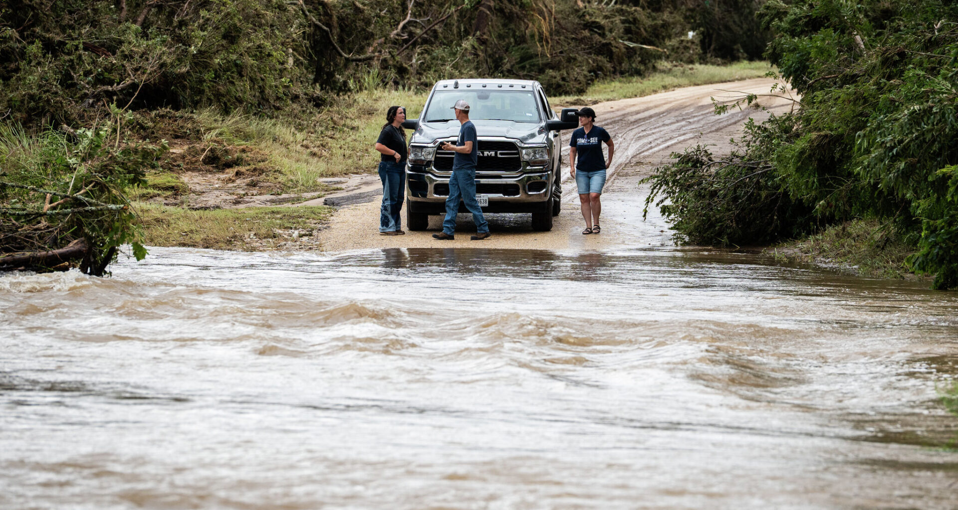
People arrive Friday at a flooded low water crossing on the Old Kerr Highway, separating them from Texas 16 after catastrophic flooding swelled rivers across Central Texas and the Hill Country.
Sara Diggins/Austin American-Statesman
After parts of Central and South Texas were inundated this week with nearly 30 inches of rain, triggering widespread and catastrophic flooding across the Hill Country, Edwards Plateau and Rio Grande Plains, weather will continue to improve as high air pressure builds into Texas from the east.

Once the upper-level atmospheric disturbance moves northwest and weakens, we return to a more typical July weather pattern Saturday, with a cloudy start to the day giving way to mostly sunny skies by the afternoon. High temperatures will climb into the low 90s, but with the humidity, the heat will feel closer to 100 degrees.
Article continues below this ad
Historic flooding, by the numbers
Throughout the flood event over the past week, meteorologists at the regional National Weather Service office for Austin and San Antonio issued six flash flood emergencies, along with numerous flash flood warnings, river flood warnings, flood advisories and tornado warnings.
Fortunately, the Austin metro area was spared the worst of the flooding, with most communities receiving a more manageable 2 to 6 inches of rainfall over the past week.
The bull’s-eye of the highest rainfall totals since Monday are in the Hill Country and southern Edwards Plateau.
National Weather Service
TEXAS FLOODING: ‘It’s devastating’: Flood survivors flee rising Pedernales River
Article continues below this ad
Here are the highest rainfall totals since Monday:
28.23 inches in Knippa (Uvalde County)
27.26 inches in Uvalde (Uvalde County)
25.36 inches in Ingram (Kerr County)
20.65 inches in Kerrville (Kerr County)
20.45 inches in Concan (Uvalde County)
TEXAS FLOODING: ‘Flash Flood Alley’: Why the Guadalupe River floods so quickly in Texas Hill Country
When is this going to be over?
We have only a slight chance of rain in the Hill Country on Saturday, but the recent heavy rainfall will continue to affect area rivers, streams, and creeks.
Article continues below this ad
“Flooding and river flooding are likely to be ongoing for several river basins, and we urge residents and visitors to be weather-aware and following local officials for latest information on street closures, river impacts, and other weather-related situations,” weather service meteorologists wrote in their latest forecast discussion.
It will be similar weather Sunday, with morning clouds giving way to afternoon sunshine. Temperatures will be a little warmer, reaching the lower to mid-90s and heat index values, or humidity-driven “feels like” temps, reaching 100 to 102 degrees.
Next week looks similar with rising temperatures as the typical summer heat dome of high air pressure builds and settles across the southwestern United States and extends into the Lone Star State.
Article continues below this ad
What can we expect for the rest of July?
So far, this month has been an active one, with below-normal temperatures dominating the past week. Over the past several days, Austin temperatures have remained in the 70s and 80s, thanks to increased cloudiness and rainfall.
The temperature outlook map for the next six to 10 days from the National Weather Service’s Climate Prediction Center shows above-normal temperatures coming to Texas.
Climate Prediction Center
The precipitation outlook map for the next six to 10 days from the National Weather Service’s Climate Prediction Center shows below-normal rainfall expected for Texas.
Climate Prediction Center
The temperature outlook map for the next eight to 14 days from the National Weather Service’s Climate Prediction Center shows above-normal temperatures coming to Texas.
Climate Prediction Center
The precipitation outlook map for the next eight to 14 days from the National Weather Service’s Climate Prediction Center shows below-normal rainfall expected in Texas.
Climate Prediction Center
This July is currently Austin’s 18th-wettest on record, with 4.17 inches of rain recorded so far, which is nearly 3 inches above normal for the month. For comparison, July 2025 ended with a little more than 6 inches of rainfall, while Austin’s wettest July on record occurred in 1919, when 12.8 inches of rain fell.
Article continues below this ad
Looking ahead, the rest of the month will be much quieter, with a return to more typical summertime weather and little to no widespread rain expected. We could still see a few sprinkles or isolated showers as the heat dome shifts around, but overall, a drier weather pattern is expected.
The Climate Prediction Center’s outlooks for the next six to 10 days and eight to 14 days both favor above-normal temperatures and below-normal rainfall across the region.