
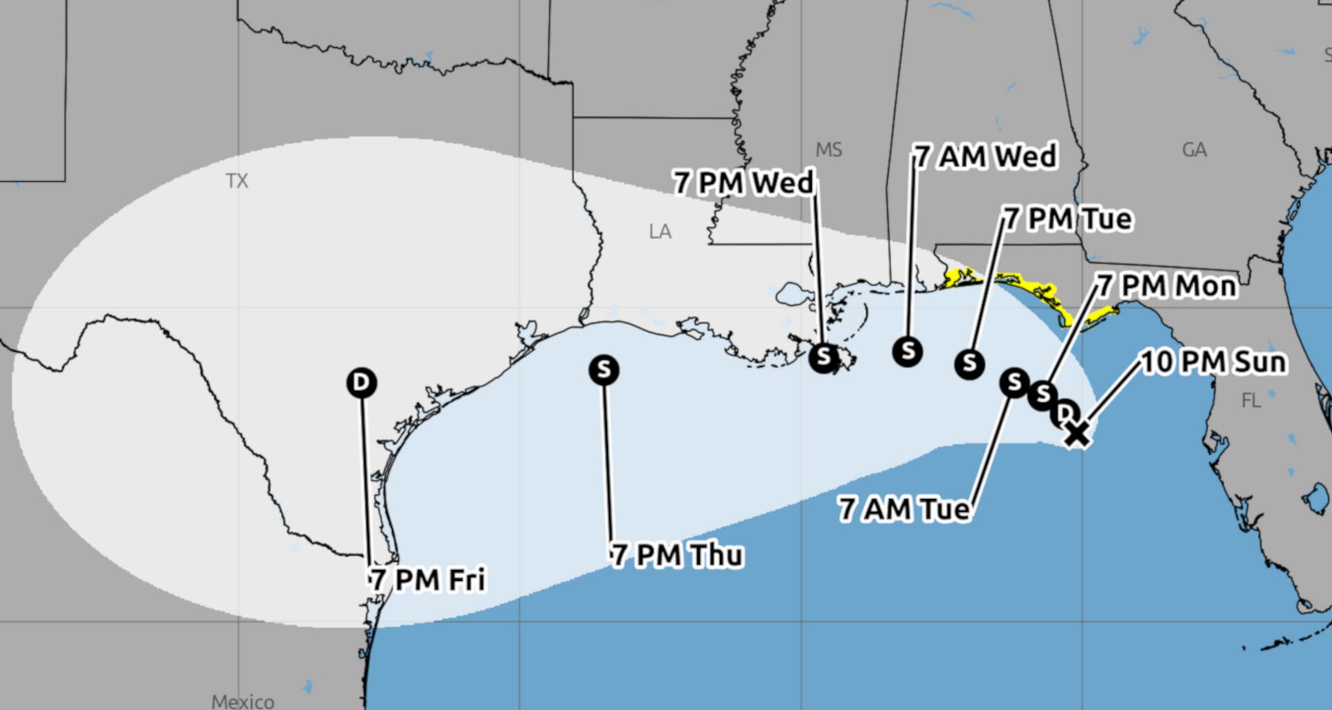
A tropical depression is expected to strengthen into Tropical Storm Bertha on Monday and could impact every Gulf Coast state from Florida to Texas. Early forecasts show this storm could potentially bring up to eight inches of rain, and the impacts stretch all the way to the middle of the Texas coast.
As of late Sunday, the depression was crawling north-northwest at just 3 mph with maximum sustained winds of 30 mph and even higher gusts, according to meteorologists from the National Hurricane Center. Once sustained winds reach 40 mph, that’s when it will get the name Bertha, the second named storm of the 2026 Atlantic hurricane season.
Meteorologists say gradual strengthening is forecast, and once the system becomes Bertha, it is expected to start moving westward somewhat parallel to the Gulf Coast. A Tropical Storm Watch is already in effect for the Florida panhandle.
Current forecasts have the system skirting by the Louisiana coast on Wednesday—possibly making landfall first there—before a Texas landfall on Thursday or Friday. But there are still multiple factors to consider between now and then. The storm must battle wind shear and dry air, which could sap the storm of its strength. And it’s not yet clear whether a strong and building ridge of high-pressure will push the storm further south.
The National Hurricane Center said the system is expected to bring 2 to 4 inches of rain with higher totals around 8 inches.
Tropical Storm force winds could hit waters off the Texas coast by Wednesday night, and that will come with a higher chance of rain and thunderstorms Thursday and Friday.