
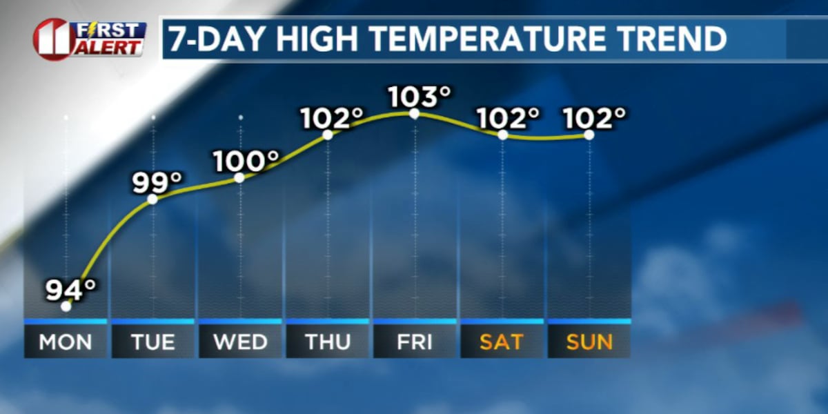
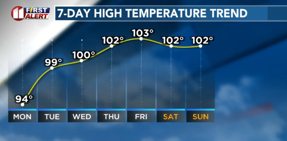
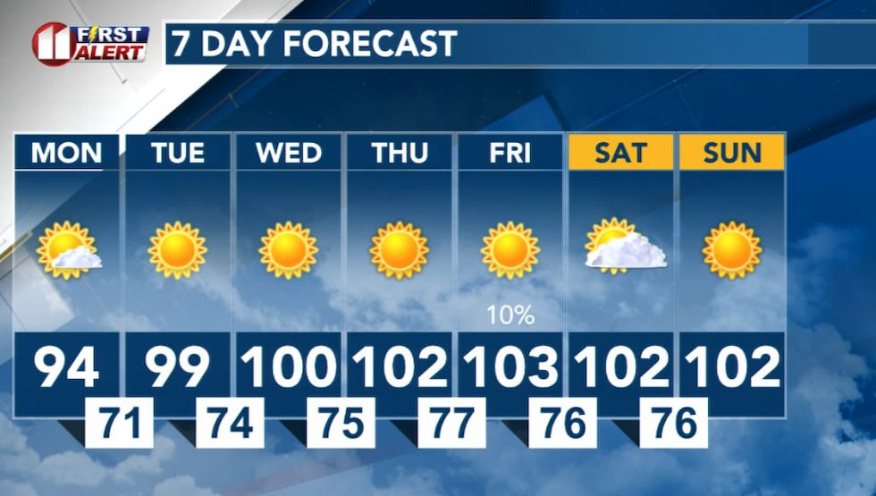
LUBBOCK, Texas (KCBD) – The warming trend begins Monday with highs climbing into the 90s across the Caprock region, but that’s just the beginning of a dangerous heat wave set to grip the area through the weekend.
An upper high pressure system is steering moisture and cooler air westward, clearing the way for scorching temperatures to take over. Record-breaking heat is possible by late this week into the weekend as highs climb into the triple digits area-wide.
 KCBD(KCBD)
Triple digit heat will return this week, initially off the Caprock Tuesday, then expanding westward to the entire area mid-late week.
Monday: The transition day
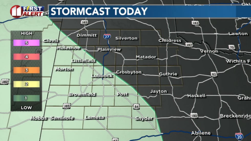
Monday will mark the shift from the recent cooler and occasionally stormy pattern to a much hotter and drier stretch. While mostly clear skies will prevail, residual moisture across the southwestern South Plains may trigger an isolated storm or two this afternoon, though chances are expected to remain under 10%.
 KCBD(KCBD)
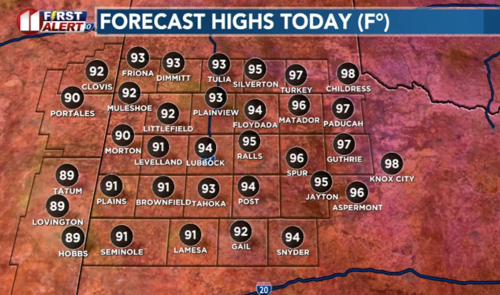
Highs will reach the low to mid-90s on the Caprock and mid-upper 90s in the Rolling Plains and southeast Texas Panhandle. A mild and dry night will follow with lows ranging from the mid-60s near the Texas/New Mexico line to the mid-70s off the Caprock.
 KCBD(KCBD)Hot, dry pattern takes hold
From Tuesday through the weekend, expect hot and dry conditions to develop and remain in place. Temperatures will climb into the triple digits, with the most intense heat arriving mid-to-late week as the high pressure system strengthens.
 KCBD(KCBD)
Copyright 2026 KCBD. All rights reserved.