
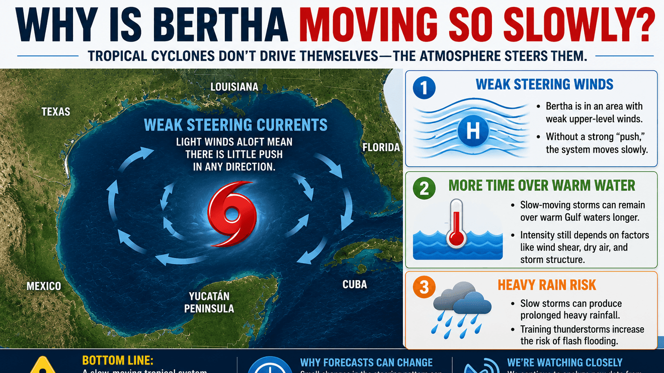
If you’ve been watching the Gulf this week, you may have noticed something unusual about the system expected to become Tropical Storm Bertha—it isn’t racing across the Gulf like many tropical storms do.
Instead, it’s moving very slowly. That slow movement is one of the biggest reasons we are paying such close attention.
Tropical Cyclones Don’t Move Themselves
A hurricane or tropical storm isn’t powered like an airplane or driven like a car. Instead, tropical cyclones are carried by the large-scale winds surrounding them.
Meteorologists call these winds the steering currents.
Think of the atmosphere as a river. A tropical cyclone is like a leaf floating downstream—it goes wherever the current takes it. When those steering winds are strong, storms move quickly. When the steering winds weaken, storms can slow dramatically, stall, or even make unexpected turns.
What’s Happening This Week?
Tropical Storm Bertha is currently located in a region where the steering currents are relatively weak. Instead of being picked up by a strong jet stream or a well-defined upper-level wind pattern, it is moving through an area with very little atmospheric “push.”
As high pressure changes across the southern United States, we expect those steering currents to change during the middle of the week. Exactly how that ridge develops will help determine where Bertha eventually travels. Small changes in the steering pattern can produce big differences in the storm’s track.
Why Slow-Moving Storms Can Be More Dangerous
People often focus on wind speed, but movement speed can be just as important. A storm moving at 20 mph may spread its rain over a large area. A storm crawling along at only a few miles per hour can repeatedly dump heavy rain over the same locations. That process, known as training, greatly increases the risk of flash flooding because thunderstorms continue to move across the same communities. Even a relatively weak tropical storm can produce significant flooding if it moves slowly enough.
This is why we are very concerned about Bertha’s path and rainfall pattern. We have not fully recovered from the drenching rains and flooding of the past few days. Any additional rainfall in this area will bring an immediate and significant flood threat.
Slow Doesn’t Mean Weak
One common misconception is that a slow-moving storm must be weakening. That’s not necessarily true. Movement speed and storm intensity are two different things.
A tropical cyclone can strengthen while barely moving or weaken while moving rapidly. Factors such as warm water, wind shear, dry air and internal storm structure determine whether the system strengthens—not simply how fast it is traveling.
Why Forecasts May Change
One reason tropical forecasts evolve is that small changes in the steering currents can produce noticeable changes in where a slow-moving storm eventually goes. When a system is moving quickly, a slight shift in direction may not have a major impact.
When a system is moving slowly, that same small shift can change where the center is located a day or two later. That’s why you’ll often see the National Hurricane Center adjust the forecast track as new observations from satellites, radar, buoys and Hurricane Hunter aircraft are incorporated into forecast models.
What South Texas Should Watch
For South Texas, the key question isn’t simply whether Bertha becomes a tropical storm.
The bigger question is: When does the storm begin moving with the larger steering currents, and where will those winds take it?
That answer will determine where the heaviest rainfall, strongest winds and greatest coastal impacts ultimately develop. As the atmosphere becomes better organized over the next several days, confidence in the forecast track should gradually improve.
Bottom Line
The slow movement of the storm isn’t unusual, but it is important.
Slow-moving tropical systems are often the most challenging to forecast because they respond to subtle changes in the atmosphere. Those same slow speeds can also increase the threat of heavy rainfall and flooding, even if the storm never becomes particularly strong.
We’ll continue monitoring Bertha around the clock and update the forecast as new information becomes available.