
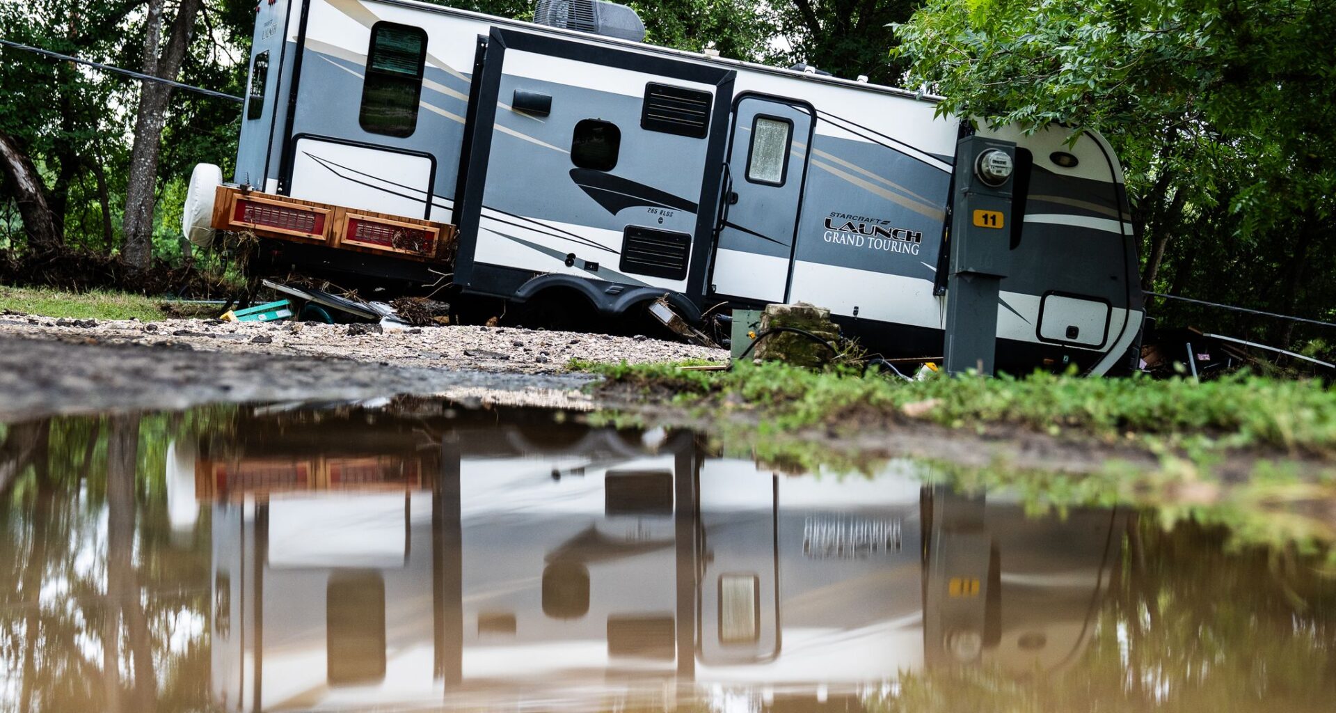
An RV sits crooked where it was washed by flooding at the Kerrville KOA near Goat Creek. Residents of the RV park woke up to dangerous flooding as Goat Creek came over its banks near the Guadalupe River.
Sara Diggins/Austin American-Statesman
The Guadalupe River reached one of its highest levels on record near Comfort for the second July in a row, swamping roads and communities as flooding across Central and South Texas killed at least two people and prompted more than 230 rescues.

Scientists say two major floods in back-to-back years don’t prove climate change is making Guadalupe River flooding more common. But they do say a warming atmosphere is making storms like these more likely to produce heavier rainfall — and that Texas’ rainfall estimates may already underestimate today’s flood risk.
Article continues below this ad
The river crested at 37.08 feet near Comfort on July 16, the fourth-highest level on record, according to Texas State Climatologist John Nielsen-Gammon. The same gauge reached 35.64 feet during the deadly July 4, 2025, flood, ranking sixth.
Did climate change contribute to the floods?
Scientists say climate change did not create either weather system. But it likely made the storms wetter.
A warmer atmosphere can hold more water vapor, giving storms more moisture to dump as rain.
Article continues below this ad
“Accurate framing would be that climate change has increased the likelihood of events of similar intensity, or equivalently that climate change has increased the expected intensity of events of similar rarity,” Nielsen-Gammon said.
Gary Shipman and Sofia Patton look across the Guadalupe River over at their ranch from Howdy’s Bar and Grill on Thursday, July 16, 2026, in Kerr County.
Andrew J. Whitaker/San Antonio Express-News
Other researchers have reached similar conclusions.
A rapid attribution analysis of the July 2025 flood by ClimaMeter found natural weather variability alone could not explain the rainfall. Researchers found conditions in the region were up to 1.5 degrees Celsius warmer and as much as 7% wetter than during similar historical events.
Article continues below this ad
Researchers cautioned that lingering moisture from Tropical Storm Barry complicated historical comparisons, and no study has yet formally calculated the event’s likelihood with and without human-caused warming.
Marshall Shepherd, an atmospheric scientist at the University of Georgia, wrote in Forbes that this month’s flooding was likely intensified by an unusually humid atmosphere fed by a warm Gulf — conditions he called “consistent with climate change.”
The federal government’s Fifth National Climate Assessment, released in 2023, also projects that extreme rainfall will become more common as the climate warms, increasing flood risks for communities and infrastructure.
Debris from the flooded Guadalupe River on Thursday, July 16, 2026, in Kerrville.
Andrew J. Whitaker/San Antonio Express-News
Are back-to-back floods unusual?
Article continues below this ad
Nielsen-Gammon said a similar stretch happened in 1935 and 1936, when the Guadalupe reached 36.9 feet and 34.4 feet at Comfort.
“So it does happen sometimes,” Nielsen-Gammon said.
The July 2025 flood peaked at an estimated 177,000 cubic feet per second, while the gauge’s all-time record crest remains 40.9 feet, set in August 1978.
Nielsen-Gammon said flood records in the southern Hill Country show no clear long-term trend. While extreme rainfall is increasing across Texas and the southern United States, those changes are difficult to detect at a single river gauge because the biggest storms are rare and unevenly distributed.
Article continues below this ad
Luke Mixon, left, and Trent Sursa, right, look at the Guadalupe River under I-10 after heavy rain caused flooding in Comfort, Texas on Thursday, July 16, 2026. Mixon said he was at an RV park in Comfort during the July 4, 2025 flood. “They said it was a 75 year flood, so I didn’t expect to see anything like this again,” Mixon said about the flood.
Aaron E. Martinez/Austin American-Statesman
Flood records elsewhere in Texas tell a similar story. The Nueces River below Uvalde was projected to crest at 27.6 feet early July 17, enough to rank as its third-highest flood after more than 27 years without a top-10 event.
“Just like you can’t conclude anything from two top-10 floods in consecutive years, you can’t conclude anything from a 28-year gap between top-10 floods,” Nielsen-Gammon said.
He said there is no clear statewide trend in peak river levels on unregulated rivers, though climate models project greater streamflow during Texas’ wettest months.
Article continues below this ad
Are Texas flood estimates keeping up?
Texas relies on NOAA’s Atlas 14 rainfall estimates, which are based on observations through 2018 and assume rainfall patterns don’t change over time.
But later research has found extreme rainfall is increasing, especially across Gulf Coast and Southeastern states.
Article continues below this ad
In a 2024 study, Nielsen-Gammon and researcher Savannah Jorgensen found Atlas 14 underestimated current rainfall intensities across the region by an average of 15% after accounting for observed trends.
NOAA is developing Atlas 15, which is expected to include both observed trends and future projections. Separately, the Texas Water Development Board has funded Nielsen-Gammon and Rice University researcher James Doss-Gollin to develop updated rainfall estimates for Texas. Their findings are under review, with final recommendations expected this fall for engineers and floodplain managers.