
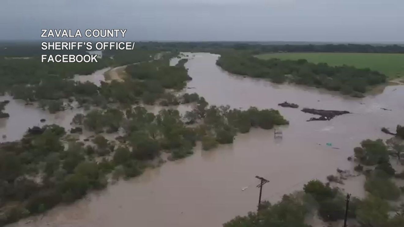
The heavy rain has ended across much of South Central Texas, but the flood danger is far from over.
While San Antonio and surrounding areas are expected to stay hot and mostly dry through the week, rivers downstream are still rising as runoff from last week’s historic flooding continues moving through the region. Forecasters warn some rivers are expected to remain at major flood stage for several more days, posing a continued threat to homes, roads, businesses and ranchland.
Frio River
The greatest concern is along the Frio River at Tilden, where the river was approaching 18 feet and rising this morning.
The National Weather Service forecasts the river will reach major flood stage around 7 p.m. tonight before cresting at 27.9 feet around 1 a.m. Wednesday. Major flood stage begins at 27 feet.
The Frio River will remain at major flood stage through Thursday.
Flooding at those levels can inundate homes and businesses, cover roads and impact agricultural operations and livestock in low-lying areas.
Residents living along the Frio River are urged to closely monitor river conditions and be prepared to move to higher ground if flooding threatens their property.
Nueces River
The Nueces River at Cotulla is also expected to remain a significant concern through the end the weekend.
The river has already risen above 22 feet and is forecast to continue climbing before cresting at 23.4 feet at 1 p.m. Wednesday, and remaining in major flood stage through Sunday.
Even though skies are expected to remain mostly sunny across South Central Texas, floodwaters will continue working their way downstream, causing rivers to rise long after the rain has stopped.
Flood danger isn’t over
Emergency officials are reminding residents that river flooding can remain dangerous even when the weather has improved.
Fast-moving currents, flooded low-water crossings and unstable riverbanks can all pose life-threatening hazards. Anyone living near the Frio or Nueces rivers should continue monitoring forecasts, avoid flooded areas and never drive around barricades or through water covering roadways.
Meanwhile, Tropical Storm Bertha is expected to track toward Louisiana and should have little impact on South Central Texas. A few showers could develop late Friday into the weekend, but forecasters do not expect widespread rainfall or renewed flooding locally.
The primary weather concern around San Antonio through midweek will instead be dangerous heat, with afternoon highs reaching the upper 90s and heat index values climbing into the triple digits.
For communities along the Frio and Nueces rivers, however, the biggest threat remains the floodwaters that continue moving downstream days after last week’s historic rainfall.