
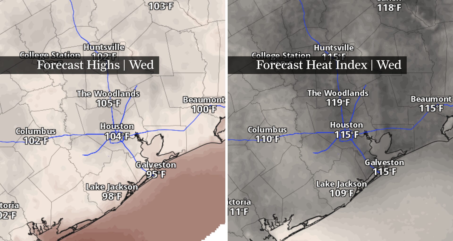
Houston could experience its hottest day in nearly three years Wednesday as dangerous heat pushes temperatures into the triple digits before Tropical Storm Bertha offers a chance at modest relief later this week.
After several days of building heat, temperatures are expected to peak Wednesday afternoon between 100 and 104 degrees across much of Southeast Texas. If Houston reaches 103 degrees, it would mark the city’s hottest day since September 2023. Heat index values could climb as high as 115 degrees, prompting an extreme heat warning for much of the region. Wednesday’s forecast also puts Houston within striking distance of the daily record high of 101 degrees, set in 2023.
Tropical Storm Bertha is expected to reach Southeast Texas later this week, likely in a much weaker state. Could it help take the edge off this week’s heat?
Wednesday’s forecast puts Houston on track for its hottest afternoon since September 2023, with highs between 100 and 104 degrees and heat index values climbing as high as 115 degrees.
An extreme heat warning is in effect from 11 a.m. through 8 p.m. Wednesday for much of Southeast Texas.
Why the heat warning matters: Wednesday’s extreme heat warning is the National Weather Service’s highest heat alert and signals that dangerous heat can quickly lead to heat-related illness. The greatest risk will be during the afternoon and early evening, so postpone strenuous outdoor activities if possible, stay hydrated and seek air conditioning frequently.
Bertha is forecast to weaken as it approaches the upper Texas coast late Thursday into Friday. While the system isn’t expected to bring significant weather hazards to Southeast Texas, increasing clouds and a few coastal showers could keep Friday’s high temperatures in the upper 90s instead of the triple digits.
Bertha’s biggest contribution to Houston weather may simply be trimming temperatures rather than bringing heavy rainfall.
Most of the storm’s heavier rainfall is expected to remain offshore, leaving Southeast Texas with only isolated showers Thursday into Friday. Gusty winds and a higher risk of rip currents are possible along Gulf beaches, but widespread flooding, damaging winds and coastal flooding are not anticipated.
By the weekend, Bertha’s influence should fade, leaving Southeast Texas with seasonably hot afternoons in the middle to upper 90s and isolated afternoon showers.