
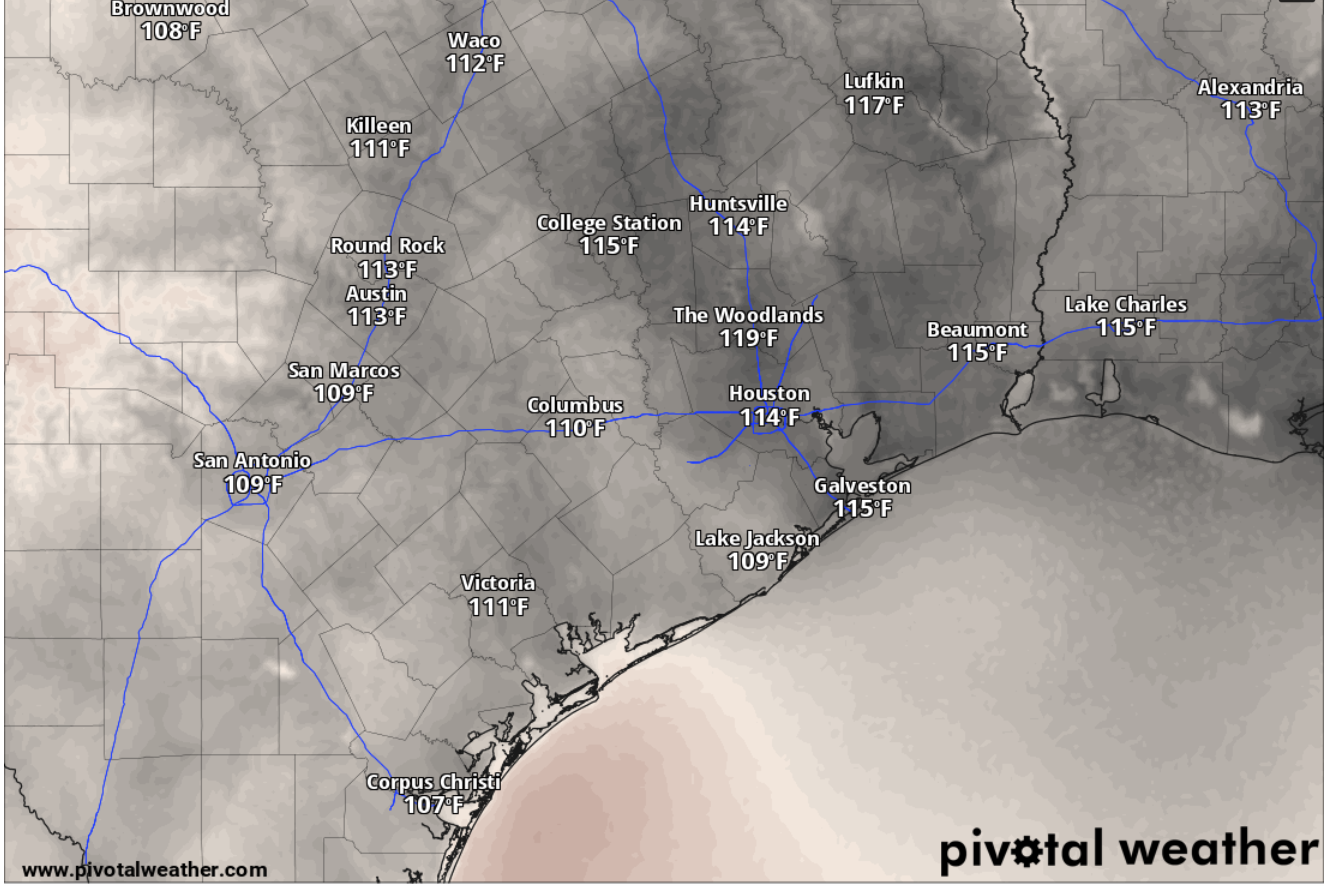
Heat index values, or humidity-driven “feels like” temperatures, will be solidly in the triple digits by 3 p.m. Wednesday, according to the National Blend of Models, a composite weather forecast model.
National Blend of Models/Pivotal Weather
San Antonio could record its first 100-degree reading of the year Wednesday, while humid, moisture-rich air drawn in by southeast winds from the Gulf of Mexico could make that temperature feel several degrees hotter, according to the National Weather Service.

“(Afternoon) high temperatures will continue to intensify through the middle of the week,” the weather service said in a forecast bulletin posted online Tuesday. “Heat index values will be highest on Wednesday and Thursday, particularly along and east of I-35.”
Article continues below this ad
San Antonio shouldn’t expect much relief from the heat at night, either. Wednesday night’s partly cloudy skies will help keep overnight temperatures above 83 degrees into Thursday morning.
Forecasters pointed to upper-level ridging, or strengthening high atmospheric pressure, near Texas that “will bring a hot and generally rain-free pattern through the middle part of the week.”
“Wednesday will easily be the warmest day of the week, especially for the Rio Grande Plains and areas along and east of the I-35 corridor where afternoon highs will reach into the lower 100s to some areas hitting the middle 100s,” the weather service said. “We will see an increase in mid-level moisture on Wednesday, which will help max heat index values to reach heat advisory criteria levels.”
Article continues below this ad
In anticipation of the combination of excesssive humidity and extreme heat, regional weather service office for San Antonio has issued a heat advisory for the San Antonio and Austin metro areas. The heat advisory, which is intended to alert the public about the increased risk of heat-related illnesses, will be in effect from noon to 8 p.m. Wednesday.
Affected Texas counties include Bexar, Comal, Guadalupe, Wilson, Karnes and Frio, as well as counties along the Interstate 35 corridor, such as Travis, Hays, Williamson and Caldwell.
Thursday forecast
San Antonio on Thursday will be sunny with temperatures approaching 100 degrees.
Article continues below this ad
“We could see some expanding of a potential heat advisory across more of the region for Thursday and heat index values will once again reach that critical threshold of 108 degrees although ambient temperatures will be slightly lower than that on Wednesday,” Platt said.
But the most unknown factor in the forecast remained several hundred miles to the east.
“Right now it will be tough to pinpoint much else in way of temperatures for the rest of the week as we continue to monitor what is now Tropical Storm Bertha,” Platt wrote.
Tropical Storm Bertha is expected to approach the Texas coast by Friday morning, according to the National Hurricane Center.
National Hurricane Center
Tropical Storm Bertha
Tropical Storm Bertha formed Monday night in the northeastern Gulf of Mexico and is expected to slowly move westward through the week. Bertha’s projected path puts it near the Texas coast as a tropical depression by early Friday.
Article continues below this ad
However, “wind shear, dry air and land interaction could limit the storm’s organization as it approaches Texas late week,” the weather service said in a statement Tuesday. “No impacts from Tropical Storm Bertha are expected inland across South-Central Texas.”
Instead, atmospheric moisture from Bertha, or its remnants, could bring a relatively low 20% to 30% chance of rain Friday through Sunday, but mainly east of the Interstate 35 corridor, forecasters said.
San Antonio on Friday should be sunny, with temperatures peaking in the upper 90s, near 100 degrees. Then, rain chances appear in the Alamo City forecast on Saturday and Sunday, albeit a slight 20% chance.
Article continues below this ad