
Houston’s hottest weather of the summer is still ahead. But the forecast may finally be hinting at a pattern change.
Don’t mistake that for an early taste of fall. Houston is on the doorstep of its longest stretch of triple-digit heat so far this year after reaching 100 degrees only once so far this summer. But longer-range outlooks increasingly suggest the ridge of high pressure responsible for the heat may gradually retreat westward as August begins, opening the door to a modest change in the weather pattern.
Houston braces for its hottest weather of the summer
Monday marks the beginning of what could become Houston’s hottest stretch of the summer. Afternoon highs will climb into the upper 90s before reaching 100 degrees or higher across much of the metro by Tuesday, with several consecutive triple-digit days possible through the end of the workweek.
Humidity will make the heat even more dangerous. Heat index values are expected to peak near or above 108 degrees at times, reaching heat advisory criteria. Overnight lows will remain in the upper 70s to around 80 degrees, providing little opportunity to recover from the daytime heat.
Rain won’t offer much relief, either. Most of Southeast Texas is expected to remain dry through at least Friday.
Forecast models hint at a Houston weather pattern change
When meteorologists look more than a week ahead, we rely less on a single forecast and more on ensemble forecasts – dozens of slightly different versions of the same forecast model that reveal the most likely weather pattern.
Those ensembles are beginning to point toward a subtle shift.
The ECMWF forecast model, sometimes referred to as the European model, suggests Houston’s hottest weather may peak around Friday before highs ease back into the middle 90s during the first week of August. The GFS weather forecast model, referred to as the American model, has temperatures somewhat higher but also hints that the upper-level ridge will gradually weaken.
‘DOG DAYS’ EXPLAINED: What are the dog days of summer? 5 things every Texan should know.
Some individual runs of the American model continue to hold on to triple-digit heat, but those projections vary more from update to update. Growing agreement between the American and European ensemble systems increases confidence that rain chances may begin returning late next weekend.
Climate Prediction Center backs the pattern change signal
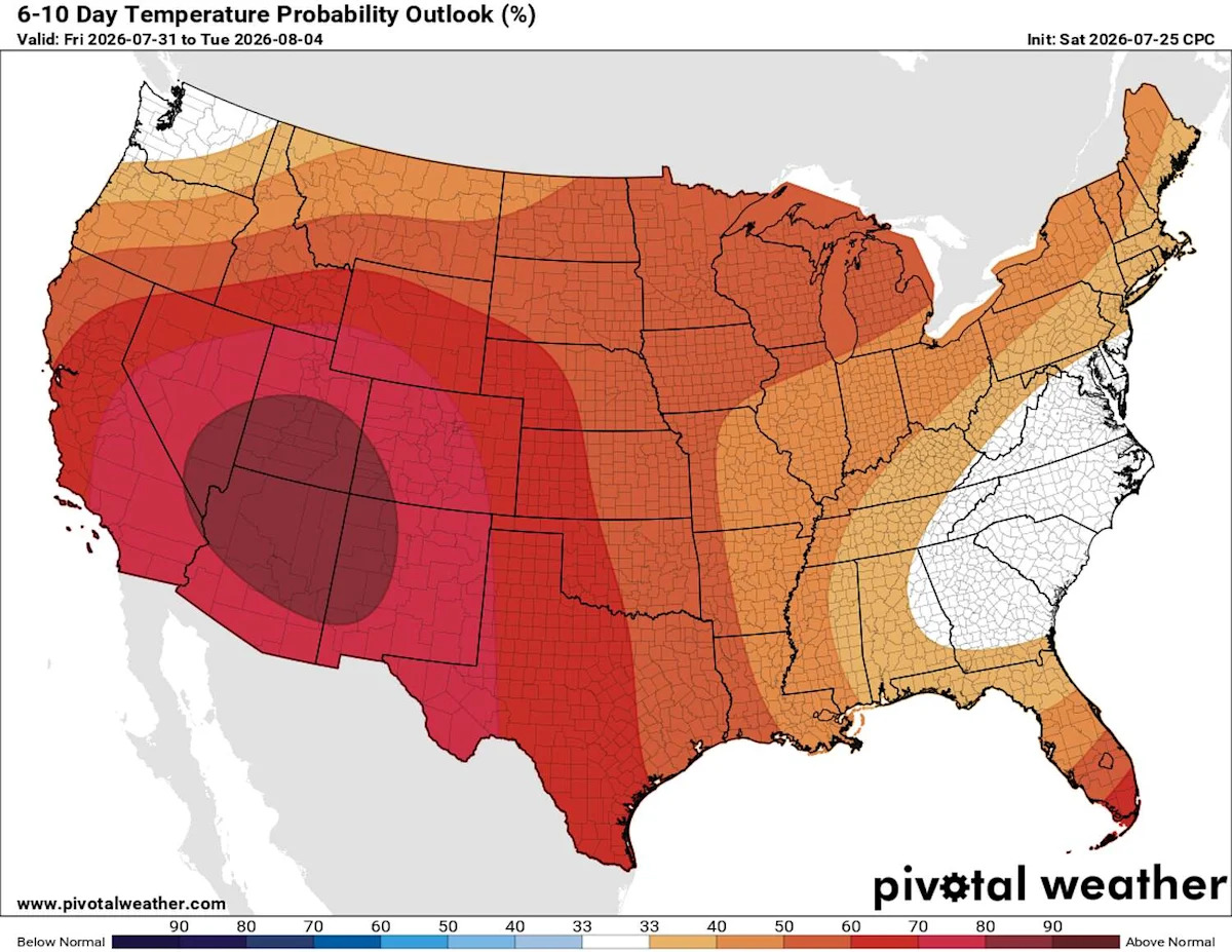
The Climate Prediction Center’s 6-10 day and 8-14 day outlooks – extending through Aug. 4 and Aug. 8, respectively – reinforce that signal. Both continue to favor above-normal temperatures across Texas while suggesting the ridge will shift westward and rain chances gradually increase during early August.

The Climate Prediction Center’s 6-10 day outlook, valid July 31 through Aug. 4, continues to favor above-normal temperatures across Texas. While the heat is expected to persist, the ridge of high pressure is forecast to begin shifting westward, a subtle change that could open the door to a weak summer cold front. (NOAA’s Climate Prediction Center / Pivotal Weather)
That doesn’t mean Houston is headed for pumpkin spice season. Even if a weak front approaches Southeast Texas, its biggest impact would likely be to bring back more typical August afternoon showers and perhaps slightly lower humidity rather than dramatically cooler temperatures.
In other words, summer isn’t going anywhere. But after what looks to be Houston’s hottest week of the year, the first meaningful signs of a pattern change may finally be starting to emerge.
Subscribe
There’s more to Houston with the Chronicle. Subscribe today for just 25¢.
This article originally published at Houston’s hottest weather is still ahead. Could a summer cold front follow?.