
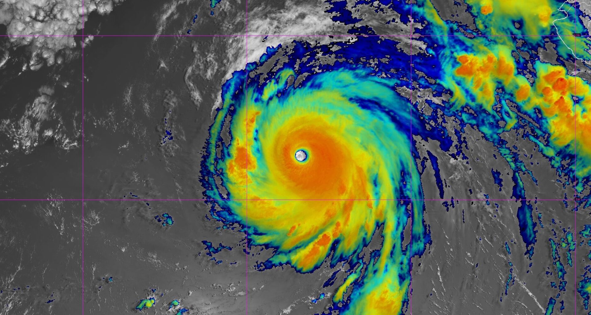
This is what explosive intensification looks like. In just 36 hours, Hurricane Genevieve strengthened from a 70-mph tropical storm into a powerful Category 4 hurricane with 155-mph winds. The storm poses no threat to Texas, but it’s a striking example of how quickly hurricanes can strengthen under the right conditions.
National Oceanic and Atmospheric Administration
Major Hurricane Genevieve spent the weekend doing what every coastal community dreads: strengthening at a breathtaking pace.
In roughly 36 hours, Genevieve transformed from a 70-mph tropical storm into the first Category 5 hurricane of the eastern Pacific’s 2026 season before weakening slightly to a powerful Category 4 with 155-mph winds by Monday morning. The storm poses no threat to Texas and is expected to remain well offshore of Mexico before gradually weakening later this week, but its remarkable intensification offers a stark reminder of one of tropical meteorology’s greatest forecasting challenges.
CLIMATE CONNECTIONS: Strong El Niño reshapes hurricane season outlook for Texas and Gulf Coast. Here’s how.
Article continues below this ad
Genevieve’s explosive strengthening also comes during an unusually active eastern Pacific hurricane season, another sign that strengthening El Niño is favoring hurricane development in the eastern Pacific while increasingly influencing conditions across the Atlantic basin.
What is rapid intensification?
Genevieve provides a textbook example or rapid intensification. Early Saturday afternoon, it was a 70-mph tropical storm. By Monday morning, it had weakened from its Category 5 peak to a 155-mph Category 4 hurricane, just 5 mph shy of Category 5 intensity.
That 85-mph increase in roughly 36 hours easily qualifies as rapid intensification, which the National Hurricane Center defines as a storm strengthening by at least 35 mph in 24 hours.
Article continues below this ad
27/1500 UTC Hurricane #Genevieve peak seas are near 44 ft. Swells generated by Genevieve are affecting portions of the SW coast of MX and S portions of the Baja California Peninsula, and will spread N along the remainder of the W coast of the Baja California Peninsula by tonight. pic.twitter.com/pmrjpPl9OC
— NHC_TAFB (@NHC_TAFB) July 27, 2026
Rapid intensification happens when several favorable ingredients come together, including exceptionally warm ocean water, abundant atmospheric moisture and light vertical wind shear — changes in wind speed or direction with height. When wind shear is weak, thunderstorms remain centered over the storm’s circulation, allowing the hurricane to organize and strengthen much faster than many people expect.
Why rapid intensification is so dangerous
Rapid intensification is among the most dangerous aspects of hurricane season because it can dramatically shorten the time people have to prepare.
A storm that appears relatively manageable one day can become a major hurricane the next, leaving little time to finalize evacuation plans or other preparations.
Article continues below this ad
HURRICANES AND AI: AI breakthrough in hurricane prediction marks major leap for Texas storm forecast accuracy.
Rapid intensification also remains one of the biggest forecasting challenges. Meteorologists have become increasingly accurate at predicting where hurricanes will go, but forecasting how quickly they’ll strengthen is far more difficult because small changes in the environment can dramatically alter a storm’s intensity.
Houston has already experienced the effects of rapid intensification. Hurricane Harvey underwent rapid intensification over the western Gulf before making landfall near Port Aransas in 2017, underscoring why Gulf Coast residents should monitor tropical forecasts closely whenever a storm enters the Gulf.
What Genevieve says about El Niño and the Atlantic hurricane season
Genevieve’s rapid rise comes as El Niño increasingly reshapes the atmosphere across the tropics. While it creates a more favorable environment for hurricanes in the eastern Pacific, it also strengthens upper-level winds across the Caribbean Sea, Gulf of Mexico and tropical Atlantic. Those stronger winds increase vertical wind shear, making it harder for tropical systems to organize and generally reducing Atlantic hurricane activity.
Article continues below this ad
That’s one reason NOAA and Colorado State University continue to project a below-normal Atlantic hurricane season in 2026 despite exceptionally warm Atlantic waters. NOAA’s next seasonal outlook, scheduled for early August, will incorporate the latest observations of El Niño and other atmospheric conditions.
Much of the eastern Pacific Ocean, where Hurricane Genevieve rapidly intensified into the first Category 5 hurricane of the 2026 eastern Pacific season, is running warmer than normal. The broad expanse of unusually warm water has helped create an environment favorable for explosive hurricane development.
WeatherBELL
But seasonal forecasts describe activity across an entire ocean basin, not what happens to any one location. El Niño’s influence is generally strongest across the Caribbean and eastern tropical Atlantic, meaning storms that form closer to the Gulf Coast can still develop when local conditions remain favorable. Texas has already experienced impacts from Tropical Storm Arthur in June and Tropical Storm Bertha in July, a reminder that even quieter seasons can still bring tropical impacts close to home.
Even with El Niño expected to suppress overall Atlantic activity, the threat of hurricanes isn’t going away. It only takes one hurricane in the wrong place to make any season memorable.
Article continues below this ad