
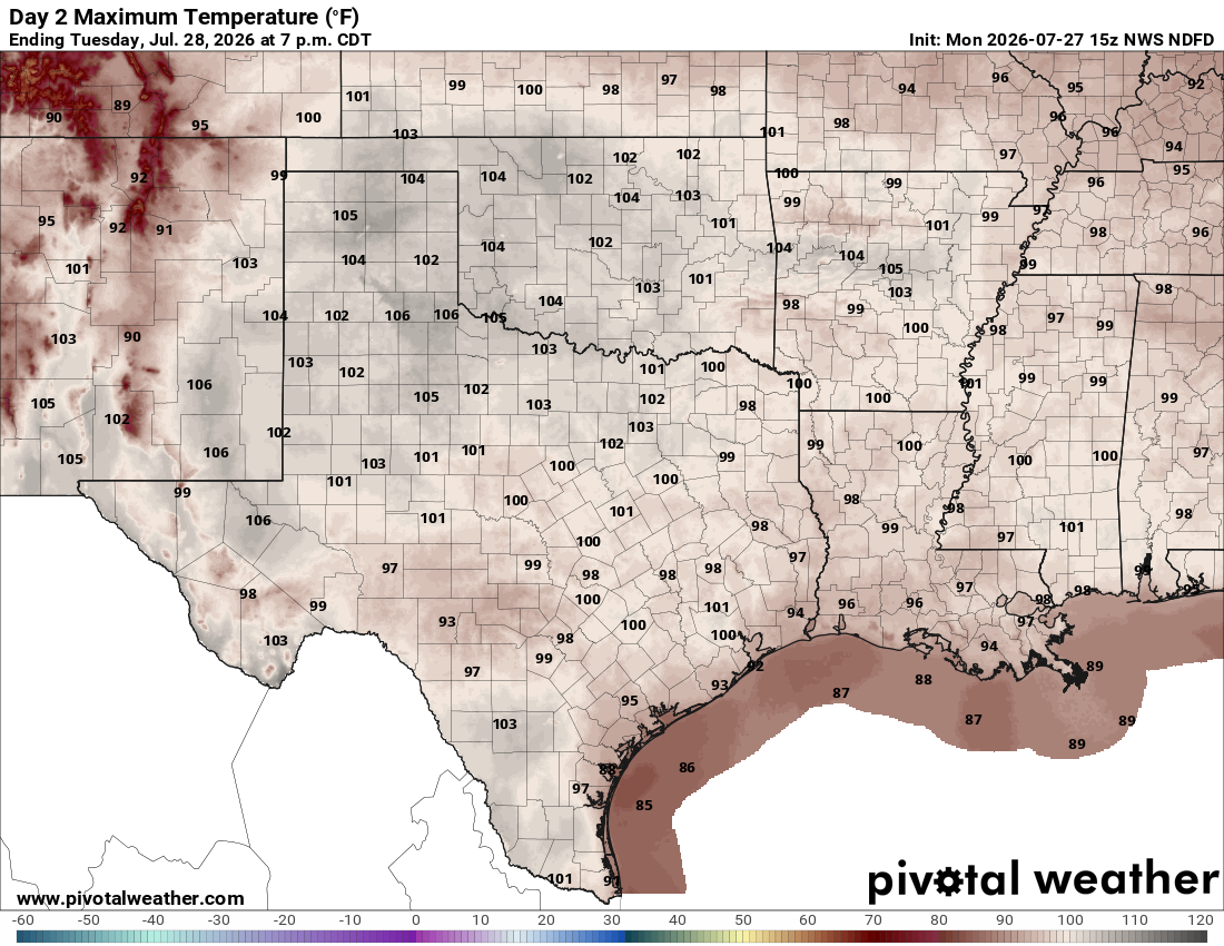
This weather pattern, known as the subtropical high, acts like a lid on a pot, with sinking air compressing and warming as it descends, trapping heat near the ground. That process suppresses the formation of towering rain clouds, leading to mostly sunny skies and allowing temperatures to climb day after day.
The heat will continue to build and may rival record highs across parts of the state, especially the Texas Panhandle and West Texas on Tuesday. Cities that could challenge records include El Paso, where the record high is 105 degrees, set in 2023, and Amarillo, where the record is 102 degrees, set in 2011. Austin’s record is expected to be safe, as the forecast 100 degrees will be below the daily record high of 105 degrees, set in 2017.
This weather pattern will stick through the workweek, with temperatures easily climbing into the triple digits Thursday and Friday.
This will add to the region’s already climbing number of three-digit days and will likely push the National Weather Service to issue heat alerts later this week. It is already highlighting the region with an elevated heat risk, ranging from moderate to major (Level 2 and 3 out of 4) through midweek, increasing to Level 3 and 4 by Friday.
Fortunately, this stretch of extreme heat isn’t expected to last much longer than a week. By the weekend, the heat dome is expected to weaken as the center of the subtropical high shifts west toward the Four Corners region, loosening its grip on Texas.
As the ridge retreats, temperatures should ease back closer to seasonal averages, and a few isolated showers or thunderstorms may return to parts of the state.
It has been two weeks since torrential rainfall fell across the Edwards Plateau, Hill Country and Rio Grande regions, with some locations receiving more than 2 feet of rain. Over several days, that water drained into streams and creeks, eventually sending area rivers out of their banks and causing flooding along the Llano, Pedernales and Guadalupe rivers. Now, all that runoff has made its way into some of the region’s major lakes, including Lake Travis.
The National Weather Service offices in Austin and San Antonio recently released satellite imagery showing the dramatic rise in lake levels across Central Texas following the mid-July rainfall event. Lake Travis is now 100% full for the first time in six years, rising more than 15 percentage points in just a few days, from 86% full before the July 14 rain event to full afterward.