
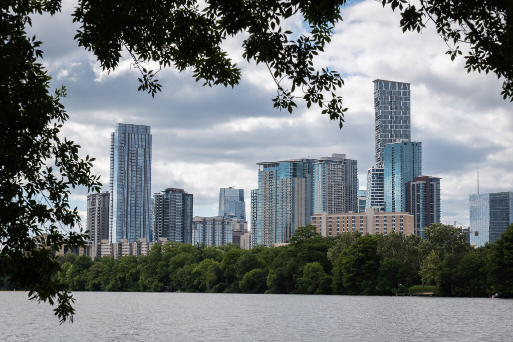
Downtown Austin, seen here from the Butler Hike-and-Bike Trail along Lady Bird Lake, has a microclimate that is influenced by the urban heat island effect.
Sara Diggins/Austin American-Statesman
You don’t have to drive very far in Austin to notice a change in the weather. One neighborhood may be several degrees warmer than another just 15 to 20 miles away. Meanwhile, one side of town can pick up a downpour for an hour but another area in the city limits stays completely dry.

That’s because Austin sits at the crossroads of two distinct climate zones: the humid, warm Coastal Plains to the east and the drier, higher-elevation Texas Hill Country to the west. Combine that with the urban heat island effect, and you get a set of unique microclimates that can make the weather feel surprisingly different from one side of town to the other.
Article continues below this ad
TEXAS FLOODS: What’s ‘flash flood alley’ and why is Austin and our region of Texas so prone to flooding?
Luckily, those differences are easy to measure because Austin has two main climate observation sites: one just west of downtown at Camp Mabry and another at Austin-Bergstrom International Airport, about 8 miles southeast of downtown.
What are microclimates?
A microclimate is a small, localized area where weather factors, including temperature, wind, humidity and rainfall, can be noticeably different from the surrounding region. These differences are often influenced by geography, topography, urban development, green spaces and trees.
Article continues below this ad
Austin geography and topography
Austin sits along the Balcones Escarpment, creating a significant change in elevation from the western part of the metropolitan area to the east. The roughly 400-foot elevation difference between Lakeway and Austin helps shape the rolling terrain and picturesque landscape that make Austin sunsets so spectacular.
A boat is seen driving on Lake Austin in Austin. Western Travis County features hilly, rocky limestone terrain and is typically less humid because of its proximity to drier West Texas air.
Mikala Compton/Austin American-Statesman
The western area features hilly, rocky limestone terrain and is typically less humid because of its proximity to drier West Texas air. The hills, valleys, and dense tree canopy can also help keep temperatures slightly cooler.
Article continues below this ad
SHAPED BY GEOGRAPHY: The fault line that shaped Austin: A guide to the Balcones Escarpment
Farther east, the flatter terrain in downtown and along the Interstate-35 corridor is more susceptible to warm, humid air masses moving inland from the Gulf of Mexico.
Urban heat Island
Downtown areas are often called “concrete jungles” because of their abundance of buildings, roads and paved surfaces and lack of green space. Unfortunately, these areas can be significantly hotter than surrounding neighborhoods, especially during the summer.
Article continues below this ad
Concrete, asphalt and buildings absorb heat during the day and slowly release it overnight, creating what’s known as the urban heat island effect.
Climate Central
Concrete, asphalt and buildings absorb heat during the day and slowly release it overnight, creating what’s known as the urban heat island effect.
According to the nonprofit climate research group Climate Central, temperatures in highly developed urban areas can be 15 to 20 degrees hotter on summer afternoons than in nearby tree-lined suburbs or rural areas.
Bodies of water and green spaces
Lakes, rivers and other bodies of water can keep nearby areas slightly cooler during the day and warmer at night because water heats and cools more slowly than land. Green spaces and tree canopies provide another cooling effect, with grass and shaded areas often measuring several degrees cooler than surrounding pavement and areas in direct sunlight. Trees act as natural cooling systems by providing shade and releasing moisture through evaporation.
Article continues below this ad
MoPac Boulevard (Loop 1) crosses the Barton Creek Greenbelt in Austin. Green spaces and tree canopies often remain several degrees cooler than surrounding pavement and urban areas in direct sunlight.
Jay Janner/Austin American-Statesman
Austin’s mix of waterways, parks and tree-covered neighborhoods creates pockets of cooler weather across the city. From Walnut Creek Metropolitan Park, Bull Creek District Park, Lady Bird Lake and Zilker Park to the Barton Creek Greenbelt, Stephenson Preserve, Mary Moore Searight Metropolitan Park and McKinney Falls State Park, these green spaces can create noticeable cooler microclimates within the Austin area.