
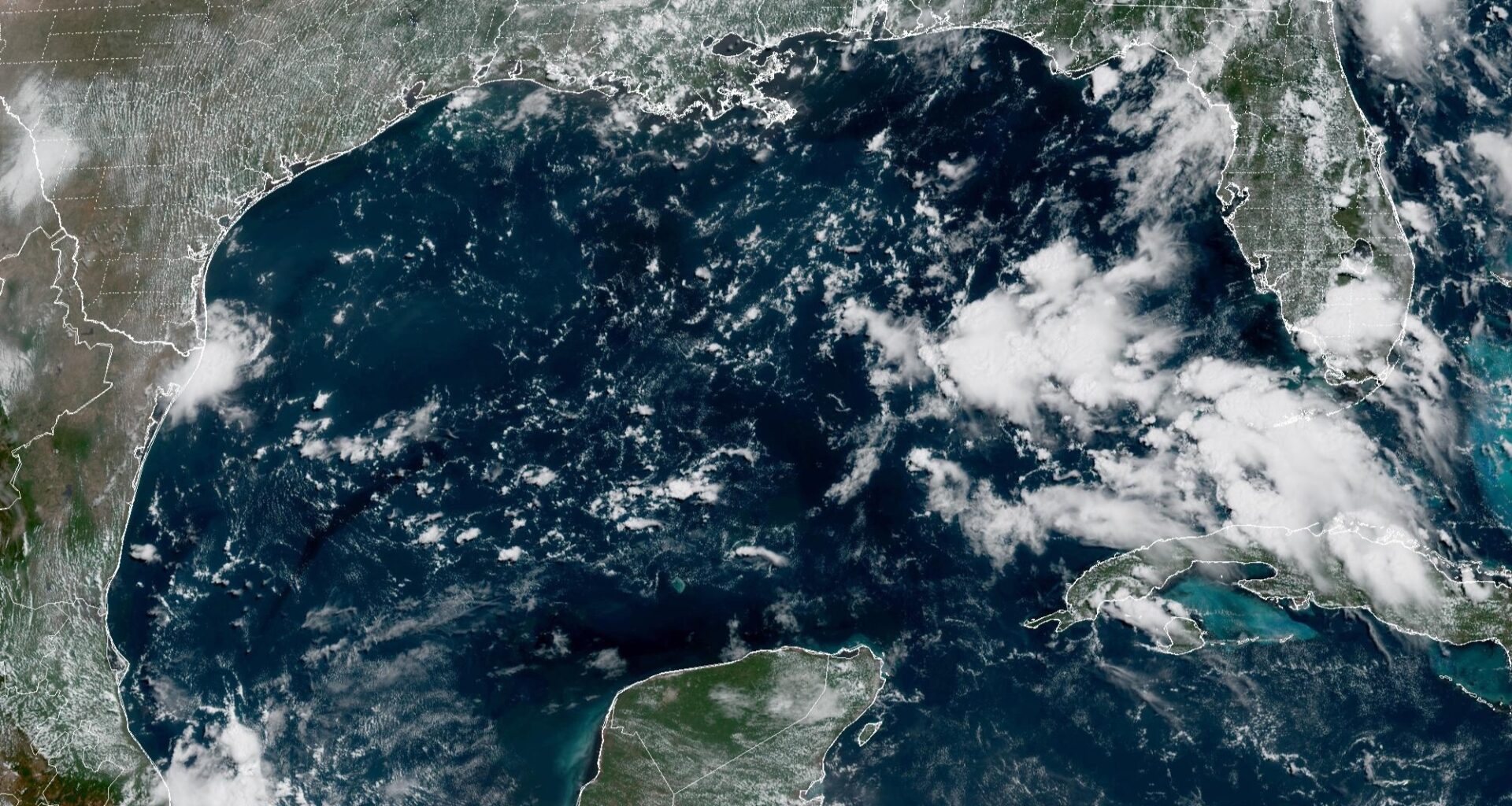
This weather satellite photo of the Gulf of Mexico taken Thursday morning shows a relatively quiet sky over Texas, pictured in the upper left.
Geostationary Operational Environmental Satellites/CIRA and NOAA
Texas hurricane odds have been nearly cut in half since April. That doesn’t mean the threat is over, though.
When Colorado State University issued its highly regarded Atlantic hurricane season forecast initially in April, the statistical odds of a hurricane affecting the Texas Gulf Coast were more than twice what they are today. Since then, confidence has steadily grown that a strengthening El Niño will continue creating conditions less favorable for Atlantic hurricanes, lowering the risk of a Texas hurricane with each monthly outlook.
Article continues below this ad
The trend is real, but it doesn’t mean the state is in the clear.
How the Texas hurricane risk has changed since April
CSU’s April forecast gave Texas a 27% chance of experiencing a hurricane within 50 miles of its coastline. That probability fell to 20% in June, 14% in July and now stands at 13% in the university’s final seasonal outlook — well below the long-term average but far from zero.
The probability of a major hurricane has followed the same trend, falling from 11% in April to 5% in August.
This chart shows Colorado State University’s odds of a tropical landfall along the Texas Gulf Coast. These numbers have dropped considerably since CSU’s first seasonal outlook was released in April.
Colorado State University / Justin Ballard
In other words, the risk of a major hurricane affecting Texas is now less than half of what CSU projected at the start of the season.
Article continues below this ad
These projections come after the emergence in the Gulf of Mexico of Tropical Storm Arthur in June and Tropical Storm Bertha in July, both of which spawned heavy rainfall in Texas.
The decline reflects both increasing confidence in a strong El Niño and the passage of time. El Niño is expected to continue creating an atmosphere less favorable for Atlantic hurricanes, and each quiet week that passes leaves fewer opportunities for storms to develop before the season ends Nov. 30.
Projected number of named storms
The updated CSU seasonal forecast released Wednesday leaves the basin-wide outlook unchanged from July: nine named storms, four hurricanes and one major hurricane. Less than 24 hours later, NOAA also maintained its expectation for a below-normal Atlantic hurricane season, reinforcing the growing consensus that El Niño will continue creating conditions less favorable for Atlantic hurricanes through the season’s peak.
Article continues below this ad
The agreement between CSU and NOAA reflects growing confidence that the large-scale climate pattern expected this spring has largely materialized, leaving little reason for either outlook to change significantly heading into the busiest stretch of hurricane season.
SEASONAL CONNECTION: What would a stronger El Niño mean for Texas hurricane season or the chances of a Houston snowfall?
The biggest shift came in July, when CSU sharply lowered its seasonal outlook. The forecast was lowered from 13 named storms, six hurricanes and two major hurricanes to nine named storms, four hurricanes and one major hurricane as confidence grew that El Niño would dominate the tropical Atlantic through the heart of hurricane season.
El Niño remains the dominant influence
The biggest change since spring hasn’t been Atlantic water temperatures. It’s been the atmosphere.
Article continues below this ad
A strengthening El Niño has increased vertical wind shear across much of the tropical Atlantic, making it more difficult for tropical cyclones to organize and intensify. As confidence in that pattern grew through the summer, CSU researchers repeatedly lowered their seasonal outlook before holding it steady in both July and August.
This diagram from NOAA shows the typical influence El Niño has on hurricane season.
NOAA
In other words, the quieter forecast isn’t based on one month’s weather. It’s based on a climate pattern that has become increasingly well established.
The peak of hurricane season is still ahead
Lower probabilities don’t eliminate hurricane risk.
Article continues below this ad
TROPICAL TRACKER: Keep an eye on tropical storms and hurricanes as they approach the Lone Star State.
Historically, about 95% of Atlantic major hurricane activity occurs after Aug. 1, and the climatological peak of hurricane season doesn’t arrive until around Sept. 10. A single hurricane making landfall along the Texas Gulf Coast would be enough to make the season memorable, regardless of how many storms ultimately form across the Atlantic.
This chart shows recorded hurricane and tropical storm activity in the Atlantic basin from 1944 to 2020. The historical peak in tropical activity occurs on Sept. 10.
NOAA’s National Hurricane Center
Seasonal forecasts describe activity across an entire ocean basin. They don’t predict where individual storms will track.
Texas’ hurricane odds may be lower than they were in April, but the calendar says the busiest weeks of hurricane season are still ahead. For Gulf Coast residents, that’s the reminder that matters most.